Kona to Sacramento is 2,434 miles (3,917 km), a flight of about 5 hours 10 minutes.
The right side wins overall thanks to the dramatic volcanic departure from Kona, which outweighs the more subtle Sierra Nevada views on the left during landing. With nearly five hours of open Pacific in between, the takeoff scenery is the flight's standout moment.
Flight Path
Open Pacific Ocean with no land visible for most of the crossing; the flight path stays well offshore until nearing the California coastline south of Point Reyes before turning inland toward Sacramento.
Great circle distance and headings ›

Phase by phase
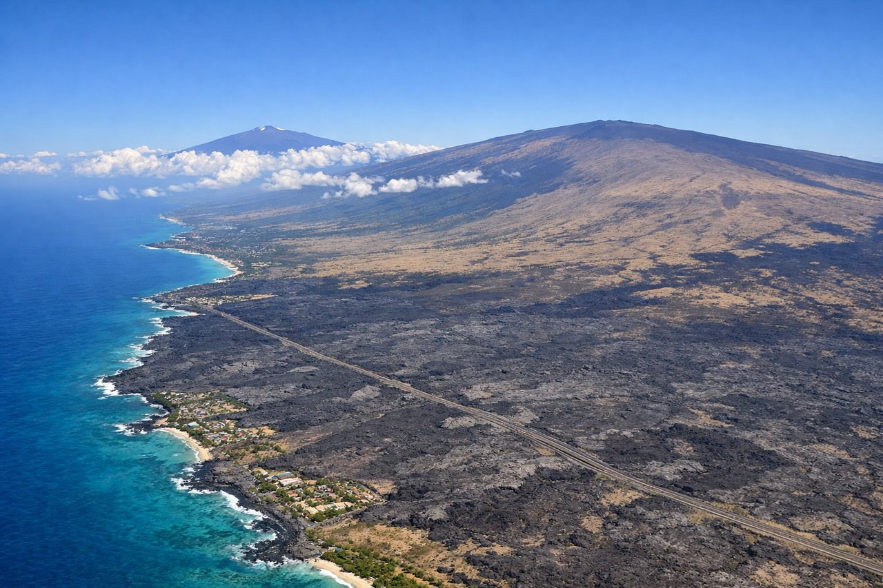
Takeoff from KOA
RIGHTDeparting KOA and turning northeast toward the mainland, the right side of the aircraft faces the Big Island's volcanic slopes. Passengers get a strong view of Hualalai's dark lava fields and, farther inland, the massive shield of Mauna Loa rising above the coast.
Landing at SMF
LEFTOn approach to SMF using the southbound runway configuration common in spring and summer's delta breeze, the aircraft descends from the north with the Sierra Nevada foothills visible off the left side. Passengers can see the low golden ridgelines east of the Sacramento Valley before touchdown.
Landmarks on this routeAll landmarks →
Will your flight be in sunlight?
Pick a date and time in the Sun Map to watch the sun move across your whole flight.
About This Route
Which side of the plane should I sit on flying from Kona International At Keahole (KOA) to Sacramento International (SMF)?
Sit on the Right side of the plane for the best views on flights from Kona to Sacramento. The right side wins overall thanks to the dramatic volcanic departure from Kona, which outweighs the more subtle Sierra Nevada views on the left during landing. With nearly five hours of open Pacific in between, the takeoff scenery is the flight's standout moment.
What can I see during takeoff from Kona International At Keahole in Kona?
During takeoff from Kona International At Keahole (KOA), sit on the Right side for the best views. Departing KOA and turning northeast toward the mainland, the right side of the aircraft faces the Big Island's volcanic slopes. Passengers get a strong view of Hualalai's dark lava fields and, farther inland, the massive shield of Mauna Loa rising above the coast. Notable sights include: Hualalai volcano, Mauna Loa's summit dome, Kona coast lava fields, Kealakekua Bay coastline.
What can I see when landing at Sacramento International in Sacramento?
When landing at Sacramento International (SMF), sit on the Left side for the best views. On approach to SMF using the southbound runway configuration common in spring and summer's delta breeze, the aircraft descends from the north with the Sierra Nevada foothills visible off the left side. Passengers can see the low golden ridgelines east of the Sacramento Valley before touchdown. Notable sights include: Sierra Nevada foothills, Sacramento River, Central Valley farmland, American River confluence.
How long is the flight from Kona to Sacramento?
The flight from Kona International At Keahole (KOA) to Sacramento International (SMF) takes about 5 hours 10 minutes. The shortest flight path between them is 2,434 miles (3,917 km); winds and air traffic control usually add a few percent.
What does the Kona to Sacramento flight path pass over?
Open Pacific Ocean with no land visible for most of the crossing; the flight path stays well offshore until nearing the California coastline south of Point Reyes before turning inland toward Sacramento.