The landing approach into Tokyo significantly outweighs the takeoff from Krakow. Mount Fuji is one of the world's most recognizable landmarks and dominates the descent, while Tokyo Bay and the Kanto Plain's urban density provide sustained visual interest. The Krakow departure, though pleasant, crosses relatively flat terrain after the initial Carpathian foothills. The right side captures the most dramatic and memorable portion of this ultra-long-haul flight.
Flight Path
The flight path crosses the Carpathian Mountains (southern Poland), the Black Sea coast (Turkey/Georgia border region), the Caucasus Mountains, the Caspian Sea, the Ural Mountains, the West Siberian Plain, Lake Baikal region, the Yenisei River valley, the Central Siberian Plateau, and the Sakha Republic before descending toward Japan. Most of the 11+ hour flight crosses sparsely populated Siberia with limited landmark density—vast taiga forests, occasional river valleys, and mountain ranges appearing as distant ridges. The Caucasus and Urals provide brief terrain drama, but the majority of cruise altitude offers monotonous forest and tundra with minimal visual variation.
Great circle distance and headings ›Phase by phase
Takeoff from KRK
LEFTKrakow's departure to the north and west reveals the Vistula River valley and the transition from the Carpathian foothills into the Polish plains. The city itself provides urban texture during initial climb.
Landing at HND
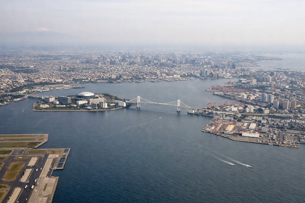
RIGHTTokyo's approach from the west crosses Mount Fuji, the Kanto Plain's urban sprawl, and Tokyo Bay with its distinctive harbor geometry. The descent into Haneda offers views of Japan's most iconic volcano and the world's largest metropolitan area.
Landmarks on this routeAll landmarks →
Will your flight be in sunlight?
See exactly which side of the plane gets sun and shade at your departure time.
About This Route
Which side of the plane should I sit on flying from Balice Jp Ii International Airport (KRK) to Tokyo International (HND)?
Sit on the Right side of the plane for the best views on flights from Krakow to Tokyo. The landing approach into Tokyo significantly outweighs the takeoff from Krakow. Mount Fuji is one of the world's most recognizable landmarks and dominates the descent, while Tokyo Bay and the Kanto Plain's urban density provide sustained visual interest. The Krakow departure, though pleasant, crosses relatively flat terrain after the initial Carpathian foothills. The right side captures the most dramatic and memorable portion of this ultra-long-haul flight.
What can I see during takeoff from Balice Jp Ii International Airport in Krakow?
During takeoff from Balice Jp Ii International Airport (KRK), sit on the Left side for the best views. Krakow's departure to the north and west reveals the Vistula River valley and the transition from the Carpathian foothills into the Polish plains. The city itself provides urban texture during initial climb. Notable sights include: Krakow city center and Wawel Castle, Vistula River meanders, Carpathian Mountains southern edge receding southward.
What can I see when landing at Tokyo International in Tokyo?
When landing at Tokyo International (HND), sit on the Right side for the best views. Tokyo's approach from the west crosses Mount Fuji, the Kanto Plain's urban sprawl, and Tokyo Bay with its distinctive harbor geometry. The descent into Haneda offers views of Japan's most iconic volcano and the world's largest metropolitan area. Notable sights include: Mount Fuji (3,776 m, snow-capped cone visible 60+ miles away), Tokyo Bay and Haneda Airport runways, Kanto Plain urban grid extending to the horizon.
How long is the flight from Krakow to Tokyo?
The flight from Balice Jp Ii International Airport (KRK) to Tokyo International (HND) takes 11h 15m.
What does the Krakow to Tokyo flight path pass over?
The flight path crosses the Carpathian Mountains (southern Poland), the Black Sea coast (Turkey/Georgia border region), the Caucasus Mountains, the Caspian Sea, the Ural Mountains, the West Siberian Plain, Lake Baikal region, the Yenisei River valley, the Central Siberian Plateau, and the Sakha Republic before descending toward Japan. Most of the 11+ hour flight crosses sparsely populated Siberia with limited landmark density—vast taiga forests, occasional river valleys, and mountain ranges appearing as distant ridges. The Caucasus and Urals provide brief terrain drama, but the majority of cruise altitude offers monotonous forest and tundra with minimal visual variation.