Right side scores higher due to superior landing scenery (Carpathians, Vistula River, Kraków's historic center) which outweighs the takeoff advantage. The cruise phase over central Europe (Poland's plains and foothills) is relatively modest on both sides, but the approach into Kraków provides distinctive urban and mountain landmarks that left side cannot match. Left side sees only Tokyo Bay departure and then 10+ hours of featureless ocean and flat terrain.
Flown HND to KRK? Did we get it right?
Flight Path
Tokyo to Krakow is 5,483 miles (8,823 km), a flight of about 11 hours 15 minutes.
The flight crosses the Eurasian landmass over Russia and Kazakhstan. Notable features include the Ural Mountains (low, forested range visible during cruise at high altitude), the Caspian Sea's northern reaches, the steppes of Kazakhstan and southern Russia (vast, flat, sparsely populated), and the transition into European Russia. The Carpathian Mountains appear during descent into Poland. Most of the cruise phase is over remote, featureless terrain with minimal landmark density.
Great circle distance and headings ›Phase by phase
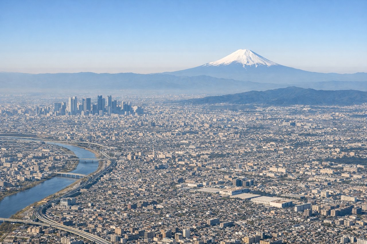
Takeoff from HND
RIGHTRight side captures Tokyo Bay and the Kanto Plain during departure. Aircraft typically depart over water (bay or ocean) to minimize noise over the city, offering views of the bay's industrial waterfront, islands, and the urban sprawl of greater Tokyo receding inland.
Landing at KRK
RIGHTRight side offers superior approach scenery into Kraków. The descent path over southern Poland reveals the Carpathian Mountains to the south and the Vistula River valley, with Kraków's historic Old Town and Wawel Castle visible during final approach. Left side sees only flat agricultural plains.
Will your flight be in sunlight?
Pick a date and time in the Sun Map to watch the sun move across your whole flight.
About This Route
Which side of the plane should I sit on flying from Tokyo International (HND) to Balice Jp Ii International Airport (KRK)?
Sit on the Right side of the plane for the best views on flights from Tokyo to Krakow. Right side scores higher due to superior landing scenery (Carpathians, Vistula River, Kraków's historic center) which outweighs the takeoff advantage. The cruise phase over central Europe (Poland's plains and foothills) is relatively modest on both sides, but the approach into Kraków provides distinctive urban and mountain landmarks that left side cannot match. Left side sees only Tokyo Bay departure and then 10+ hours of featureless ocean and flat terrain.
What can I see during takeoff from Tokyo International in Tokyo?
During takeoff from Tokyo International (HND), sit on the Right side for the best views. Right side captures Tokyo Bay and the Kanto Plain during departure. Aircraft typically depart over water (bay or ocean) to minimize noise over the city, offering views of the bay's industrial waterfront, islands, and the urban sprawl of greater Tokyo receding inland. Notable sights include: Tokyo Bay, Haneda's artificial islands and terminals, Kanto Plain extending west, Tokyo's urban grid.
What can I see when landing at Balice Jp Ii International Airport in Krakow?
When landing at Balice Jp Ii International Airport (KRK), sit on the Right side for the best views. Right side offers superior approach scenery into Kraków. The descent path over southern Poland reveals the Carpathian Mountains to the south and the Vistula River valley, with Kraków's historic Old Town and Wawel Castle visible during final approach. Left side sees only flat agricultural plains. Notable sights include: Carpathian Mountains (southern horizon), Vistula River valley, Kraków's Old Town and Wawel Castle, Balice airport and surrounding farmland.
How long is the flight from Tokyo to Krakow?
The flight from Tokyo International (HND) to Balice Jp Ii International Airport (KRK) takes about 11 hours 15 minutes. The shortest flight path between them is 5,483 miles (8,823 km); winds and air traffic control usually add a few percent.
What does the Tokyo to Krakow flight path pass over?
The flight crosses the Eurasian landmass over Russia and Kazakhstan. Notable features include the Ural Mountains (low, forested range visible during cruise at high altitude), the Caspian Sea's northern reaches, the steppes of Kazakhstan and southern Russia (vast, flat, sparsely populated), and the transition into European Russia. The Carpathian Mountains appear during descent into Poland. Most of the cruise phase is over remote, featureless terrain with minimal landmark density.