Right side scores higher due to superior urban and coastal scenery at both ends of the flight. Takeoff offers the Petronas Towers and Strait of Malacca; landing provides the dramatic Øresund Strait, bridge, and Copenhagen harbor approach. Left side is dominated by flat inland terrain with minimal distinctive features throughout the flight.
Flown KUL to CPH? Did we get it right?
Flight Path
Kuala Lumpur to Copenhagen is 6,025 miles (9,696 km), a flight of about 11 hours 45 minutes.
The flight path crosses the Arabian Sea, the Arabian Peninsula (Oman and Saudi Arabia), the Persian Gulf region, Iraq, Turkey's Anatolian plateau, the Black Sea, Eastern Europe (Romania, Hungary, Slovakia), and the Carpathian Mountains before descending into Denmark. Notable midpoint landmarks include the Zagros Mountains (Iran-Iraq border), the Taurus Mountains (southern Turkey), and the Carpathians (Romania-Slovakia border). The route primarily follows a great-circle path over open water and continental terrain with limited dramatic scenery in the middle 6-7 hours of cruise.
Great circle distance and headings ›


Phase by phase
Takeoff from KUL
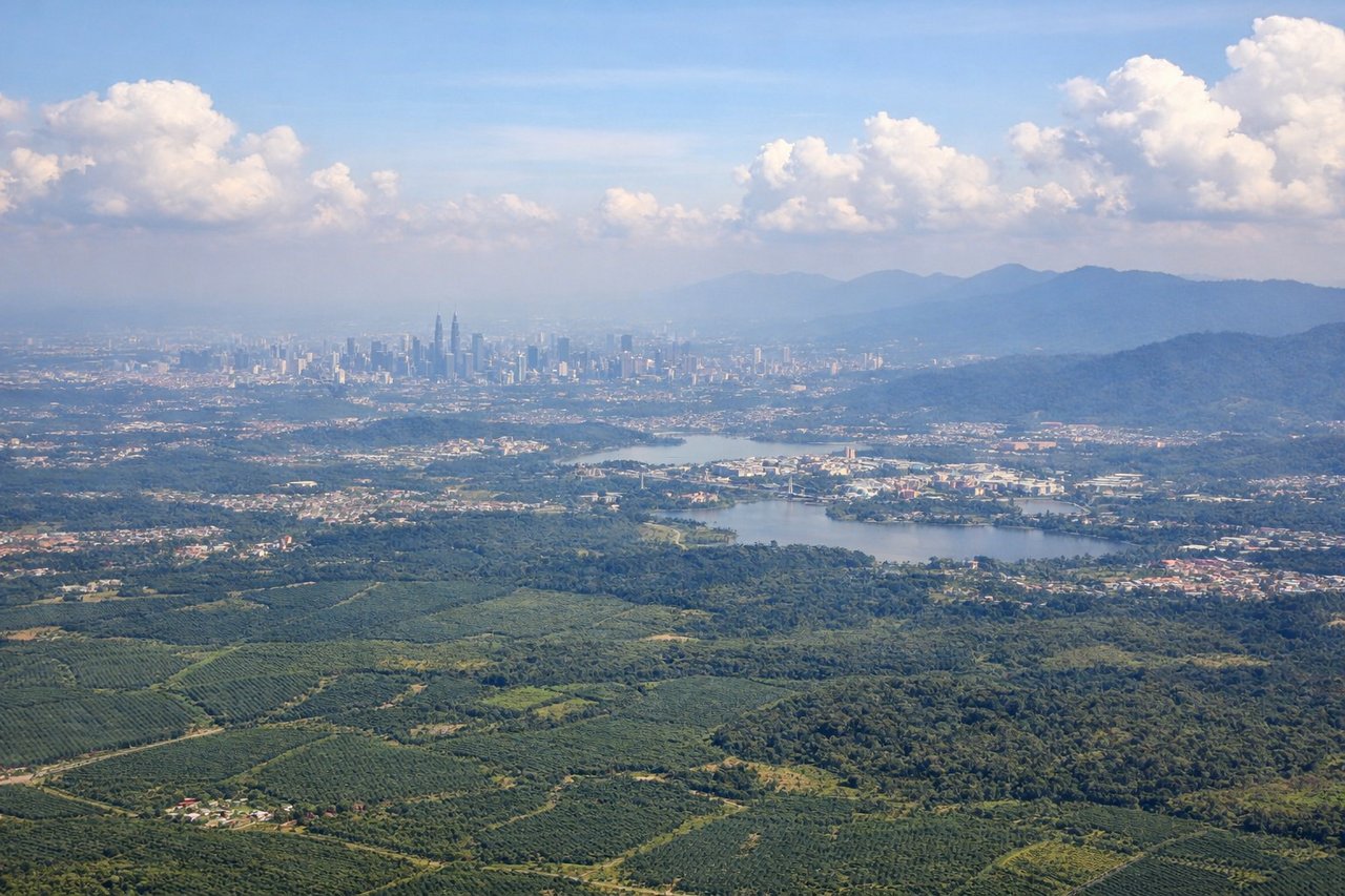
RIGHTRight side captures the Klang Valley urban sprawl and Petronas Twin Towers during initial climb, with the Strait of Malacca visible beyond. Left side shows only inland plains and distant haze toward the interior.
Landing at CPH
RIGHTRight side (starboard) offers views of the Danish coastline, Øresund Strait, and the approach over the Amager Marshes and Copenhagen harbor during descent into CPH runway 22L/22R. Left side shows only flat inland Jutland and German plains.
Will your flight be in sunlight?
Pick a date and time in the Sun Map to watch the sun move across your whole flight.
About This Route
Which side of the plane should I sit on flying from Kuala Lumpur International (KUL) to Kastrup (CPH)?
Sit on the Right side of the plane for the best views on flights from Kuala Lumpur to Copenhagen. Right side scores higher due to superior urban and coastal scenery at both ends of the flight. Takeoff offers the Petronas Towers and Strait of Malacca; landing provides the dramatic Øresund Strait, bridge, and Copenhagen harbor approach. Left side is dominated by flat inland terrain with minimal distinctive features throughout the flight.
What can I see during takeoff from Kuala Lumpur International in Kuala Lumpur?
During takeoff from Kuala Lumpur International (KUL), sit on the Right side for the best views. Right side captures the Klang Valley urban sprawl and Petronas Twin Towers during initial climb, with the Strait of Malacca visible beyond. Left side shows only inland plains and distant haze toward the interior. Notable sights include: Petronas Twin Towers and Kuala Lumpur skyline, Klang Valley industrial zone, Strait of Malacca coastline.
What can I see when landing at Kastrup in Copenhagen?
When landing at Kastrup (CPH), sit on the Right side for the best views. Right side (starboard) offers views of the Danish coastline, Øresund Strait, and the approach over the Amager Marshes and Copenhagen harbor during descent into CPH runway 22L/22R. Left side shows only flat inland Jutland and German plains. Notable sights include: Øresund Strait and Malmö-Copenhagen bridge, Copenhagen harbor and Amager district, Danish coastline and Baltic approaches.
How long is the flight from Kuala Lumpur to Copenhagen?
The flight from Kuala Lumpur International (KUL) to Kastrup (CPH) takes about 11 hours 45 minutes. The shortest flight path between them is 6,025 miles (9,696 km); winds and air traffic control usually add a few percent.
What does the Kuala Lumpur to Copenhagen flight path pass over?
The flight path crosses the Arabian Sea, the Arabian Peninsula (Oman and Saudi Arabia), the Persian Gulf region, Iraq, Turkey's Anatolian plateau, the Black Sea, Eastern Europe (Romania, Hungary, Slovakia), and the Carpathian Mountains before descending into Denmark. Notable midpoint landmarks include the Zagros Mountains (Iran-Iraq border), the Taurus Mountains (southern Turkey), and the Carpathians (Romania-Slovakia border). The route primarily follows a great-circle path over open water and continental terrain with limited dramatic scenery in the middle 6-7 hours of cruise.