Kuala Lumpur to Chengdu is 1,927 miles (3,102 km), a flight of about 3 hours 25 minutes.
Right side scores higher (3.5 vs 2.5) due to superior scenery during both takeoff and landing phases. Takeoff captures Kuala Lumpur's iconic skyline and the Titiwangsa Range; landing provides the dramatic transition from the Chengdu Plain's agricultural landscape to the city itself and the Longquan Mountains. Left side offers primarily flat terrain and open plains with minimal distinctive landmarks throughout the flight.
Flight Path
The flight path crosses the South China Sea and enters mainland China over Guangdong Province. Notable midpoint features include the Hainan Island landmass (visible to the south on the right side during cruise), the Guangdong coastal plains, and the transition into the Sichuan Basin as the aircraft approaches Chengdu. The Wuyi Mountains and other ranges of southern China form the terrain backbone along the route's northern section.
Great circle distance and headings ›Phase by phase
Takeoff from KUL
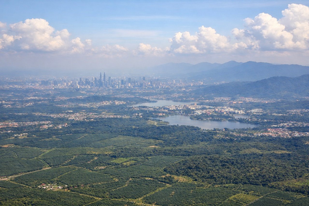
RIGHTRight side captures the Klang Valley urban sprawl and Petronas Twin Towers during initial climb, with views toward the Titiwangsa Range to the northeast. Left side faces open terrain and the Strait of Malacca with minimal urban features during departure.
Landing at CTU
RIGHTRight side offers superior approach scenery: the Chengdu Plain with its agricultural patchwork, the Longquan Mountains to the east, and the city of Chengdu itself during final descent. Left side faces open plains with fewer distinctive landmarks during the approach corridor.
Landmarks on this routeAll landmarks →
Will your flight be in sunlight?
Pick a date and time in the Sun Map to watch the sun move across your whole flight.
About This Route
Which side of the plane should I sit on flying from Kuala Lumpur International (KUL) to Shuangliu (CTU)?
Sit on the Right side of the plane for the best views on flights from Kuala Lumpur to Chengdu. Right side scores higher (3.5 vs 2.5) due to superior scenery during both takeoff and landing phases. Takeoff captures Kuala Lumpur's iconic skyline and the Titiwangsa Range; landing provides the dramatic transition from the Chengdu Plain's agricultural landscape to the city itself and the Longquan Mountains. Left side offers primarily flat terrain and open plains with minimal distinctive landmarks throughout the flight.
What can I see during takeoff from Kuala Lumpur International in Kuala Lumpur?
During takeoff from Kuala Lumpur International (KUL), sit on the Right side for the best views. Right side captures the Klang Valley urban sprawl and Petronas Twin Towers during initial climb, with views toward the Titiwangsa Range to the northeast. Left side faces open terrain and the Strait of Malacca with minimal urban features during departure. Notable sights include: Petronas Twin Towers and Kuala Lumpur skyline, Klang Valley urban grid, Titiwangsa Range foothills.
What can I see when landing at Shuangliu in Chengdu?
When landing at Shuangliu (CTU), sit on the Right side for the best views. Right side offers superior approach scenery: the Chengdu Plain with its agricultural patchwork, the Longquan Mountains to the east, and the city of Chengdu itself during final descent. Left side faces open plains with fewer distinctive landmarks during the approach corridor. Notable sights include: Chengdu city center and urban sprawl, Longquan Mountains eastern ridge, Chengdu Plain agricultural fields, Funan River valley.
How long is the flight from Kuala Lumpur to Chengdu?
The flight from Kuala Lumpur International (KUL) to Shuangliu (CTU) takes about 3 hours 25 minutes. The shortest flight path between them is 1,927 miles (3,102 km); winds and air traffic control usually add a few percent.
What does the Kuala Lumpur to Chengdu flight path pass over?
The flight path crosses the South China Sea and enters mainland China over Guangdong Province. Notable midpoint features include the Hainan Island landmass (visible to the south on the right side during cruise), the Guangdong coastal plains, and the transition into the Sichuan Basin as the aircraft approaches Chengdu. The Wuyi Mountains and other ranges of southern China form the terrain backbone along the route's northern section.