Kuala Lumpur to Yogyakarta is 944 miles (1,519 km), a flight of about 2 hours 15 minutes.
While takeoff favors the right, the landing approach offers superior views of the dramatic volcanic landscape (Merapi and Merbabu) that defines the Yogyakarta region. The landing experience outweighs the takeoff advantage.
Flight Path
The flight path crosses the Strait of Malacca and the Sumatra coastline, then proceeds southeast over the Sumatra interior (dense rainforest, largely featureless from altitude), before crossing into Java. The Java Sea lies to the north of the route. Visibility of specific midpoint features depends heavily on cloud cover, but the transition from Sumatra's dark green forest to Java's more varied terrain (volcanic peaks, agricultural areas, settlements) is typically noticeable around the 1-hour mark.
Great circle distance and headings ›Phase by phase
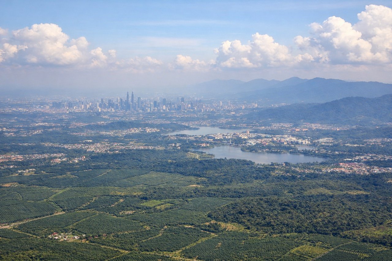
Takeoff from KUL
RIGHTKUL typically departs from runways 14L/R or 15L/R heading northeast. Right-side seats offer views of the Klang Valley's urban sprawl and the Strait of Malacca to the northwest during the initial climb, with the Titiwangsa Range visible as a distant ridge on the horizon.
Landing at JOG
LEFTAdi Sutjipto typically uses runways 09/27 for landing. Left-side seats on approach from the northwest provide views of the Merapi and Merbabu volcanic peaks to the north and the Progo River valley, with the city of Yogyakarta visible on the southern approach.
Landmarks on this routeAll landmarks →
Will your flight be in sunlight?
Pick a date and time in the Sun Map to watch the sun move across your whole flight.
About This Route
Which side of the plane should I sit on flying from Kuala Lumpur International (KUL) to Adisutjipto International Airport (JOG)?
Sit on the Left side of the plane for the best views on flights from Kuala Lumpur to Yogyakarta. While takeoff favors the right, the landing approach offers superior views of the dramatic volcanic landscape (Merapi and Merbabu) that defines the Yogyakarta region. The landing experience outweighs the takeoff advantage.
What can I see during takeoff from Kuala Lumpur International in Kuala Lumpur?
During takeoff from Kuala Lumpur International (KUL), sit on the Right side for the best views. KUL typically departs from runways 14L/R or 15L/R heading northeast. Right-side seats offer views of the Klang Valley's urban sprawl and the Strait of Malacca to the northwest during the initial climb, with the Titiwangsa Range visible as a distant ridge on the horizon. Notable sights include: Klang Valley urban area, Strait of Malacca (northwest), Titiwangsa Mountain Range (distant northeast horizon), Port Klang industrial zone.
What can I see when landing at Adisutjipto International Airport in Yogyakarta?
When landing at Adisutjipto International Airport (JOG), sit on the Left side for the best views. Adi Sutjipto typically uses runways 09/27 for landing. Left-side seats on approach from the northwest provide views of the Merapi and Merbabu volcanic peaks to the north and the Progo River valley, with the city of Yogyakarta visible on the southern approach. Notable sights include: Mount Merapi (active volcano, north), Mount Merbabu (north-northeast), Progo River valley, Yogyakarta city grid.
How long is the flight from Kuala Lumpur to Yogyakarta?
The flight from Kuala Lumpur International (KUL) to Adisutjipto International Airport (JOG) takes about 2 hours 15 minutes. The shortest flight path between them is 944 miles (1,519 km); winds and air traffic control usually add a few percent.
What does the Kuala Lumpur to Yogyakarta flight path pass over?
The flight path crosses the Strait of Malacca and the Sumatra coastline, then proceeds southeast over the Sumatra interior (dense rainforest, largely featureless from altitude), before crossing into Java. The Java Sea lies to the north of the route. Visibility of specific midpoint features depends heavily on cloud cover, but the transition from Sumatra's dark green forest to Java's more varied terrain (volcanic peaks, agricultural areas, settlements) is typically noticeable around the 1-hour mark.