While the departure side has a brief glimpse of distant mountains, the right side wins overall because of the striking Santubong peak and river delta scenery during the Kuching approach, which is more visually distinctive than anything seen from the left across this mostly flat, sea-crossing route.
Flown KUL to KCH? Did we get it right?
Flight Path
Kuala Lumpur to Kuching is 603 miles (971 km), a flight of about 1 hour 40 minutes.
Open waters of the South China Sea between Peninsular Malaysia and Borneo, with no islands or landmarks visible along the direct route.
Great circle distance and headings ›Phase by phase
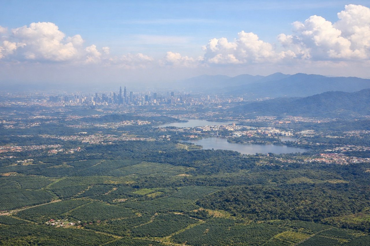
Takeoff from KUL
LEFTClimbing out of KUL toward the southeast, the left side offers a distant view of the Titiwangsa Range's forested ridgelines fading into haze to the north, along with the sprawl of Kuala Lumpur's outer suburbs. The right side mostly shows flat oil-palm plantations with no notable relief.
Landing at KCH
RIGHTOn approach into Kuching, the aircraft typically tracks in from the South China Sea over the Sarawak coastline, and the right side gets the clearer view of Mount Santubong's distinctive peak rising near the river mouth along with the braided channels of the Sarawak River delta. The left side mostly faces inland toward flatter, less distinctive terrain.
Will your flight be in sunlight?
Pick a date and time in the Sun Map to watch the sun move across your whole flight.
About This Route
Which side of the plane should I sit on flying from Kuala Lumpur International (KUL) to Kuching International (KCH)?
Sit on the Right side of the plane for the best views on flights from Kuala Lumpur to Kuching. While the departure side has a brief glimpse of distant mountains, the right side wins overall because of the striking Santubong peak and river delta scenery during the Kuching approach, which is more visually distinctive than anything seen from the left across this mostly flat, sea-crossing route.
What can I see during takeoff from Kuala Lumpur International in Kuala Lumpur?
During takeoff from Kuala Lumpur International (KUL), sit on the Left side for the best views. Climbing out of KUL toward the southeast, the left side offers a distant view of the Titiwangsa Range's forested ridgelines fading into haze to the north, along with the sprawl of Kuala Lumpur's outer suburbs. The right side mostly shows flat oil-palm plantations with no notable relief. Notable sights include: Titiwangsa mountain range, Kuala Lumpur suburban sprawl, Klang Valley plantations.
What can I see when landing at Kuching International in Kuching?
When landing at Kuching International (KCH), sit on the Right side for the best views. On approach into Kuching, the aircraft typically tracks in from the South China Sea over the Sarawak coastline, and the right side gets the clearer view of Mount Santubong's distinctive peak rising near the river mouth along with the braided channels of the Sarawak River delta. The left side mostly faces inland toward flatter, less distinctive terrain. Notable sights include: Mount Santubong, Sarawak River delta, South China Sea coastline, Kuching city along the riverbanks.
How long is the flight from Kuala Lumpur to Kuching?
The flight from Kuala Lumpur International (KUL) to Kuching International (KCH) takes about 1 hour 40 minutes. The shortest flight path between them is 603 miles (971 km); winds and air traffic control usually add a few percent.
What does the Kuala Lumpur to Kuching flight path pass over?
Open waters of the South China Sea between Peninsular Malaysia and Borneo, with no islands or landmarks visible along the direct route.