While takeoff offers good Kuala Lumpur views on the right, the landing approach on the left provides more sustained scenic interest—the Indus plain, Ravi River, and Lahore's urban-agricultural transition are visually distinctive. The flight path northwestward means left-side seats capture more of the mid-flight geography over central India and Pakistan.
Flight Path
The flight crosses the Bay of Bengal, then the Indian subcontinent. Notable features visible at cruise altitude include the Western Ghats mountain range (if visible through haze on the western edge of the Deccan Plateau), the Ganges River plain, and the transition into the Indo-Gangetic Plain. As the aircraft approaches Pakistan, the Thar Desert becomes visible as a tan, arid expanse east of the Indus River. The Indus River itself is a major landmark—a pale, winding ribbon cutting through the desert and agricultural plains of Sindh and Punjab provinces.
Great circle distance and headings ›Phase by phase
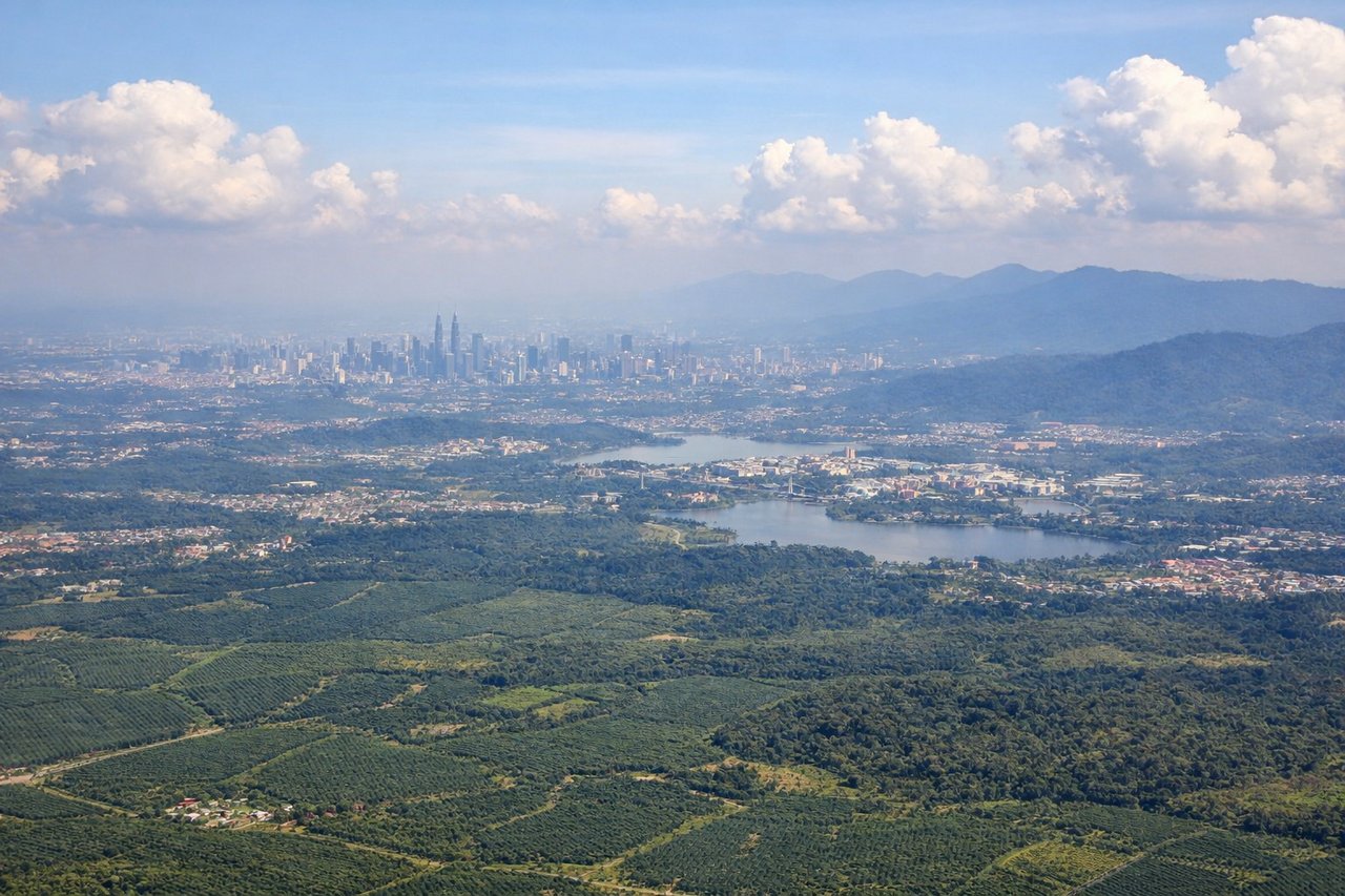
Takeoff from KUL
RIGHTRight-side seats capture the Klang Valley and Kuala Lumpur's urban sprawl as the aircraft climbs northwestward. You'll see the city grid, the Petronas Twin Towers area, and the transition to palm oil plantations and forested terrain inland.
Landing at LHE
LEFTLeft-side seats offer views of the Indus River plain and the approach to Lahore from the southeast. As the aircraft descends toward Allama Iqbal International, you'll see the flat agricultural plains, irrigation canals, and the city's urban sprawl along the Ravi River.
Will your flight be in sunlight?
See exactly which side of the plane gets sun and shade at your departure time.
About This Route
Which side of the plane should I sit on flying from Kuala Lumpur International (KUL) to Allama Iqbal International (LHE)?
Sit on the Left side of the plane for the best views on flights from Kuala Lumpur to Lahore. While takeoff offers good Kuala Lumpur views on the right, the landing approach on the left provides more sustained scenic interest—the Indus plain, Ravi River, and Lahore's urban-agricultural transition are visually distinctive. The flight path northwestward means left-side seats capture more of the mid-flight geography over central India and Pakistan.
What can I see during takeoff from Kuala Lumpur International in Kuala Lumpur?
During takeoff from Kuala Lumpur International (KUL), sit on the Right side for the best views. Right-side seats capture the Klang Valley and Kuala Lumpur's urban sprawl as the aircraft climbs northwestward. You'll see the city grid, the Petronas Twin Towers area, and the transition to palm oil plantations and forested terrain inland. Notable sights include: Klang Valley urban area, Petronas Twin Towers district, Selangor River valley, forested interior plateau.
What can I see when landing at Allama Iqbal International in Lahore?
When landing at Allama Iqbal International (LHE), sit on the Left side for the best views. Left-side seats offer views of the Indus River plain and the approach to Lahore from the southeast. As the aircraft descends toward Allama Iqbal International, you'll see the flat agricultural plains, irrigation canals, and the city's urban sprawl along the Ravi River. Notable sights include: Indus River plain, Ravi River, Lahore urban area, irrigation canal network.
How long is the flight from Kuala Lumpur to Lahore?
The flight from Kuala Lumpur International (KUL) to Allama Iqbal International (LHE) takes Approximately 4 hours 45 minutes to 5 hours 15 minutes.
What does the Kuala Lumpur to Lahore flight path pass over?
The flight crosses the Bay of Bengal, then the Indian subcontinent. Notable features visible at cruise altitude include the Western Ghats mountain range (if visible through haze on the western edge of the Deccan Plateau), the Ganges River plain, and the transition into the Indo-Gangetic Plain. As the aircraft approaches Pakistan, the Thar Desert becomes visible as a tan, arid expanse east of the Indus River. The Indus River itself is a major landmark—a pale, winding ribbon cutting through the desert and agricultural plains of Sindh and Punjab provinces.