Kuala Lumpur to Padang is 263 miles (424 km), a flight of about 1 hour 15 minutes.
Right side scores higher (3.5 vs 2.5) due to superior scenery on both legs: KUL departure captures the iconic Petronas Towers and Klang Valley urban drama, while PDG arrival showcases the dramatic Barisan Mountains, coastal Padang, and the Indian Ocean. Left side is dominated by suburban sprawl and open ocean with minimal distinctive features.
Flight Path
Strait of Malacca coastline (Perak and Selangor provinces), transition from Malaysian peninsula to Sumatran waters, Barisan Mountains visible on Sumatran coast during descent phase
Great circle distance and headings ›Phase by phase
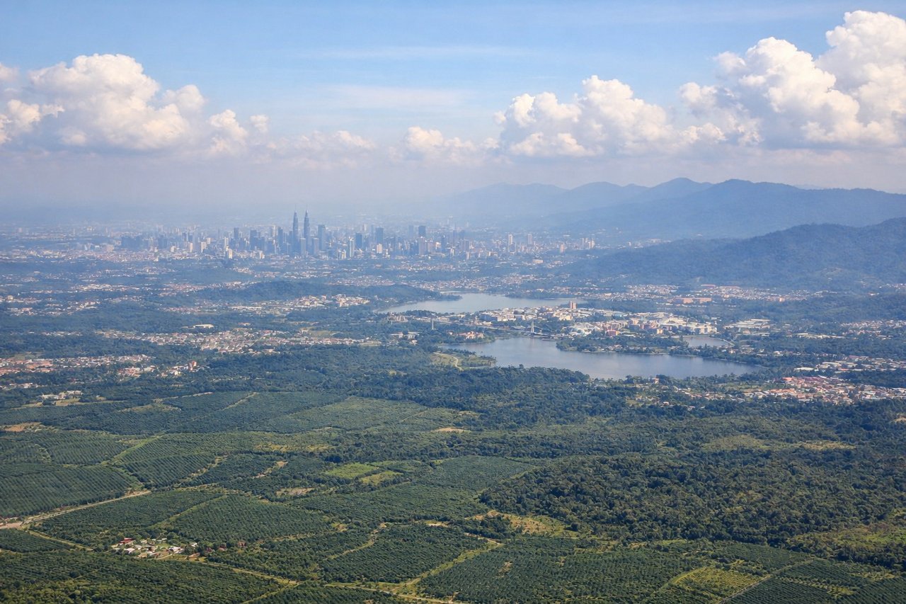
Takeoff from KUL
RIGHTRight side captures the Klang Valley urban sprawl and Petronas Twin Towers during initial climb, with views toward the Titiwangsa Range to the northeast. Left side faces open terrain and suburban areas with less immediate visual interest.
Landing at PDG
RIGHTRight side (runway 33 approach from the northeast) offers views of Padang's coastal setting, the Indian Ocean, and the Barisan Mountains rising inland. Left side faces open ocean with minimal landmarks during the long approach descent.
Will your flight be in sunlight?
Pick a date and time in the Sun Map to watch the sun move across your whole flight.
About This Route
Which side of the plane should I sit on flying from Kuala Lumpur International (KUL) to Minangkabau International Airport (PDG)?
Sit on the Right side of the plane for the best views on flights from Kuala Lumpur to Padang. Right side scores higher (3.5 vs 2.5) due to superior scenery on both legs: KUL departure captures the iconic Petronas Towers and Klang Valley urban drama, while PDG arrival showcases the dramatic Barisan Mountains, coastal Padang, and the Indian Ocean. Left side is dominated by suburban sprawl and open ocean with minimal distinctive features.
What can I see during takeoff from Kuala Lumpur International in Kuala Lumpur?
During takeoff from Kuala Lumpur International (KUL), sit on the Right side for the best views. Right side captures the Klang Valley urban sprawl and Petronas Twin Towers during initial climb, with views toward the Titiwangsa Range to the northeast. Left side faces open terrain and suburban areas with less immediate visual interest. Notable sights include: Petronas Twin Towers and Kuala Lumpur skyline, Klang Valley industrial zone, Titiwangsa Range foothills.
What can I see when landing at Minangkabau International Airport in Padang?
When landing at Minangkabau International Airport (PDG), sit on the Right side for the best views. Right side (runway 33 approach from the northeast) offers views of Padang's coastal setting, the Indian Ocean, and the Barisan Mountains rising inland. Left side faces open ocean with minimal landmarks during the long approach descent. Notable sights include: Padang city and harbor, Indian Ocean coastline, Barisan Mountains inland, Minangkabau International Airport runway.
How long is the flight from Kuala Lumpur to Padang?
The flight from Kuala Lumpur International (KUL) to Minangkabau International Airport (PDG) takes about 1 hour 15 minutes. The shortest flight path between them is 263 miles (424 km); winds and air traffic control usually add a few percent.
What does the Kuala Lumpur to Padang flight path pass over?
Strait of Malacca coastline (Perak and Selangor provinces), transition from Malaysian peninsula to Sumatran waters, Barisan Mountains visible on Sumatran coast during descent phase