Kuala Lumpur to Surabaya is 1,036 miles (1,667 km), a flight of about 2 hours 15 minutes.
Right-side seats capture the most dramatic geography: the Klang Valley and Strait of Malacca on departure, then the Java Sea and Madura Strait on arrival. The route crosses open water for most of the flight, so the departure and arrival phases offer the best visual rewards on the right side.
Flight Path
The flight path crosses the Java Sea for roughly 90 minutes. At cruise altitude (around 35,000 feet), the sea appears as open blue water with occasional cloud formations. The Riau Islands (if visible through haze) lie to the east of the direct track. No major landmasses are crossed during the cruise phase—the route is almost entirely over water, making the departure and arrival phases the primary viewing opportunities.
Great circle distance and headings ›

Phase by phase
Takeoff from KUL
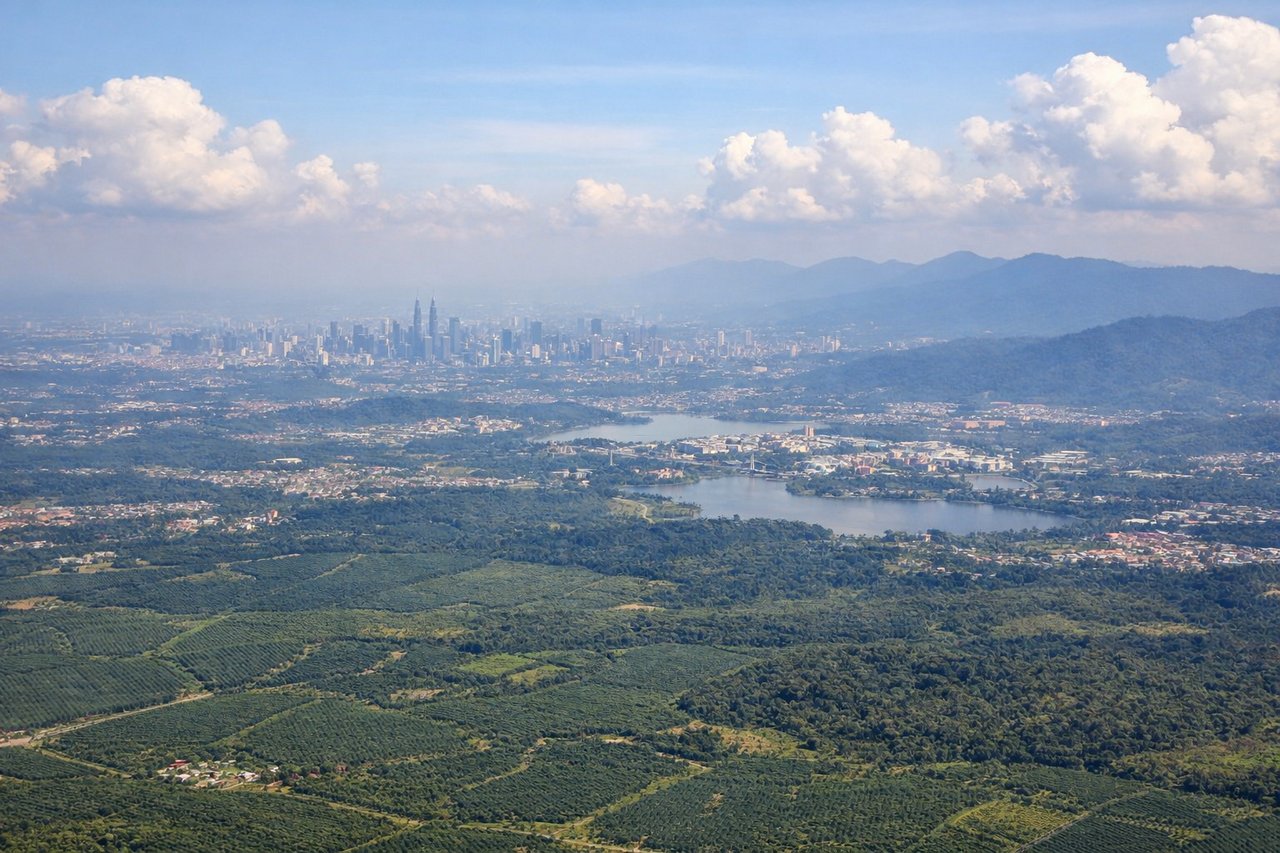
RIGHTKUL typically departs on runways 15L/15R (northbound) or 03L/03R (southbound). Right-side seats on northbound departures offer views of the Klang Valley's urban sprawl and the Strait of Malacca beyond. Southbound departures show less dramatic geography, making northbound the preferred scenario.
Landing at SUB
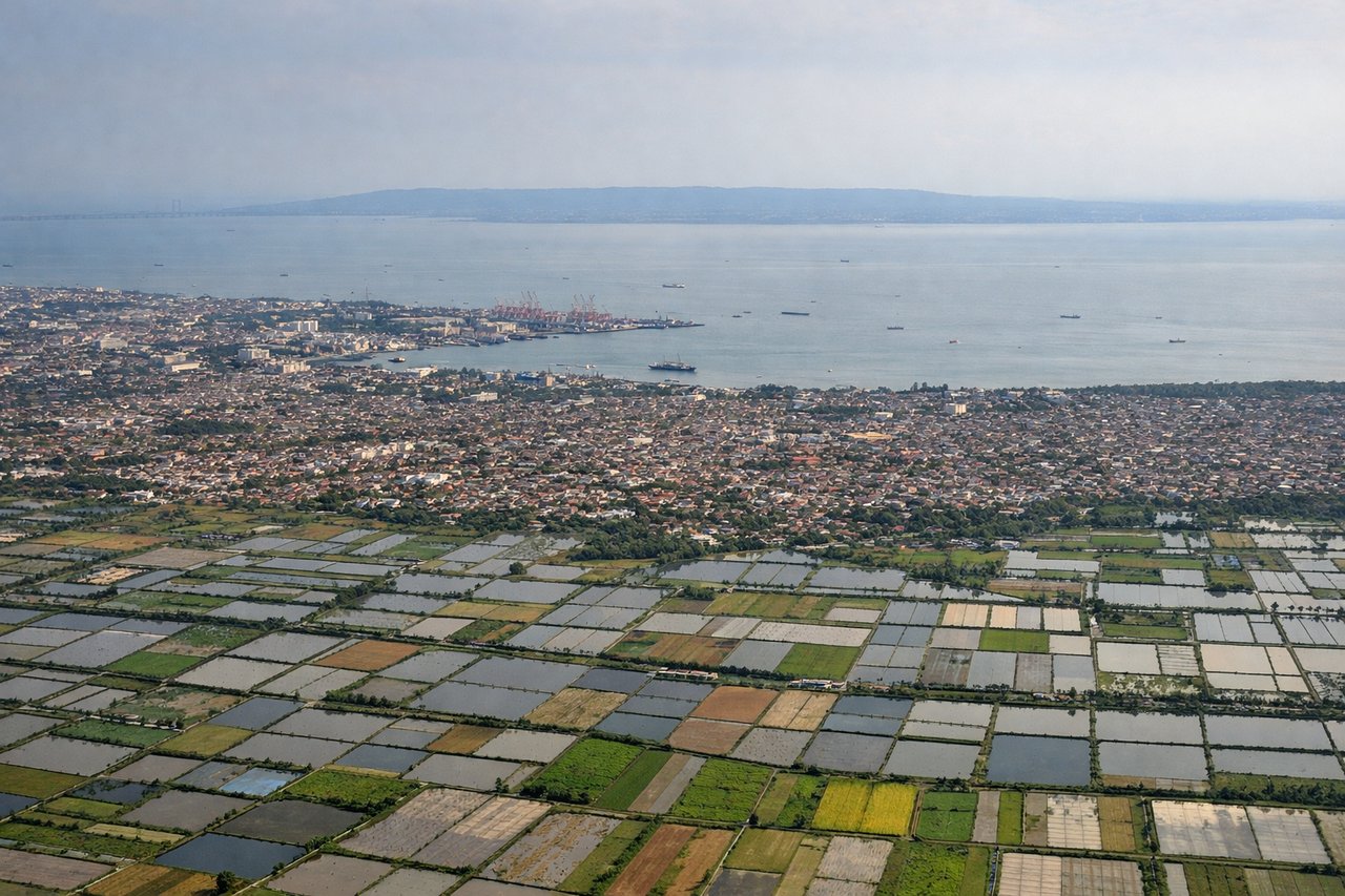
LEFTApproaching SUB from the northwest, aircraft descend over the Java Sea then the Surabaya urban area. Left-side seats capture the Java Sea's open water during descent, then the transition to the city's eastern coastal districts and the Madura Strait. Right-side views show inland industrial zones with less visual interest.
Landmarks on this routeAll landmarks →
Will your flight be in sunlight?
Pick a date and time in the Sun Map to watch the sun move across your whole flight.
About This Route
Which side of the plane should I sit on flying from Kuala Lumpur International (KUL) to Juanda International Airport (SUB)?
Sit on the Right side of the plane for the best views on flights from Kuala Lumpur to Surabaya. Right-side seats capture the most dramatic geography: the Klang Valley and Strait of Malacca on departure, then the Java Sea and Madura Strait on arrival. The route crosses open water for most of the flight, so the departure and arrival phases offer the best visual rewards on the right side.
What can I see during takeoff from Kuala Lumpur International in Kuala Lumpur?
During takeoff from Kuala Lumpur International (KUL), sit on the Right side for the best views. KUL typically departs on runways 15L/15R (northbound) or 03L/03R (southbound). Right-side seats on northbound departures offer views of the Klang Valley's urban sprawl and the Strait of Malacca beyond. Southbound departures show less dramatic geography, making northbound the preferred scenario. Notable sights include: Klang Valley urban development, Strait of Malacca (northwest), Titiwangsa Range foothills (east), Selangor River delta.
What can I see when landing at Juanda International Airport in Surabaya?
When landing at Juanda International Airport (SUB), sit on the Left side for the best views. Approaching SUB from the northwest, aircraft descend over the Java Sea then the Surabaya urban area. Left-side seats capture the Java Sea's open water during descent, then the transition to the city's eastern coastal districts and the Madura Strait. Right-side views show inland industrial zones with less visual interest. Notable sights include: Java Sea (northwest approach), Surabaya's coastal districts and harbor, Madura Island (northeast), Suramadu Bridge (if visible at lower altitude).
How long is the flight from Kuala Lumpur to Surabaya?
The flight from Kuala Lumpur International (KUL) to Juanda International Airport (SUB) takes about 2 hours 15 minutes. The shortest flight path between them is 1,036 miles (1,667 km); winds and air traffic control usually add a few percent.
What does the Kuala Lumpur to Surabaya flight path pass over?
The flight path crosses the Java Sea for roughly 90 minutes. At cruise altitude (around 35,000 feet), the sea appears as open blue water with occasional cloud formations. The Riau Islands (if visible through haze) lie to the east of the direct track. No major landmasses are crossed during the cruise phase—the route is almost entirely over water, making the departure and arrival phases the primary viewing opportunities.