The left side offers the more consistent scenic narrative across the flight: KL's skyline and mountain backdrop on departure, followed by Sumatra's southern highlands during cruise, and Mount Merapi's dramatic volcanic profile on arrival. The right side is dominated by open water for much of the route with less terrain variety.
Flown KUL to YIA? Did we get it right?
Flight Path
Kuala Lumpur to Yogyakarta is 934 miles (1,503 km), a flight of about 2 hours 10 minutes.
Southern tip of Sumatra's Barisan mountains, the Sunda Strait, and the open waters of the Java Sea before the Java coastline comes into view
Great circle distance and headings ›Phase by phase
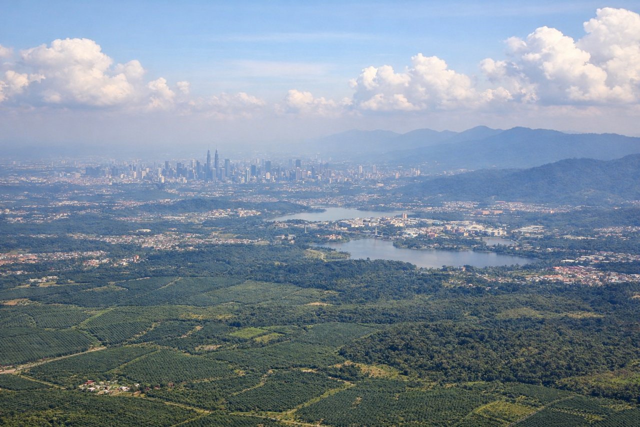
Takeoff from KUL
LEFTDeparting KUL to the south, the left side gives passengers a view back toward the Kuala Lumpur skyline and the Titiwangsa mountain range that forms the spine of Peninsular Malaysia. The right side mostly faces the flatter coastal plain toward the Strait of Malacca with less definition.
Landing at YIA
LEFTOn approach into YIA, the descent path from the north brings Mount Merapi's volcanic cone into view on the left side, along with Java's fertile volcanic plains. The right side faces mostly toward the open Indian Ocean with less distinctive terrain until final turn.
Will your flight be in sunlight?
Pick a date and time in the Sun Map to watch the sun move across your whole flight.
About This Route
Which side of the plane should I sit on flying from Kuala Lumpur International (KUL) to Yogyakarta International Airport (YIA)?
Sit on the Left side of the plane for the best views on flights from Kuala Lumpur to Yogyakarta. The left side offers the more consistent scenic narrative across the flight: KL's skyline and mountain backdrop on departure, followed by Sumatra's southern highlands during cruise, and Mount Merapi's dramatic volcanic profile on arrival. The right side is dominated by open water for much of the route with less terrain variety.
What can I see during takeoff from Kuala Lumpur International in Kuala Lumpur?
During takeoff from Kuala Lumpur International (KUL), sit on the Left side for the best views. Departing KUL to the south, the left side gives passengers a view back toward the Kuala Lumpur skyline and the Titiwangsa mountain range that forms the spine of Peninsular Malaysia. The right side mostly faces the flatter coastal plain toward the Strait of Malacca with less definition. Notable sights include: Kuala Lumpur skyline (Petronas Towers area), Titiwangsa mountain range, Klang Valley urban sprawl.
What can I see when landing at Yogyakarta International Airport in Yogyakarta?
When landing at Yogyakarta International Airport (YIA), sit on the Left side for the best views. On approach into YIA, the descent path from the north brings Mount Merapi's volcanic cone into view on the left side, along with Java's fertile volcanic plains. The right side faces mostly toward the open Indian Ocean with less distinctive terrain until final turn. Notable sights include: Mount Merapi volcanic cone, Yogyakarta's agricultural plains, Progo River valley.
How long is the flight from Kuala Lumpur to Yogyakarta?
The flight from Kuala Lumpur International (KUL) to Yogyakarta International Airport (YIA) takes about 2 hours 10 minutes. The shortest flight path between them is 934 miles (1,503 km); winds and air traffic control usually add a few percent.
What does the Kuala Lumpur to Yogyakarta flight path pass over?
Southern tip of Sumatra's Barisan mountains, the Sunda Strait, and the open waters of the Java Sea before the Java coastline comes into view