The right side delivers the most dramatic scenery at departure — the Spring Mountains, Red Rock Canyon, and the Las Vegas Strip are genuinely spectacular and hard to beat. The landing views on the left are pleasant but the Iowa farmland and modest skyline are less visually striking. Right side wins overall for the takeoff spectacle alone.
Flown LAS to DSM? Did we get it right?
Flight Path
Las Vegas to Des Moines is 1,213 miles (1,953 km), a flight of about 3 hours 15 minutes.
The flight crosses the Colorado Plateau and Utah's canyon country early on, then transitions over the Rocky Mountain foothills near Grand Junction, CO. The central portion crosses the high plains of Colorado and Nebraska — flat, agricultural, and largely featureless at altitude. The Missouri River valley is visible as the flight enters Iowa from the west, with the Loess Hills visible as a subtle ridge along the Iowa-Nebraska border.
Great circle distance and headings ›


Phase by phase
Takeoff from LAS
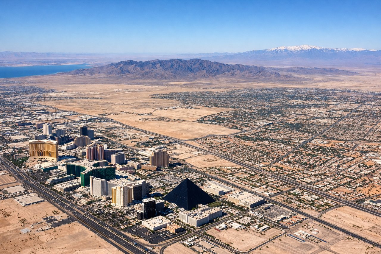
RIGHTMcCarran typically departs northbound or southbound on runways 19/01 or 25/07. On a northeast-bound departure toward DSM, the aircraft climbs out over the Las Vegas Valley and banks northeast, putting the Spring Mountains and Red Rock Canyon on the right side. The Strip and downtown Las Vegas are also visible to the right during the initial climb.
Landing at DSM
LEFTDes Moines International primarily uses runways 13/31 and 05/23. On approach from the west-southwest, the aircraft typically descends over the Iowa farmland grid and lines up from the northwest or west. The left side gives a clear view of the Des Moines River, the downtown skyline, and the Iowa State Capitol dome as the plane descends into the metro area.
Will your flight be in sunlight?
Pick a date and time in the Sun Map to watch the sun move across your whole flight.
About This Route
Which side of the plane should I sit on flying from Mc Carran International (LAS) to Des Moines International (DSM)?
Sit on the Right side of the plane for the best views on flights from Las Vegas to Des Moines. The right side delivers the most dramatic scenery at departure — the Spring Mountains, Red Rock Canyon, and the Las Vegas Strip are genuinely spectacular and hard to beat. The landing views on the left are pleasant but the Iowa farmland and modest skyline are less visually striking. Right side wins overall for the takeoff spectacle alone.
What can I see during takeoff from Mc Carran International in Las Vegas?
During takeoff from Mc Carran International (LAS), sit on the Right side for the best views. McCarran typically departs northbound or southbound on runways 19/01 or 25/07. On a northeast-bound departure toward DSM, the aircraft climbs out over the Las Vegas Valley and banks northeast, putting the Spring Mountains and Red Rock Canyon on the right side. The Strip and downtown Las Vegas are also visible to the right during the initial climb. Notable sights include: Las Vegas Strip (resort corridor), Red Rock Canyon escarpment, Spring Mountains (Charleston Peak at 11,918 ft), Lake Mead to the east.
What can I see when landing at Des Moines International in Des Moines?
When landing at Des Moines International (DSM), sit on the Left side for the best views. Des Moines International primarily uses runways 13/31 and 05/23. On approach from the west-southwest, the aircraft typically descends over the Iowa farmland grid and lines up from the northwest or west. The left side gives a clear view of the Des Moines River, the downtown skyline, and the Iowa State Capitol dome as the plane descends into the metro area. Notable sights include: Des Moines River, Iowa State Capitol building, downtown Des Moines skyline, Saylorville Lake to the north.
How long is the flight from Las Vegas to Des Moines?
The flight from Mc Carran International (LAS) to Des Moines International (DSM) takes about 3 hours 15 minutes. The shortest flight path between them is 1,213 miles (1,953 km); winds and air traffic control usually add a few percent.
What does the Las Vegas to Des Moines flight path pass over?
The flight crosses the Colorado Plateau and Utah's canyon country early on, then transitions over the Rocky Mountain foothills near Grand Junction, CO. The central portion crosses the high plains of Colorado and Nebraska — flat, agricultural, and largely featureless at altitude. The Missouri River valley is visible as the flight enters Iowa from the west, with the Loess Hills visible as a subtle ridge along the Iowa-Nebraska border.