Las Vegas to Oakland is 407 miles (654 km), a flight of about 1 hour 10 minutes.
The right side wins at takeoff but the left side delivers the more dramatic payoff: the San Francisco Bay approach is one of the most iconic urban water landings in the US, and the left seat sees all of it. For the full flight, left also catches the Sierra Nevada from the east as you cross into California, which is a significant visual event.
Flight Path
The flight crosses the Mojave Desert, then the southern end of the Great Basin. Crossing into California, the Sierra Nevada appears as a dramatic north-south wall of granite peaks. Depending on routing, you may pass near or over Yosemite high country or the Lake Tahoe basin. The Central Valley (San Joaquin Valley) is a broad flat agricultural patchwork before the Bay Area hills rise on the western edge.
Great circle distance and headings ›


Phase by phase
Takeoff from LAS
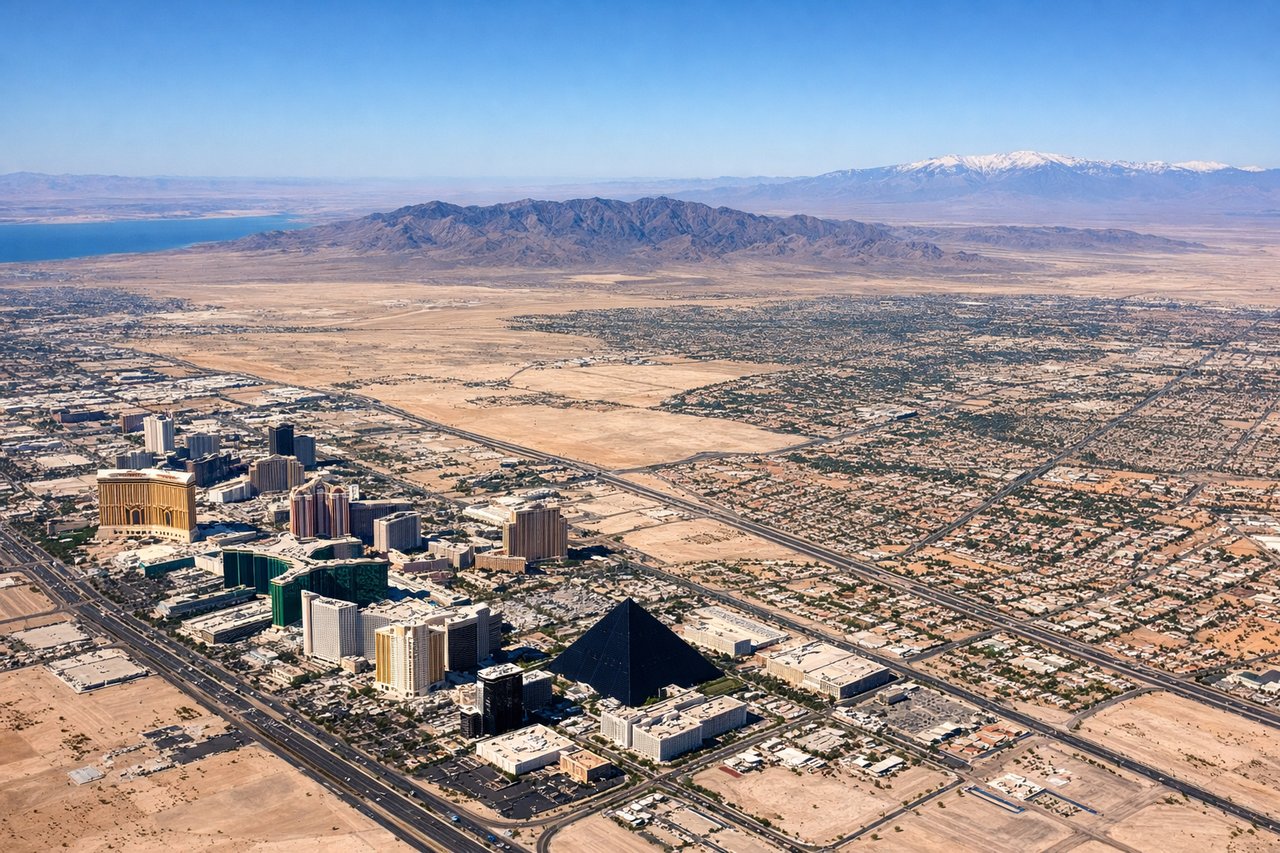
RIGHTMcCarran typically departs northwest on runway 26L/26R or south on 19L/19R. On a northwest departure toward Oakland, the right side gives you the Las Vegas Strip in its full north-south glory as you bank left, plus the Spring Mountains and Red Rock Canyon to the west. Left side gets suburban sprawl.
Landing at OAK
LEFTOakland approaches typically come in from the east or southeast over the Bay. On approach from the east, the left side faces north and gives you San Francisco Bay, the Bay Bridge, San Francisco skyline, and Marin headlands. Right side looks toward the East Bay hills and suburban Alameda County.
Landmarks on this routeAll landmarks →
Will your flight be in sunlight?
Pick a date and time in the Sun Map to watch the sun move across your whole flight.
About This Route
Which side of the plane should I sit on flying from Mc Carran International (LAS) to Metropolitan Oakland International (OAK)?
Sit on the Left side of the plane for the best views on flights from Las Vegas to Oakland. The right side wins at takeoff but the left side delivers the more dramatic payoff: the San Francisco Bay approach is one of the most iconic urban water landings in the US, and the left seat sees all of it. For the full flight, left also catches the Sierra Nevada from the east as you cross into California, which is a significant visual event.
What can I see during takeoff from Mc Carran International in Las Vegas?
During takeoff from Mc Carran International (LAS), sit on the Right side for the best views. McCarran typically departs northwest on runway 26L/26R or south on 19L/19R. On a northwest departure toward Oakland, the right side gives you the Las Vegas Strip in its full north-south glory as you bank left, plus the Spring Mountains and Red Rock Canyon to the west. Left side gets suburban sprawl. Notable sights include: Las Vegas Strip (south to north), Red Rock Canyon escarpment, Spring Mountains (Charleston Peak at 11,918 ft), Lake Mead visible to the northeast.
What can I see when landing at Metropolitan Oakland International in Oakland?
When landing at Metropolitan Oakland International (OAK), sit on the Left side for the best views. Oakland approaches typically come in from the east or southeast over the Bay. On approach from the east, the left side faces north and gives you San Francisco Bay, the Bay Bridge, San Francisco skyline, and Marin headlands. Right side looks toward the East Bay hills and suburban Alameda County. Notable sights include: San Francisco Bay, San Francisco skyline and downtown, Bay Bridge (eastern span visible), Marin Headlands and Golden Gate Bridge in the far distance.
How long is the flight from Las Vegas to Oakland?
The flight from Mc Carran International (LAS) to Metropolitan Oakland International (OAK) takes about 1 hour 10 minutes. The shortest flight path between them is 407 miles (654 km); winds and air traffic control usually add a few percent.
What does the Las Vegas to Oakland flight path pass over?
The flight crosses the Mojave Desert, then the southern end of the Great Basin. Crossing into California, the Sierra Nevada appears as a dramatic north-south wall of granite peaks. Depending on routing, you may pass near or over Yosemite high country or the Lake Tahoe basin. The Central Valley (San Joaquin Valley) is a broad flat agricultural patchwork before the Bay Area hills rise on the western edge.