Los Angeles to Guatemala City is 2,194 miles (3,532 km), a flight of about 5 hours 15 minutes.
The right side delivers a more consistent scenic arc: Southern California coastline and islands at departure, glimpses of the Mexican Pacific coast during cruise, and a volcano-studded highland approach into Guatemala City, while the left side is dominated by urban haze and less distinct interior terrain.
Flight Path
Pacific coastal lowlands and Sierra Madre del Sur foothills of southern Mexico, with the Gulf of Tehuantepec visible where the coastline narrows near Oaxaca and Chiapas before the route enters Guatemalan airspace.
Great circle distance and headings ›Phase by phase
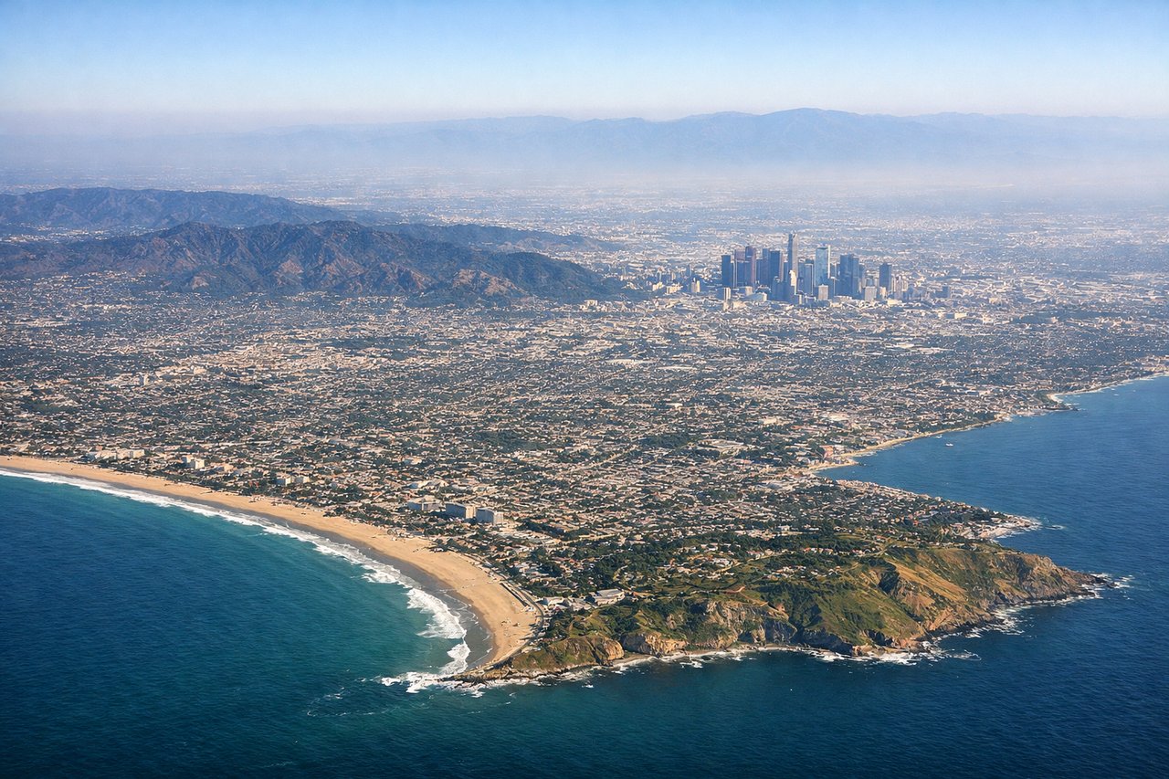
Takeoff from LAX
RIGHTAfter the initial westbound roll off LAX, the aircraft banks south toward Central America, putting the Pacific Ocean, Palos Verdes Peninsula, and Catalina Island on the right side. The left side mostly shows the hazy LA basin sprawl and San Gabriel foothills receding inland.
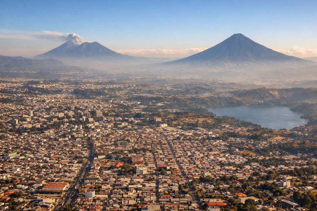
Landing at GUA
RIGHTOn the typical runway 20 approach into Guatemala City, the plane descends from the north with the volcanic cones of Fuego and Acatenango visible off to the southwest, best seen from the right side. The left side mainly shows Pacaya volcano and Lake Amatitlan, which are scenic but less dramatic.
Landmarks on this routeAll landmarks →
Will your flight be in sunlight?
Pick a date and time in the Sun Map to watch the sun move across your whole flight.
About This Route
Which side of the plane should I sit on flying from Los Angeles International (LAX) to La Aurora (GUA)?
Sit on the Right side of the plane for the best views on flights from Los Angeles to Guatemala City. The right side delivers a more consistent scenic arc: Southern California coastline and islands at departure, glimpses of the Mexican Pacific coast during cruise, and a volcano-studded highland approach into Guatemala City, while the left side is dominated by urban haze and less distinct interior terrain.
What can I see during takeoff from Los Angeles International in Los Angeles?
During takeoff from Los Angeles International (LAX), sit on the Right side for the best views. After the initial westbound roll off LAX, the aircraft banks south toward Central America, putting the Pacific Ocean, Palos Verdes Peninsula, and Catalina Island on the right side. The left side mostly shows the hazy LA basin sprawl and San Gabriel foothills receding inland. Notable sights include: Palos Verdes Peninsula, Santa Catalina Island, Pacific coastline near San Diego, Baja California's northern coast.
What can I see when landing at La Aurora in Guatemala City?
When landing at La Aurora (GUA), sit on the Right side for the best views. On the typical runway 20 approach into Guatemala City, the plane descends from the north with the volcanic cones of Fuego and Acatenango visible off to the southwest, best seen from the right side. The left side mainly shows Pacaya volcano and Lake Amatitlan, which are scenic but less dramatic. Notable sights include: Volcán de Fuego, Volcán Acatenango, Guatemala City highland valley, Volcán de Agua in the distance.
How long is the flight from Los Angeles to Guatemala City?
The flight from Los Angeles International (LAX) to La Aurora (GUA) takes about 5 hours 15 minutes. The shortest flight path between them is 2,194 miles (3,532 km); winds and air traffic control usually add a few percent.
What does the Los Angeles to Guatemala City flight path pass over?
Pacific coastal lowlands and Sierra Madre del Sur foothills of southern Mexico, with the Gulf of Tehuantepec visible where the coastline narrows near Oaxaca and Chiapas before the route enters Guatemalan airspace.