Guatemala City to Los Angeles is 2,194 miles (3,532 km), a flight of about 5 hours 15 minutes.
The right side delivers the more dramatic and varied scenery: Guatemala's volcanoes at departure, glimpses of Mexico's Sierra Madre ranges during cruise, and the San Gabriel Mountains with the LA skyline on arrival, compared to the left side's longer stretches of Pacific coastline and open water.
Flight Path
Sierra Madre Occidental foothills, the Gulf of California, and the arid coastal plains of Sonora and Sinaloa along the flight path
Great circle distance and headings ›Phase by phase
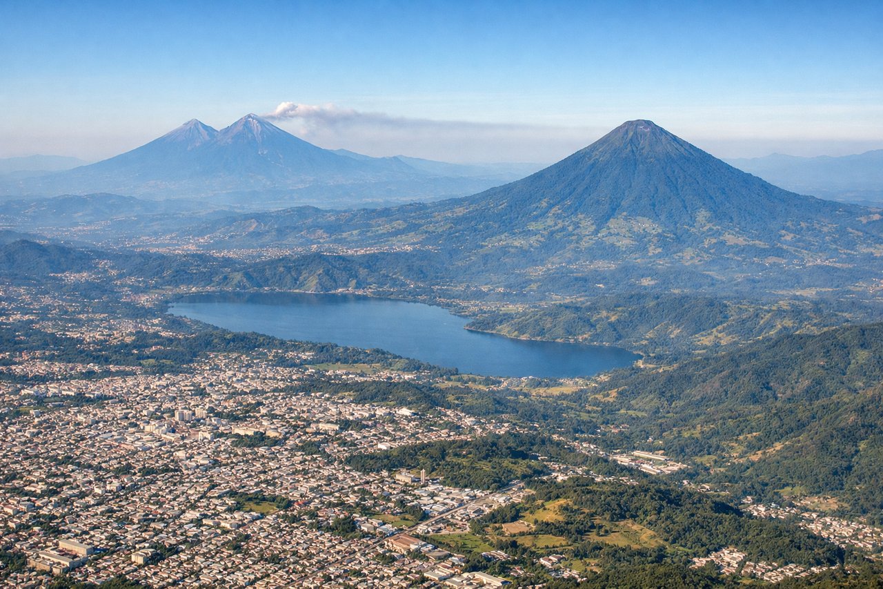
Takeoff from GUA
RIGHTDeparting GUA to the south before turning northwest puts Guatemala's volcanic chain on the right side of the aircraft, offering dramatic close-up views of the cones ringing Guatemala City as the plane climbs and banks toward Mexico.

Landing at LAX
RIGHTOn the typical west-flow approach into LAX, the aircraft crosses the LA basin heading west, putting the San Gabriel Mountains and the downtown Los Angeles skyline on the right side of the cabin just before the turn onto final approach.
Landmarks on this routeAll landmarks →
Will your flight be in sunlight?
Pick a date and time in the Sun Map to watch the sun move across your whole flight.
About This Route
Which side of the plane should I sit on flying from La Aurora (GUA) to Los Angeles International (LAX)?
Sit on the Right side of the plane for the best views on flights from Guatemala City to Los Angeles. The right side delivers the more dramatic and varied scenery: Guatemala's volcanoes at departure, glimpses of Mexico's Sierra Madre ranges during cruise, and the San Gabriel Mountains with the LA skyline on arrival, compared to the left side's longer stretches of Pacific coastline and open water.
What can I see during takeoff from La Aurora in Guatemala City?
During takeoff from La Aurora (GUA), sit on the Right side for the best views. Departing GUA to the south before turning northwest puts Guatemala's volcanic chain on the right side of the aircraft, offering dramatic close-up views of the cones ringing Guatemala City as the plane climbs and banks toward Mexico. Notable sights include: Volcán de Agua, Volcán de Fuego, Acatenango, Guatemala City basin.
What can I see when landing at Los Angeles International in Los Angeles?
When landing at Los Angeles International (LAX), sit on the Right side for the best views. On the typical west-flow approach into LAX, the aircraft crosses the LA basin heading west, putting the San Gabriel Mountains and the downtown Los Angeles skyline on the right side of the cabin just before the turn onto final approach. Notable sights include: San Gabriel Mountains, Downtown Los Angeles skyline, San Fernando Valley, Griffith Park hills.
How long is the flight from Guatemala City to Los Angeles?
The flight from La Aurora (GUA) to Los Angeles International (LAX) takes about 5 hours 15 minutes. The shortest flight path between them is 2,194 miles (3,532 km); winds and air traffic control usually add a few percent.
What does the Guatemala City to Los Angeles flight path pass over?
Sierra Madre Occidental foothills, the Gulf of California, and the arid coastal plains of Sonora and Sinaloa along the flight path