Guatemala City to Dallas-Fort Worth is 1,330 miles (2,140 km), a flight of about 3 hours 45 minutes.
The left side wins on the strength of Guatemala's volcanic departure sequence and a more engaging urban view on the DFW approach, while the right side spends much of the cruise over the featureless Gulf of Mexico or flat Texas coastal plain.
Flight Path
Gulf of Mexico open water, Yucatan Peninsula coastline near Campeche, and the low coastal plains of southern Texas near Corpus Christi
Great circle distance and headings ›Phase by phase
Takeoff from GUA
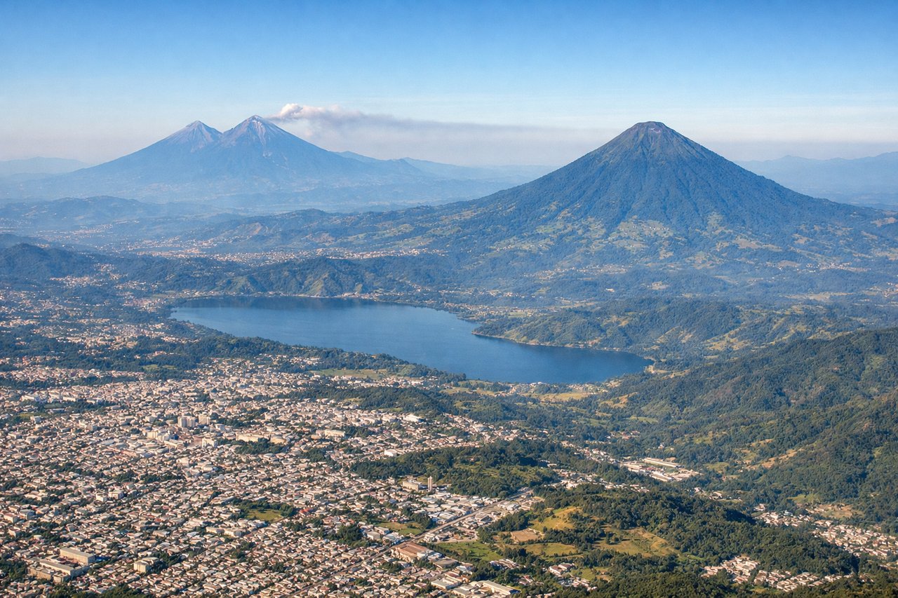
LEFTDeparting GUA on runway 02 (northbound), the aircraft climbs away from Guatemala City with the volcanic cordillera - Agua, Fuego, Acatenango, and Pacaya - arrayed to the south and southwest, visible on the left side as the plane banks onto its northbound routing. This is one of the most dramatic volcanic skylines visible from any Central American departure.

Landing at DFW
LEFTOn approach to DFW from the south under typical wind conditions, the final turn onto the parallel runways offers a left-side view over the sprawling Dallas-Fort Worth metroplex and its many reservoirs, a more visually engaging urban scene than the flat farmland typically seen from the right.
Will your flight be in sunlight?
Pick a date and time in the Sun Map to watch the sun move across your whole flight.
About This Route
Which side of the plane should I sit on flying from La Aurora (GUA) to Dallas Fort Worth International (DFW)?
Sit on the Left side of the plane for the best views on flights from Guatemala City to Dallas-Fort Worth. The left side wins on the strength of Guatemala's volcanic departure sequence and a more engaging urban view on the DFW approach, while the right side spends much of the cruise over the featureless Gulf of Mexico or flat Texas coastal plain.
What can I see during takeoff from La Aurora in Guatemala City?
During takeoff from La Aurora (GUA), sit on the Left side for the best views. Departing GUA on runway 02 (northbound), the aircraft climbs away from Guatemala City with the volcanic cordillera - Agua, Fuego, Acatenango, and Pacaya - arrayed to the south and southwest, visible on the left side as the plane banks onto its northbound routing. This is one of the most dramatic volcanic skylines visible from any Central American departure. Notable sights include: Volcán de Agua, Volcán de Fuego, Acatenango, Pacaya.
What can I see when landing at Dallas Fort Worth International in Dallas-Fort Worth?
When landing at Dallas Fort Worth International (DFW), sit on the Left side for the best views. On approach to DFW from the south under typical wind conditions, the final turn onto the parallel runways offers a left-side view over the sprawling Dallas-Fort Worth metroplex and its many reservoirs, a more visually engaging urban scene than the flat farmland typically seen from the right. Notable sights include: Dallas-Fort Worth metroplex skyline, Joe Pool Lake, Trinity River tributaries.
How long is the flight from Guatemala City to Dallas-Fort Worth?
The flight from La Aurora (GUA) to Dallas Fort Worth International (DFW) takes about 3 hours 45 minutes. The shortest flight path between them is 1,330 miles (2,140 km); winds and air traffic control usually add a few percent.
What does the Guatemala City to Dallas-Fort Worth flight path pass over?
Gulf of Mexico open water, Yucatan Peninsula coastline near Campeche, and the low coastal plains of southern Texas near Corpus Christi