Guatemala City to Miami is 1,019 miles (1,640 km), a flight of about 2 hours 40 minutes.
The right side delivers the dramatic volcanic highlands of Guatemala on departure — one of the most visually striking takeoff views in Central America — and still offers reasonable views of the Yucatán coastline and western Cuba en route. The left side wins at landing, but the departure scenery on the right is the highlight of this flight.
Flight Path
The flight tracks northeast over the Yucatán Peninsula (flat jungle canopy with occasional Maya archaeological sites visible as clearings), crosses the Gulf of Mexico's southeastern corner near the Yucatán Channel, passes over or near western Cuba's Pinar del Río province and the Sierra de los Órganos, then crosses the Florida Straits before reaching the Florida Keys and the Everglades on approach to Miami.
Great circle distance and headings ›


Phase by phase
Takeoff from GUA
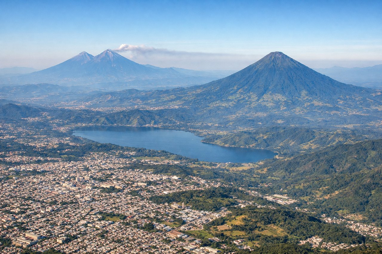
RIGHTLa Aurora's primary departure runway 01 heads north, putting the volcanic chain of Guatemala's Central Highlands on the right (east) side. You get a direct view of Volcán de Agua, Volcán Acatenango, and Volcán de Fuego rising above the valley as the aircraft climbs out over Guatemala City.
Landing at MIA
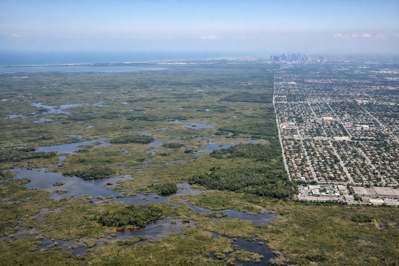
LEFTMIA typically uses runway 09/27 or 08L/26R for arrivals from the west-southwest. Approaching from the southwest over the Florida Everglades, the left (south) side gives you the clearest view of Biscayne Bay, the Miami Beach barrier island, and the downtown Miami skyline as the aircraft turns onto final approach.
Landmarks on this routeAll landmarks →
Will your flight be in sunlight?
Pick a date and time in the Sun Map to watch the sun move across your whole flight.
About This Route
Which side of the plane should I sit on flying from La Aurora (GUA) to Miami International (MIA)?
Sit on the Right side of the plane for the best views on flights from Guatemala City to Miami. The right side delivers the dramatic volcanic highlands of Guatemala on departure — one of the most visually striking takeoff views in Central America — and still offers reasonable views of the Yucatán coastline and western Cuba en route. The left side wins at landing, but the departure scenery on the right is the highlight of this flight.
What can I see during takeoff from La Aurora in Guatemala City?
During takeoff from La Aurora (GUA), sit on the Right side for the best views. La Aurora's primary departure runway 01 heads north, putting the volcanic chain of Guatemala's Central Highlands on the right (east) side. You get a direct view of Volcán de Agua, Volcán Acatenango, and Volcán de Fuego rising above the valley as the aircraft climbs out over Guatemala City. Notable sights include: Volcán de Agua (3,760m), Volcán Acatenango (3,976m), Volcán de Fuego (3,763m) with possible ash plume, Lake Amatitlán directly below during initial climb.
What can I see when landing at Miami International in Miami?
When landing at Miami International (MIA), sit on the Left side for the best views. MIA typically uses runway 09/27 or 08L/26R for arrivals from the west-southwest. Approaching from the southwest over the Florida Everglades, the left (south) side gives you the clearest view of Biscayne Bay, the Miami Beach barrier island, and the downtown Miami skyline as the aircraft turns onto final approach. Notable sights include: Biscayne Bay, Miami Beach and South Beach barrier island, Downtown Miami skyline, Florida Keys chain visible to the south on clear days.
How long is the flight from Guatemala City to Miami?
The flight from La Aurora (GUA) to Miami International (MIA) takes about 2 hours 40 minutes. The shortest flight path between them is 1,019 miles (1,640 km); winds and air traffic control usually add a few percent.
What does the Guatemala City to Miami flight path pass over?
The flight tracks northeast over the Yucatán Peninsula (flat jungle canopy with occasional Maya archaeological sites visible as clearings), crosses the Gulf of Mexico's southeastern corner near the Yucatán Channel, passes over or near western Cuba's Pinar del Río province and the Sierra de los Órganos, then crosses the Florida Straits before reaching the Florida Keys and the Everglades on approach to Miami.