Guatemala City to Newark is 2,055 miles (3,307 km), a flight of about 4 hours 30 minutes.
The right side delivers the dramatic Guatemalan volcanic chain on departure, which is genuinely one of the most spectacular airport climb-outs in the Americas. The landing view from the left is excellent but more familiar. Right side wins on the strength of the takeoff alone.
Flight Path
After departing Guatemala, the route tracks northeast over the Yucatán Peninsula (flat jungle canopy visible on clear days), then crosses the Gulf of Mexico with open water for roughly 90 minutes. The Florida Peninsula may appear on the right in the distance. The route then follows the US East Coast corridor over Georgia, the Carolinas, Virginia, and Maryland before descending into the New York metro area. The Appalachian ridgelines of Virginia and Pennsylvania are visible as parallel forested folds from either side during descent.
Great circle distance and headings ›
.jpg?width=600)
.jpeg?width=600)
Phase by phase
Takeoff from GUA
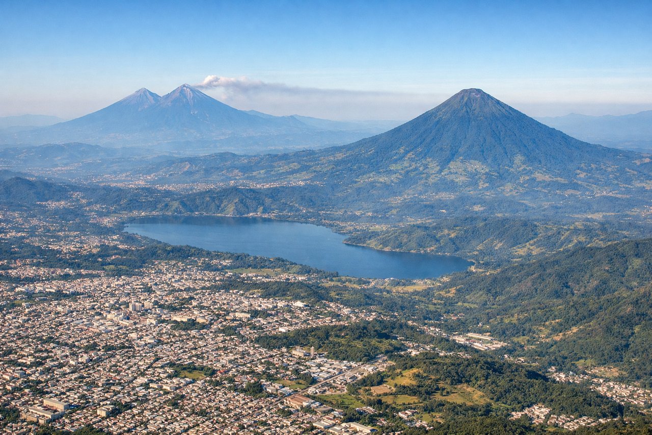
RIGHTLa Aurora's primary runway 01/19 means northbound departures climb out heading north, putting the volcanic chain of Guatemala's Central Highlands on the right (east) side. You get a direct view of Volcán de Agua, Volcán Acatenango, and Volcán de Fuego rising above the valley as the aircraft climbs.
Landing at EWR
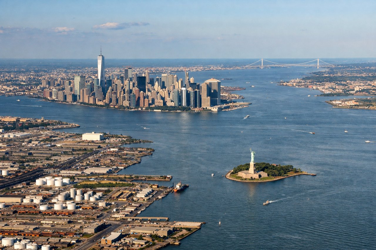
LEFTFlights from Guatemala typically approach EWR from the southwest, with aircraft lining up for runway 22L/22R or 29 depending on winds. A left-side seat gives you the Manhattan skyline, Upper New York Bay, and the Verrazano-Narrows Bridge as the aircraft descends over New Jersey.
Landmarks on this routeAll landmarks →
Will your flight be in sunlight?
Pick a date and time in the Sun Map to watch the sun move across your whole flight.
About This Route
Which side of the plane should I sit on flying from La Aurora (GUA) to Newark Liberty International (EWR)?
Sit on the Right side of the plane for the best views on flights from Guatemala City to Newark. The right side delivers the dramatic Guatemalan volcanic chain on departure, which is genuinely one of the most spectacular airport climb-outs in the Americas. The landing view from the left is excellent but more familiar. Right side wins on the strength of the takeoff alone.
What can I see during takeoff from La Aurora in Guatemala City?
During takeoff from La Aurora (GUA), sit on the Right side for the best views. La Aurora's primary runway 01/19 means northbound departures climb out heading north, putting the volcanic chain of Guatemala's Central Highlands on the right (east) side. You get a direct view of Volcán de Agua, Volcán Acatenango, and Volcán de Fuego rising above the valley as the aircraft climbs. Notable sights include: Volcán de Agua (3,760m), Volcán Acatenango (3,976m), Volcán de Fuego (3,763m) with possible plume, Lake Amatitlán directly below during initial climb.
What can I see when landing at Newark Liberty International in Newark?
When landing at Newark Liberty International (EWR), sit on the Left side for the best views. Flights from Guatemala typically approach EWR from the southwest, with aircraft lining up for runway 22L/22R or 29 depending on winds. A left-side seat gives you the Manhattan skyline, Upper New York Bay, and the Verrazano-Narrows Bridge as the aircraft descends over New Jersey. Notable sights include: Manhattan skyline, Upper New York Bay, Verrazano-Narrows Bridge, Newark Bay and Port Newark container terminals.
How long is the flight from Guatemala City to Newark?
The flight from La Aurora (GUA) to Newark Liberty International (EWR) takes about 4 hours 30 minutes. The shortest flight path between them is 2,055 miles (3,307 km); winds and air traffic control usually add a few percent.
What does the Guatemala City to Newark flight path pass over?
After departing Guatemala, the route tracks northeast over the Yucatán Peninsula (flat jungle canopy visible on clear days), then crosses the Gulf of Mexico with open water for roughly 90 minutes. The Florida Peninsula may appear on the right in the distance. The route then follows the US East Coast corridor over Georgia, the Carolinas, Virginia, and Maryland before descending into the New York metro area. The Appalachian ridgelines of Virginia and Pennsylvania are visible as parallel forested folds from either side during descent.