The right side wins at takeoff but the left side delivers the more dramatic and geographically unique payoff on approach into Panama — the canal, the Bridge of the Americas, and the Pacific skyline are genuinely rare sights. Over the flight's midpoint through Central America, the left side also tracks closer to the Pacific coast volcanoes of Guatemala, El Salvador, and Costa Rica.
Flown LAX to PTY? Did we get it right?
Flight Path
Los Angeles to Panama City is 3,011 miles (4,845 km), a flight of about 5 hours 30 minutes.
The flight tracks southeast along the Pacific coast of Mexico past Baja California, then crosses Guatemala and El Salvador where the Pacific volcanic chain is visible — a line of conical stratovolcanoes including Tajumulco and Santa Ana running parallel to the coast. Over Costa Rica the Cordillera Central is visible including Volcán Irazú. The narrow isthmus of Panama appears at the end with dense jungle and the canal cutting across it.
Great circle distance and headings ›

Phase by phase
Takeoff from LAX
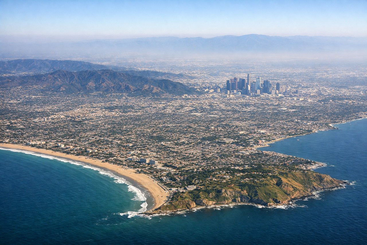
RIGHTLAX departures heading south or southeast on runways 24L/24R put the Santa Monica Mountains, downtown LA skyline, and the sweep of Santa Monica Bay on the right side. You get a clear look back at the LA Basin as the aircraft banks southeast toward Mexico.
Landing at PTY
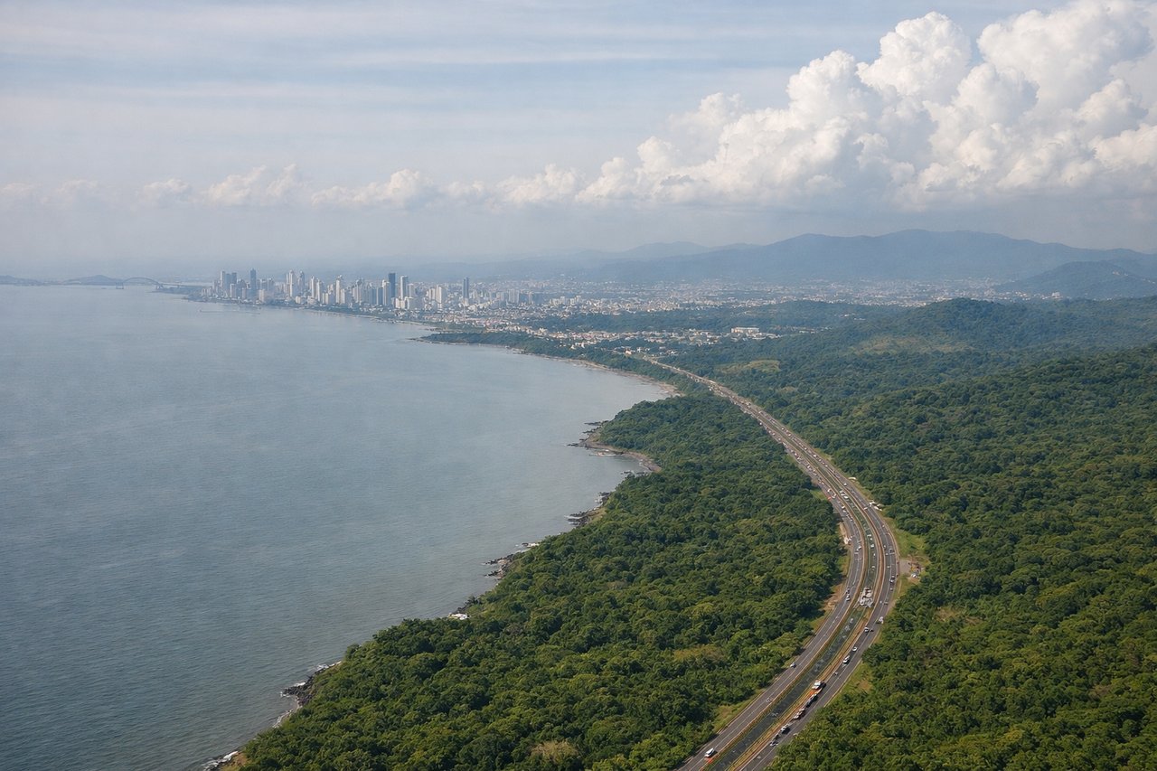
LEFTTocumen sits east of Panama City, and aircraft typically approach from the north or northwest on runway 03L/03R. The left side gives you Panama City's skyline along the Pacific coast of the isthmus, the Bridge of the Americas over the Pacific entrance to the Panama Canal, and the canal itself cutting across the narrow land bridge.
Will your flight be in sunlight?
Pick a date and time in the Sun Map to watch the sun move across your whole flight.
About This Route
Which side of the plane should I sit on flying from Los Angeles International (LAX) to Tocumen International (PTY)?
Sit on the Left side of the plane for the best views on flights from Los Angeles to Panama City. The right side wins at takeoff but the left side delivers the more dramatic and geographically unique payoff on approach into Panama — the canal, the Bridge of the Americas, and the Pacific skyline are genuinely rare sights. Over the flight's midpoint through Central America, the left side also tracks closer to the Pacific coast volcanoes of Guatemala, El Salvador, and Costa Rica.
What can I see during takeoff from Los Angeles International in Los Angeles?
During takeoff from Los Angeles International (LAX), sit on the Right side for the best views. LAX departures heading south or southeast on runways 24L/24R put the Santa Monica Mountains, downtown LA skyline, and the sweep of Santa Monica Bay on the right side. You get a clear look back at the LA Basin as the aircraft banks southeast toward Mexico. Notable sights include: Santa Monica Bay coastline, downtown Los Angeles skyline to the northeast, Palos Verdes Peninsula, Channel Islands on the horizon.
What can I see when landing at Tocumen International in Panama City?
When landing at Tocumen International (PTY), sit on the Left side for the best views. Tocumen sits east of Panama City, and aircraft typically approach from the north or northwest on runway 03L/03R. The left side gives you Panama City's skyline along the Pacific coast of the isthmus, the Bridge of the Americas over the Pacific entrance to the Panama Canal, and the canal itself cutting across the narrow land bridge. Notable sights include: Panama City skyline (Punta Pacifica and Miraflores area), Bridge of the Americas, Panama Canal Pacific entrance, Miraflores Locks visible from altitude.
How long is the flight from Los Angeles to Panama City?
The flight from Los Angeles International (LAX) to Tocumen International (PTY) takes about 5 hours 30 minutes. The shortest flight path between them is 3,011 miles (4,845 km); winds and air traffic control usually add a few percent.
What does the Los Angeles to Panama City flight path pass over?
The flight tracks southeast along the Pacific coast of Mexico past Baja California, then crosses Guatemala and El Salvador where the Pacific volcanic chain is visible — a line of conical stratovolcanoes including Tajumulco and Santa Ana running parallel to the coast. Over Costa Rica the Cordillera Central is visible including Volcán Irazú. The narrow isthmus of Panama appears at the end with dense jungle and the canal cutting across it.