The takeoff from Labasa offers more dramatic natural scenery with volcanic peaks and tropical seascape. While Dublin's approach is urban and geographically interesting, the Fiji departure provides superior scenic variety and visual impact from a window seat.
Flight Path
This ultra-long-haul route crosses the Pacific and Indian Oceans. Key midpoint geography includes: the International Date Line (crossed during the flight), the vast open Pacific Ocean with no visible landmarks for roughly 10-12 hours, the Equator crossing, and eventually the approach to the African and European continents. The flight path passes south of major island groups (Samoa, Tonga) and north of New Zealand. Over the Indian Ocean, the route crosses open water with no significant visible landmarks. As the aircraft approaches Europe, the Atlas Mountains of North Africa may be visible on the southern horizon during the final 2-3 hours, followed by the Mediterranean coast and eventually the Irish and British coastlines.
Great circle distance and headings ›Phase by phase
Takeoff from LBS
RIGHTLabasa is on the northern coast of Vanua Levu. A right-side seat offers views of the Koro Sea and the volcanic peaks of central Vanua Levu as the aircraft climbs northwestward. Left seats face inland terrain with less dramatic scenery.
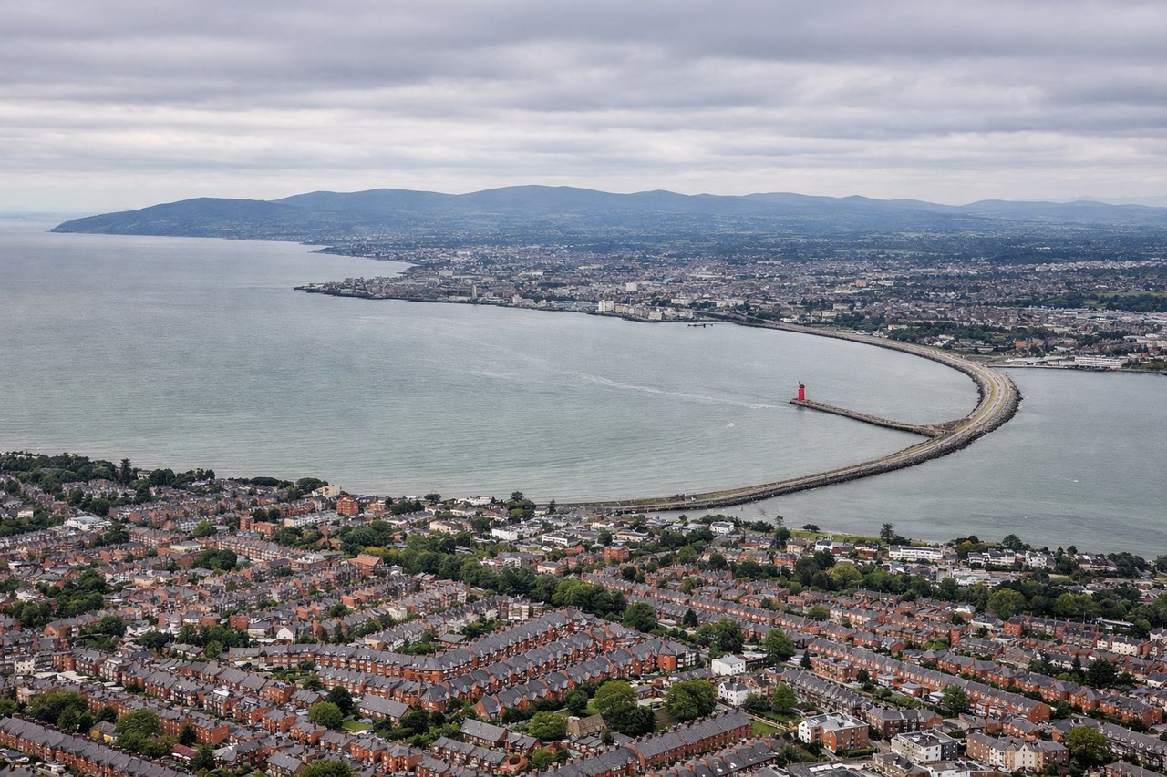
Landing at DUB
LEFTApproaching Dublin from the southwest, left-side seats capture views of the Irish coastline, Dublin Bay, and the city itself. The aircraft descends over the Irish Sea and follows the coast northward, making the left side optimal for seeing Howth Head, Dublin Bay's geography, and the city sprawl.
Landmarks on this routeAll landmarks →
Will your flight be in sunlight?
See exactly which side of the plane gets sun and shade at your departure time.
About This Route
Which side of the plane should I sit on flying from Labasa Airport (LBS) to Dublin (DUB)?
Sit on the Right side of the plane for the best views on flights from Labasa to Dublin. The takeoff from Labasa offers more dramatic natural scenery with volcanic peaks and tropical seascape. While Dublin's approach is urban and geographically interesting, the Fiji departure provides superior scenic variety and visual impact from a window seat.
What can I see during takeoff from Labasa Airport in Labasa?
During takeoff from Labasa Airport (LBS), sit on the Right side for the best views. Labasa is on the northern coast of Vanua Levu. A right-side seat offers views of the Koro Sea and the volcanic peaks of central Vanua Levu as the aircraft climbs northwestward. Left seats face inland terrain with less dramatic scenery. Notable sights include: Koro Sea, Vanua Levu volcanic ridge, Bua Province coastline, fringing coral reefs.
What can I see when landing at Dublin in Dublin?
When landing at Dublin (DUB), sit on the Left side for the best views. Approaching Dublin from the southwest, left-side seats capture views of the Irish coastline, Dublin Bay, and the city itself. The aircraft descends over the Irish Sea and follows the coast northward, making the left side optimal for seeing Howth Head, Dublin Bay's geography, and the city sprawl. Notable sights include: Dublin Bay, Howth Head, River Liffey estuary, Dublin city center and suburbs.
How long is the flight from Labasa to Dublin?
The flight from Labasa Airport (LBS) to Dublin (DUB) takes 16h 20m.
What does the Labasa to Dublin flight path pass over?
This ultra-long-haul route crosses the Pacific and Indian Oceans. Key midpoint geography includes: the International Date Line (crossed during the flight), the vast open Pacific Ocean with no visible landmarks for roughly 10-12 hours, the Equator crossing, and eventually the approach to the African and European continents. The flight path passes south of major island groups (Samoa, Tonga) and north of New Zealand. Over the Indian Ocean, the route crosses open water with no significant visible landmarks. As the aircraft approaches Europe, the Atlas Mountains of North Africa may be visible on the southern horizon during the final 2-3 hours, followed by the Mediterranean coast and eventually the Irish and British coastlines.