The takeoff from Larnaca offers more dramatic and visually distinctive scenery with the Troodos Mountains and Mediterranean context. While the Brussels landing provides interesting urban and river valley views, the Cyprus departure has greater visual impact and geographic variety.
Flown LCA to BRU? Did we get it right?
Flight Path
Larnaca to Brussels is 1,825 miles (2,936 km), a flight of about 4 hours 45 minutes.
The flight path crosses the Mediterranean northwestward, passing over the Aegean Sea and Greece. You'll see the Greek mainland coast (Peloponnese and central Greece) on the left during mid-flight at cruise altitude. The Balkans appear as you approach Central Europe, with the Danube valley visible in the distance before descending into Belgium. The entire route follows relatively clear geography with the Mediterranean, Greek islands, and European plains providing continuous reference points.
Great circle distance and headings ›Phase by phase
Takeoff from LCA
RIGHTRight side captures the Troodos Mountains immediately inland from Larnaca, rising dramatically to 6,400 feet. You'll also see the Larnaca coastline and salt lakes to the left as you climb, but the mountain range dominates the right view during the initial climb-out.
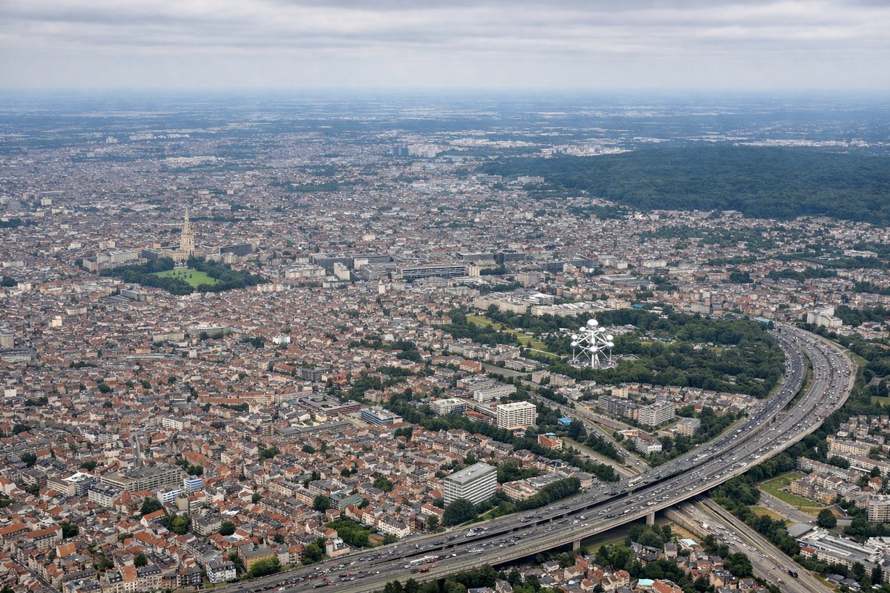
Landing at BRU
LEFTLeft side provides the best approach views into Brussels. As you descend over Belgium, the left wing shows the Meuse River valley and the approach corridor over Flanders, with the city of Brussels itself becoming visible on the left as you descend toward Zaventem runway.
Will your flight be in sunlight?
Pick a date and time in the Sun Map to watch the sun move across your whole flight.
About This Route
Which side of the plane should I sit on flying from Larnaca (LCA) to Brussels Natl (BRU)?
Sit on the Right side of the plane for the best views on flights from Larnaca to Brussels. The takeoff from Larnaca offers more dramatic and visually distinctive scenery with the Troodos Mountains and Mediterranean context. While the Brussels landing provides interesting urban and river valley views, the Cyprus departure has greater visual impact and geographic variety.
What can I see during takeoff from Larnaca in Larnaca?
During takeoff from Larnaca (LCA), sit on the Right side for the best views. Right side captures the Troodos Mountains immediately inland from Larnaca, rising dramatically to 6,400 feet. You'll also see the Larnaca coastline and salt lakes to the left as you climb, but the mountain range dominates the right view during the initial climb-out. Notable sights include: Troodos Mountains, Larnaca Salt Lake, Mediterranean coastline, Akrotiri Bay.
What can I see when landing at Brussels Natl in Brussels?
When landing at Brussels Natl (BRU), sit on the Left side for the best views. Left side provides the best approach views into Brussels. As you descend over Belgium, the left wing shows the Meuse River valley and the approach corridor over Flanders, with the city of Brussels itself becoming visible on the left as you descend toward Zaventem runway. Notable sights include: Meuse River valley, Flanders plains, Brussels metropolitan area, Zaventem airport approach corridor.
How long is the flight from Larnaca to Brussels?
The flight from Larnaca (LCA) to Brussels Natl (BRU) takes about 4 hours 45 minutes. The shortest flight path between them is 1,825 miles (2,936 km); winds and air traffic control usually add a few percent.
What does the Larnaca to Brussels flight path pass over?
The flight path crosses the Mediterranean northwestward, passing over the Aegean Sea and Greece. You'll see the Greek mainland coast (Peloponnese and central Greece) on the left during mid-flight at cruise altitude. The Balkans appear as you approach Central Europe, with the Danube valley visible in the distance before descending into Belgium. The entire route follows relatively clear geography with the Mediterranean, Greek islands, and European plains providing continuous reference points.