Right side scores higher (3.5 vs 2.5) due to consistent water-based scenery: the Gulf of Finland during departure and the Sea of Marmara/Bosphorus during arrival. These provide visual variety and recognizable landmarks throughout the flight. Left side remains predominantly flat terrain and open steppe with minimal distinctive features.
Flown LED to SAW? Did we get it right?
Flight Path
St. Petersburg to Pendik, Istanbul is 1,307 miles (2,103 km), a flight of about 2 hours 50 minutes.
Black Sea coast of Turkey (Rize and Trabzon regions visible at cruise altitude), Pontic Mountains running east-west along Turkish coastline, Danube River valley and Balkans (Bulgaria/Romania border region), Thrace plains of European Turkey
Great circle distance and headings ›Phase by phase
Takeoff from LED
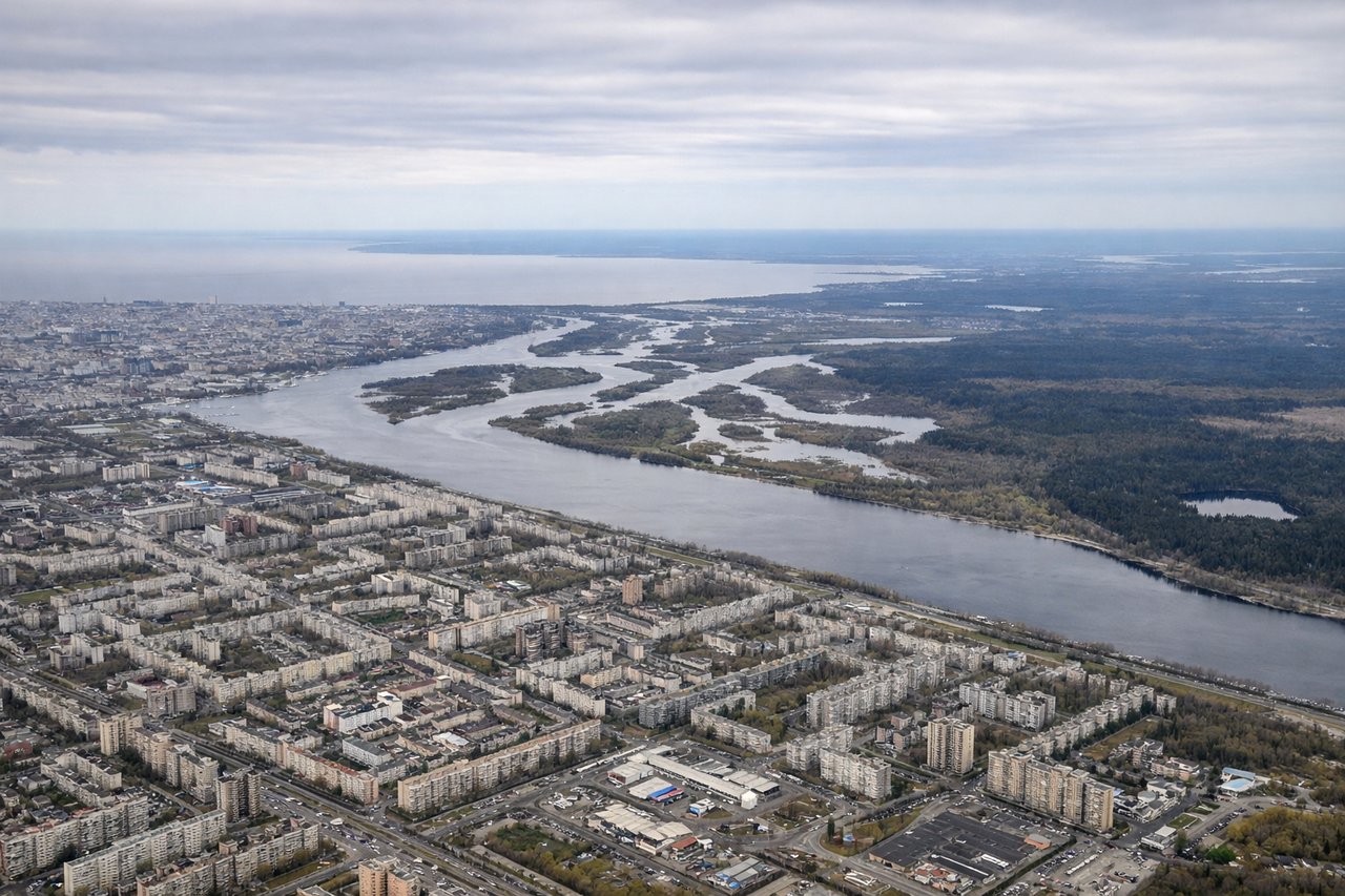
RIGHTRight side captures the Gulf of Finland coastline and the city of St. Petersburg's waterfront during initial climb. Left side faces inland toward flat terrain north of the city.
Landing at SAW
RIGHTRight side offers views of the Sea of Marmara, the Bosphorus strait, and Istanbul's Asian shoreline during approach to SAW. Left side faces the Anatolian plateau interior with fewer distinctive landmarks.
Will your flight be in sunlight?
Pick a date and time in the Sun Map to watch the sun move across your whole flight.
About This Route
Which side of the plane should I sit on flying from Pulkovo (LED) to Istanbul Sabiha Gökçen International Airport (SAW)?
Sit on the Right side of the plane for the best views on flights from St. Petersburg to Pendik, Istanbul. Right side scores higher (3.5 vs 2.5) due to consistent water-based scenery: the Gulf of Finland during departure and the Sea of Marmara/Bosphorus during arrival. These provide visual variety and recognizable landmarks throughout the flight. Left side remains predominantly flat terrain and open steppe with minimal distinctive features.
What can I see during takeoff from Pulkovo in St. Petersburg?
During takeoff from Pulkovo (LED), sit on the Right side for the best views. Right side captures the Gulf of Finland coastline and the city of St. Petersburg's waterfront during initial climb. Left side faces inland toward flat terrain north of the city. Notable sights include: Gulf of Finland, Neva River delta, St. Petersburg urban sprawl, Lake Ladoga (distant).
What can I see when landing at Istanbul Sabiha Gökçen International Airport in Pendik, Istanbul?
When landing at Istanbul Sabiha Gökçen International Airport (SAW), sit on the Right side for the best views. Right side offers views of the Sea of Marmara, the Bosphorus strait, and Istanbul's Asian shoreline during approach to SAW. Left side faces the Anatolian plateau interior with fewer distinctive landmarks. Notable sights include: Sea of Marmara, Bosphorus strait, Pendik waterfront, Asian Istanbul coastline.
How long is the flight from St. Petersburg to Pendik, Istanbul?
The flight from Pulkovo (LED) to Istanbul Sabiha Gökçen International Airport (SAW) takes about 2 hours 50 minutes. The shortest flight path between them is 1,307 miles (2,103 km); winds and air traffic control usually add a few percent.
What does the St. Petersburg to Pendik, Istanbul flight path pass over?
Black Sea coast of Turkey (Rize and Trabzon regions visible at cruise altitude), Pontic Mountains running east-west along Turkish coastline, Danube River valley and Balkans (Bulgaria/Romania border region), Thrace plains of European Turkey