The left side captures the most dramatic scenery on both legs: London's Thames estuary and urban landscape on departure, then the Cascade Range and Willamette Valley on arrival. The landing views are particularly striking.
Flown LHR to EUG? Did we get it right?
Flight Path
London to Eugene is 5,001 miles (8,048 km), a flight of about 10 hours 15 minutes.
Over the Atlantic, you'll cross the Grand Banks of Newfoundland and the Davis Strait region. The flight typically passes north of Greenland's ice sheet (visible on clear days as a massive white expanse) and over the Canadian Arctic archipelago. Approaching North America, the Rocky Mountains become visible in the distance as the aircraft descends toward the Pacific Northwest. The flight path generally avoids major mountain ranges until the final descent, when the Cascades appear.
Great circle distance and headings ›


Phase by phase
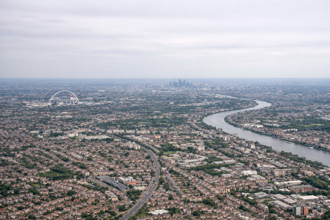
Takeoff from LHR
RIGHTRight side offers views of the Thames estuary and the North Sea coastline as the aircraft climbs out on a westbound heading. You'll see the sprawling London metropolitan area receding below, with the river's distinctive meanders clearly visible.
Landing at EUG
LEFTLeft side provides excellent views during descent into Eugene. You'll see the Cascade Range to the east and the Willamette Valley's agricultural landscape spreading out below. The approach typically brings the Cascades into clear view on the left as you descend from the northeast.
Will your flight be in sunlight?
Pick a date and time in the Sun Map to watch the sun move across your whole flight.
About This Route
Which side of the plane should I sit on flying from Heathrow (LHR) to Eugene Airport (EUG)?
Sit on the Left side of the plane for the best views on flights from London to Eugene. The left side captures the most dramatic scenery on both legs: London's Thames estuary and urban landscape on departure, then the Cascade Range and Willamette Valley on arrival. The landing views are particularly striking.
What can I see during takeoff from Heathrow in London?
During takeoff from Heathrow (LHR), sit on the Right side for the best views. Right side offers views of the Thames estuary and the North Sea coastline as the aircraft climbs out on a westbound heading. You'll see the sprawling London metropolitan area receding below, with the river's distinctive meanders clearly visible. Notable sights include: Thames estuary, North Sea coast, Greater London urban sprawl, Essex marshlands.
What can I see when landing at Eugene Airport in Eugene?
When landing at Eugene Airport (EUG), sit on the Left side for the best views. Left side provides excellent views during descent into Eugene. You'll see the Cascade Range to the east and the Willamette Valley's agricultural landscape spreading out below. The approach typically brings the Cascades into clear view on the left as you descend from the northeast. Notable sights include: Cascade Range (Mount Hood visible on clear days), Willamette Valley farmland, McKenzie River, Spencer Butte.
How long is the flight from London to Eugene?
The flight from Heathrow (LHR) to Eugene Airport (EUG) takes about 10 hours 15 minutes. The shortest flight path between them is 5,001 miles (8,048 km); winds and air traffic control usually add a few percent.
What does the London to Eugene flight path pass over?
Over the Atlantic, you'll cross the Grand Banks of Newfoundland and the Davis Strait region. The flight typically passes north of Greenland's ice sheet (visible on clear days as a massive white expanse) and over the Canadian Arctic archipelago. Approaching North America, the Rocky Mountains become visible in the distance as the aircraft descends toward the Pacific Northwest. The flight path generally avoids major mountain ranges until the final descent, when the Cascades appear.