Right-side seats dominate both departure and arrival, offering the Thames estuary and English Channel on takeoff, then the dramatic volcanic landscape and Lake Amatitlán on descent into Guatemala City.
Flown LHR to GUA? Did we get it right?
Flight Path
London to Guatemala City is 5,436 miles (8,749 km), a flight of about 10 hours 15 minutes.
The flight path crosses the Atlantic Ocean, passing south of Ireland and the Azores, then over the open Atlantic. The westbound route typically passes south of Newfoundland and over the Caribbean. Notable features include the Mid-Atlantic ridge area (not visually distinct at altitude), the Caribbean Sea's deep blue waters, and the Yucatan Peninsula's limestone platform visible on approach to Central America. The Bahamas' shallow turquoise banks may be visible if the route passes nearby. Most of the flight is over open ocean with no significant landmarks visible.
Great circle distance and headings ›


Phase by phase
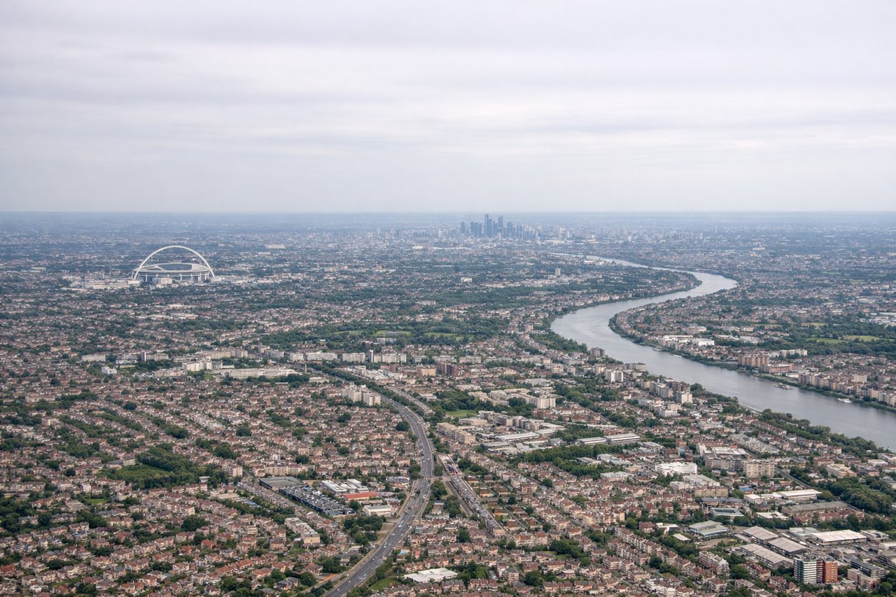
Takeoff from LHR
RIGHTRight-side seats offer views of the Thames estuary and the English Channel as the aircraft climbs out westward from Heathrow. You'll see the river's distinctive meanders and the Kent coastline receding below.

Landing at GUA
RIGHTRight-side seats provide excellent views during the descent into Guatemala City. You'll see the volcanic highlands of the Sierra Madre range and the high-altitude valley containing the city, with Lake Amatitlán visible to the south.
Will your flight be in sunlight?
Pick a date and time in the Sun Map to watch the sun move across your whole flight.
About This Route
Which side of the plane should I sit on flying from Heathrow (LHR) to La Aurora (GUA)?
Sit on the Right side of the plane for the best views on flights from London to Guatemala City. Right-side seats dominate both departure and arrival, offering the Thames estuary and English Channel on takeoff, then the dramatic volcanic landscape and Lake Amatitlán on descent into Guatemala City.
What can I see during takeoff from Heathrow in London?
During takeoff from Heathrow (LHR), sit on the Right side for the best views. Right-side seats offer views of the Thames estuary and the English Channel as the aircraft climbs out westward from Heathrow. You'll see the river's distinctive meanders and the Kent coastline receding below. Notable sights include: Thames estuary, English Channel, Kent coastline, North Downs ridge.
What can I see when landing at La Aurora in Guatemala City?
When landing at La Aurora (GUA), sit on the Right side for the best views. Right-side seats provide excellent views during the descent into Guatemala City. You'll see the volcanic highlands of the Sierra Madre range and the high-altitude valley containing the city, with Lake Amatitlán visible to the south. Notable sights include: Sierra Madre volcanic range, Lake Amatitlán, Guatemala City urban sprawl, Pacaya and Agua volcanoes.
How long is the flight from London to Guatemala City?
The flight from Heathrow (LHR) to La Aurora (GUA) takes about 10 hours 15 minutes. The shortest flight path between them is 5,436 miles (8,749 km); winds and air traffic control usually add a few percent.
What does the London to Guatemala City flight path pass over?
The flight path crosses the Atlantic Ocean, passing south of Ireland and the Azores, then over the open Atlantic. The westbound route typically passes south of Newfoundland and over the Caribbean. Notable features include the Mid-Atlantic ridge area (not visually distinct at altitude), the Caribbean Sea's deep blue waters, and the Yucatan Peninsula's limestone platform visible on approach to Central America. The Bahamas' shallow turquoise banks may be visible if the route passes nearby. Most of the flight is over open ocean with no significant landmarks visible.