Right-side seats offer superior views for the majority of the flight. Departure provides excellent Andes and Pacific views, and the northbound routing over Central America keeps the volcanic highlands and terrain features positioned favorably on the right side during cruise and descent.
Flown LIM to SAL? Did we get it right?
Flight Path
Lima to San Salvador is 1,940 miles (3,123 km), a flight of about 4 hours 45 minutes.
The flight path crosses the Pacific Ocean for roughly 2 hours, then makes landfall over Guatemala/Honduras border region. Notable features include the Guatemalan highlands (visible as elevated terrain with volcanic peaks), Lake Atitlán area (if at optimal altitude and clarity), and the transition into El Salvador's volcanic plateau. The Mesoamerican Trench runs beneath the ocean route but is not visually distinctive from altitude. Coastal mountain ranges of Central America become increasingly prominent as the aircraft approaches El Salvador.
Great circle distance and headings ›Phase by phase

Takeoff from LIM
RIGHTRight-side seats capture the Andes foothills and the Pacific coastline as the aircraft climbs northwestward from LIM's primary runway (01/19). The western exposure reveals the dramatic transition from Lima's coastal plain to the rising terrain inland.
Landing at SAL
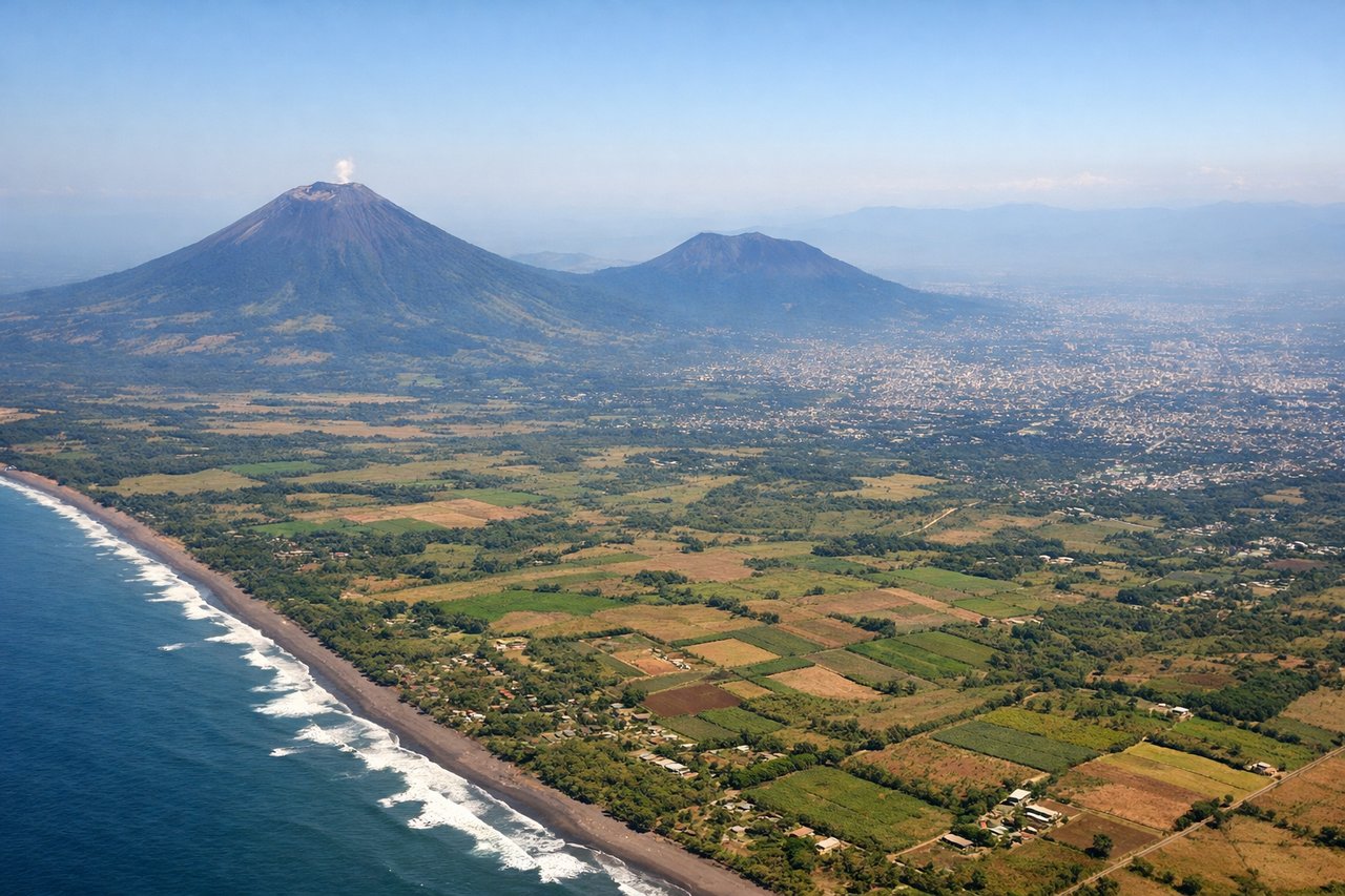
LEFTLeft-side seats provide the best views during descent into SAL. The approach typically uses runway 01 (northbound), and left-side passengers see the volcanic landscape of central El Salvador, including the San Salvador volcanic complex and the surrounding highlands that define the region's topography.
Will your flight be in sunlight?
Pick a date and time in the Sun Map to watch the sun move across your whole flight.
About This Route
Which side of the plane should I sit on flying from Jorge Chávez International Airport (LIM) to El Salvador International (SAL)?
Sit on the Right side of the plane for the best views on flights from Lima to San Salvador. Right-side seats offer superior views for the majority of the flight. Departure provides excellent Andes and Pacific views, and the northbound routing over Central America keeps the volcanic highlands and terrain features positioned favorably on the right side during cruise and descent.
What can I see during takeoff from Jorge Chávez International Airport in Lima?
During takeoff from Jorge Chávez International Airport (LIM), sit on the Right side for the best views. Right-side seats capture the Andes foothills and the Pacific coastline as the aircraft climbs northwestward from LIM's primary runway (01/19). The western exposure reveals the dramatic transition from Lima's coastal plain to the rising terrain inland. Notable sights include: Pacific Ocean (immediate west), Andes foothills (southeast rising inland), Lima urban sprawl (beneath and receding), Callao port district (southwest).
What can I see when landing at El Salvador International in San Salvador?
When landing at El Salvador International (SAL), sit on the Left side for the best views. Left-side seats provide the best views during descent into SAL. The approach typically uses runway 01 (northbound), and left-side passengers see the volcanic landscape of central El Salvador, including the San Salvador volcanic complex and the surrounding highlands that define the region's topography. Notable sights include: San Salvador volcanic field (multiple cones visible), Central American highlands (rolling terrain), Lake Ilopango (if visible during descent corridor), San Salvador city sprawl.
How long is the flight from Lima to San Salvador?
The flight from Jorge Chávez International Airport (LIM) to El Salvador International (SAL) takes about 4 hours 45 minutes. The shortest flight path between them is 1,940 miles (3,123 km); winds and air traffic control usually add a few percent.
What does the Lima to San Salvador flight path pass over?
The flight path crosses the Pacific Ocean for roughly 2 hours, then makes landfall over Guatemala/Honduras border region. Notable features include the Guatemalan highlands (visible as elevated terrain with volcanic peaks), Lake Atitlán area (if at optimal altitude and clarity), and the transition into El Salvador's volcanic plateau. The Mesoamerican Trench runs beneath the ocean route but is not visually distinctive from altitude. Coastal mountain ranges of Central America become increasingly prominent as the aircraft approaches El Salvador.