Lisbon to Terceira is 966 miles (1,554 km), a flight of about 2 hours 35 minutes.
Right-side seats provide superior views for both segments: the Tagus estuary and Lisbon's waterfront during departure, and the best perspective of Terceira Island's volcanic terrain and Atlantic swells during descent. The flight path generally heads west-southwest, making right-side seats optimal for viewing the route's most distinctive features.
Flight Path
The flight crosses the Atlantic at roughly 35,000 feet with no significant landmarks visible—open ocean throughout the middle segment. The route passes over deep Atlantic waters west of Portugal's continental shelf, with no islands or notable geographic features between Lisbon and Terceira. Visibility of the ocean surface is limited at cruise altitude, though cloud formations and occasional weather systems may be visible. The approach to Terceira begins around 100 nautical miles out, with the island becoming visible as a small dark mass on the horizon before growing larger during descent.
Great circle distance and headings ›.jpg?width=600)

Phase by phase
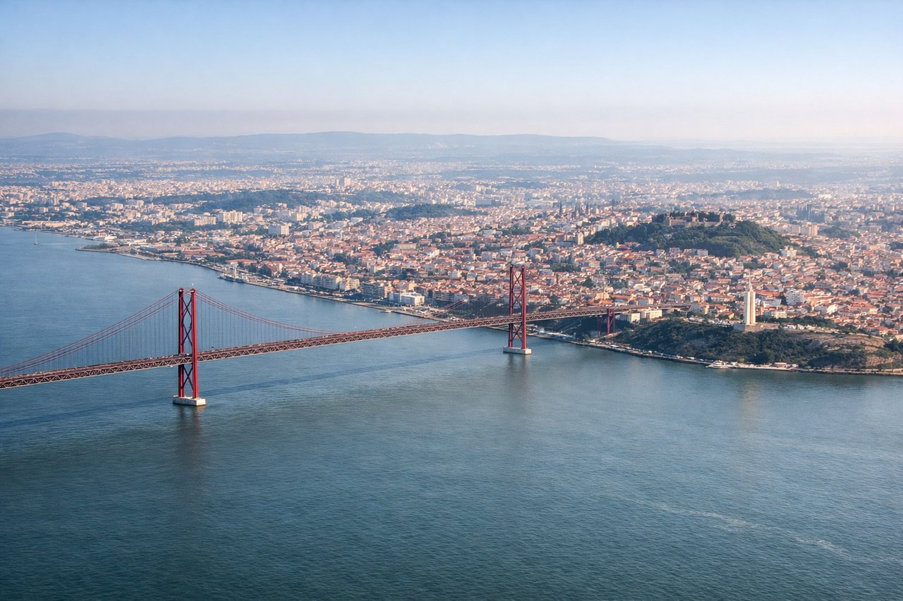
Takeoff from LIS
RIGHTLisbon typically departs runway 03 (northeast) or 21 (southwest). Right-side seats offer the best view of the Tagus River estuary and the city's western districts during initial climb. If departing 03, you'll see the river bend and Belém district; if 21, the right side captures the Atlantic coastline and Cascais area as you turn northeast.
Landing at TER
LEFTLajes Airport (runway 09/27) on Terceira Island sits on relatively flat terrain. Left-side seats during approach offer views of the island's volcanic landscape and the Atlantic swells approaching from the west. The descent path typically comes from the northwest, so left seats capture the island's western coastline and interior terrain before landing.
Landmarks on this routeAll landmarks →
Will your flight be in sunlight?
Pick a date and time in the Sun Map to watch the sun move across your whole flight.
About This Route
Which side of the plane should I sit on flying from Lisboa (LIS) to Lajes (TER)?
Sit on the Right side of the plane for the best views on flights from Lisbon to Terceira. Right-side seats provide superior views for both segments: the Tagus estuary and Lisbon's waterfront during departure, and the best perspective of Terceira Island's volcanic terrain and Atlantic swells during descent. The flight path generally heads west-southwest, making right-side seats optimal for viewing the route's most distinctive features.
What can I see during takeoff from Lisboa in Lisbon?
During takeoff from Lisboa (LIS), sit on the Right side for the best views. Lisbon typically departs runway 03 (northeast) or 21 (southwest). Right-side seats offer the best view of the Tagus River estuary and the city's western districts during initial climb. If departing 03, you'll see the river bend and Belém district; if 21, the right side captures the Atlantic coastline and Cascais area as you turn northeast. Notable sights include: Tagus River estuary, Belém district waterfront, Cascais coastal town, Atlantic Ocean horizon.
What can I see when landing at Lajes in Terceira?
When landing at Lajes (TER), sit on the Left side for the best views. Lajes Airport (runway 09/27) on Terceira Island sits on relatively flat terrain. Left-side seats during approach offer views of the island's volcanic landscape and the Atlantic swells approaching from the west. The descent path typically comes from the northwest, so left seats capture the island's western coastline and interior terrain before landing. Notable sights include: Terceira Island volcanic plateau, Atlantic Ocean swells, Lajes airfield perimeter, island's western coastline.
How long is the flight from Lisbon to Terceira?
The flight from Lisboa (LIS) to Lajes (TER) takes about 2 hours 35 minutes. The shortest flight path between them is 966 miles (1,554 km); winds and air traffic control usually add a few percent.
What does the Lisbon to Terceira flight path pass over?
The flight crosses the Atlantic at roughly 35,000 feet with no significant landmarks visible—open ocean throughout the middle segment. The route passes over deep Atlantic waters west of Portugal's continental shelf, with no islands or notable geographic features between Lisbon and Terceira. Visibility of the ocean surface is limited at cruise altitude, though cloud formations and occasional weather systems may be visible. The approach to Terceira begins around 100 nautical miles out, with the island becoming visible as a small dark mass on the horizon before growing larger during descent.