The takeoff from Lisbon offers more visually distinctive scenery with the Tagus estuary and city waterfront. While the landing approach to Vandenberg shows good coastal and mountain views, the departure from Lisbon provides sharper, more memorable landmarks during the initial climb phase when visibility is clearest.
Flown LIS to VBG? Did we get it right?
Flight Path
Lisbon to Lompoc is 5,732 miles (9,224 km), a flight of about 10 hours.
The flight path crosses the Atlantic Ocean for roughly 7-8 hours with no significant landmarks visible—only open ocean and occasional cloud formations. As you approach the North American continent, you may see the Canadian Maritime provinces or northeastern US coastline depending on routing. The final 2-3 hours approach the California coast, with views of the Sierra Nevada mountains, Central Valley, and eventually the Santa Ynez range near Vandenberg.
Great circle distance and headings ›


Phase by phase
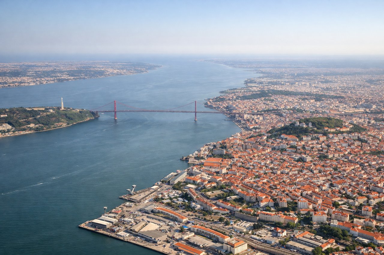
Takeoff from LIS
LEFTLeft side offers views of the Tagus River estuary and Lisbon's waterfront as the aircraft climbs northwest over the Atlantic. You'll see the city's grid layout and the bridge crossing the estuary before heading out over open ocean.
Landing at VBG
RIGHTRight side provides views of the California coast and the Santa Ynez Mountains as you descend toward Vandenberg. The Pacific coastline, Point Conception, and the distinctive terrain around Lompoc are visible on approach from the west.
Will your flight be in sunlight?
Pick a date and time in the Sun Map to watch the sun move across your whole flight.
About This Route
Which side of the plane should I sit on flying from Lisboa (LIS) to Vandenberg Afb (VBG)?
Sit on the Left side of the plane for the best views on flights from Lisbon to Lompoc. The takeoff from Lisbon offers more visually distinctive scenery with the Tagus estuary and city waterfront. While the landing approach to Vandenberg shows good coastal and mountain views, the departure from Lisbon provides sharper, more memorable landmarks during the initial climb phase when visibility is clearest.
What can I see during takeoff from Lisboa in Lisbon?
During takeoff from Lisboa (LIS), sit on the Left side for the best views. Left side offers views of the Tagus River estuary and Lisbon's waterfront as the aircraft climbs northwest over the Atlantic. You'll see the city's grid layout and the bridge crossing the estuary before heading out over open ocean. Notable sights include: Tagus River estuary, Lisbon city center and waterfront, 25 de Abril Bridge, Atlantic coastline.
What can I see when landing at Vandenberg Afb in Lompoc?
When landing at Vandenberg Afb (VBG), sit on the Right side for the best views. Right side provides views of the California coast and the Santa Ynez Mountains as you descend toward Vandenberg. The Pacific coastline, Point Conception, and the distinctive terrain around Lompoc are visible on approach from the west. Notable sights include: Santa Ynez Mountains, Pacific coastline, Point Conception, Lompoc valley.
How long is the flight from Lisbon to Lompoc?
The flight from Lisboa (LIS) to Vandenberg Afb (VBG) takes about 10 hours. The shortest flight path between them is 5,732 miles (9,224 km); winds and air traffic control usually add a few percent.
What does the Lisbon to Lompoc flight path pass over?
The flight path crosses the Atlantic Ocean for roughly 7-8 hours with no significant landmarks visible—only open ocean and occasional cloud formations. As you approach the North American continent, you may see the Canadian Maritime provinces or northeastern US coastline depending on routing. The final 2-3 hours approach the California coast, with views of the Sierra Nevada mountains, Central Valley, and eventually the Santa Ynez range near Vandenberg.