The takeoff from El Alto offers more dramatic and distinctive scenery—the Altiplano escarpment and Cordillera Real are visually striking and geographically unique. The landing approach over São Paulo is extensive but less visually varied (mostly urban grid). Right side during departure provides the stronger scenic experience.
Flight Path
The flight path crosses the Amazon basin lowlands after descending from the Andes. Notable features include the Madeira River system (visible as a dark linear feature threading through rainforest canopy around 2 hours into flight), extensive green rainforest coverage across central Brazil, and the gradual transition from Amazon basin to the Brazilian Shield plateau as the aircraft approaches São Paulo state. The terrain remains predominantly forested and sparsely populated for most of the journey, with few visible landmarks until approaching the densely urbanized São Paulo region in the final descent phase.
Great circle distance and headings ›


Phase by phase
Takeoff from LPB
RIGHTRight side captures the dramatic eastern escarpment of the Altiplano as the aircraft climbs northeast from El Alto. The steep terrain drop and Lake Titicaca visibility (weather permitting) dominate the early climb-out phase on this heading.
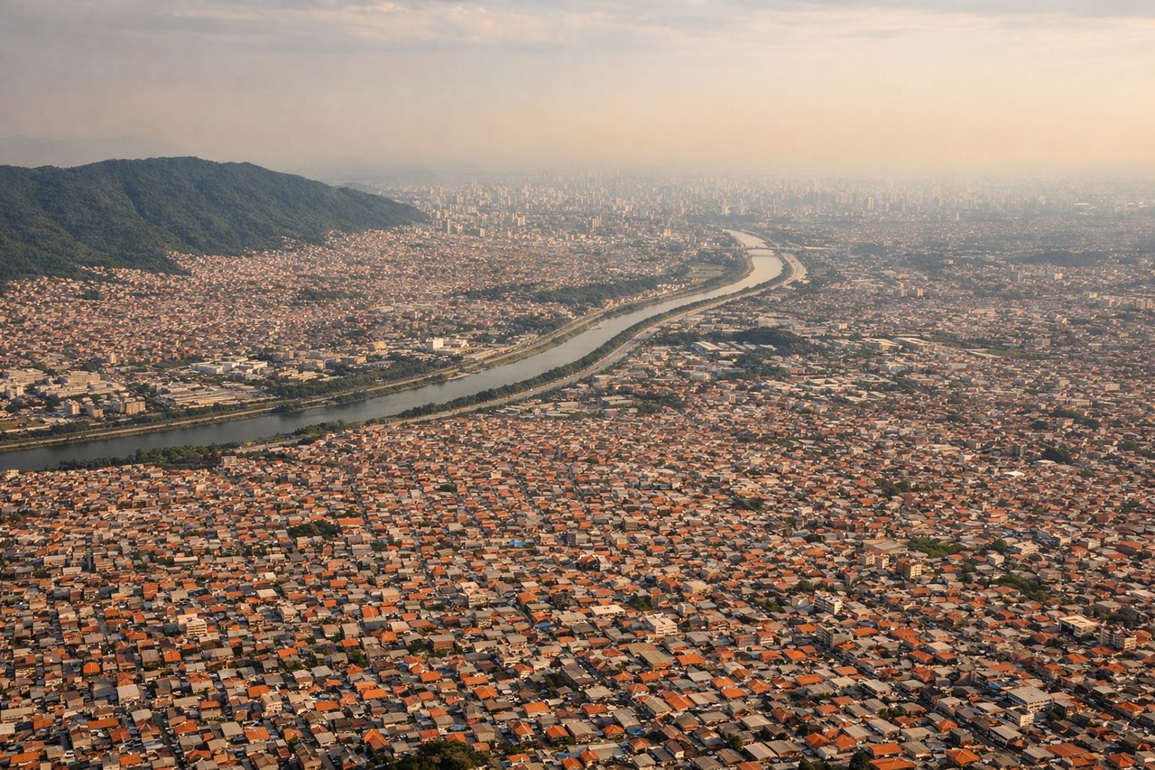
Landing at GRU
LEFTLeft side offers views of the Atlantic coastal region and the approach corridor over São Paulo state. As the aircraft descends toward Guarulhos, the left side reveals the transition from interior plateau to the densely urbanized São Paulo metropolitan area and surrounding Atlantic Forest remnants.
Landmarks on this routeAll landmarks →
Will your flight be in sunlight?
See exactly which side of the plane gets sun and shade at your departure time.
About This Route
Which side of the plane should I sit on flying from El Alto International (LPB) to Guarulhos (GRU)?
Sit on the Right side of the plane for the best views on flights from La Paz to Sao Paulo. The takeoff from El Alto offers more dramatic and distinctive scenery—the Altiplano escarpment and Cordillera Real are visually striking and geographically unique. The landing approach over São Paulo is extensive but less visually varied (mostly urban grid). Right side during departure provides the stronger scenic experience.
What can I see during takeoff from El Alto International in La Paz?
During takeoff from El Alto International (LPB), sit on the Right side for the best views. Right side captures the dramatic eastern escarpment of the Altiplano as the aircraft climbs northeast from El Alto. The steep terrain drop and Lake Titicaca visibility (weather permitting) dominate the early climb-out phase on this heading. Notable sights include: Cordillera Real (snow-capped peaks to the southeast), Lake Titicaca (northern horizon), Altiplano plateau edge (immediate right side), La Paz city sprawl (below and left).
What can I see when landing at Guarulhos in Sao Paulo?
When landing at Guarulhos (GRU), sit on the Left side for the best views. Left side offers views of the Atlantic coastal region and the approach corridor over São Paulo state. As the aircraft descends toward Guarulhos, the left side reveals the transition from interior plateau to the densely urbanized São Paulo metropolitan area and surrounding Atlantic Forest remnants. Notable sights include: São Paulo metropolitan sprawl (dominant urban grid), Serra da Mantiqueira foothills (western horizon), Paraíba River valley (threading through terrain), Atlantic Forest patches (green areas between urban zones).
How long is the flight from La Paz to Sao Paulo?
The flight from El Alto International (LPB) to Guarulhos (GRU) takes Approximately 4 hours 15 minutes.
What does the La Paz to Sao Paulo flight path pass over?
The flight path crosses the Amazon basin lowlands after descending from the Andes. Notable features include the Madeira River system (visible as a dark linear feature threading through rainforest canopy around 2 hours into flight), extensive green rainforest coverage across central Brazil, and the gradual transition from Amazon basin to the Brazilian Shield plateau as the aircraft approaches São Paulo state. The terrain remains predominantly forested and sparsely populated for most of the journey, with few visible landmarks until approaching the densely urbanized São Paulo region in the final descent phase.