Lewiston to Salt Lake City is 461 miles (741 km), a flight of about 1 hour 15 minutes.
While takeoff offers mountain scenery, the landing approach provides more dramatic and varied visuals: the Wasatch Range is more imposing than the Wallowas, and the Great Salt Lake adds a significant water feature not present on departure. The left side captures the most visually distinctive portion of the flight.
Flight Path
The flight path crosses the Blue Mountains, then transitions into the high desert plateau of eastern Utah. Notable features include the Burnt River drainage, the Powder River Basin terrain, and the transition from forested mountains to sagebrush-covered high desert. The Raft River Mountains and Grouse Creek Mountains may be visible to the south depending on exact routing. As the aircraft approaches Salt Lake City from the north, the Bear River and its valley become visible before the final descent into the Wasatch Range.
Great circle distance and headings ›Phase by phase
Takeoff from LWS
RIGHTRight-side seats offer views of the Wallowa Mountains and Grande Ronde Valley as the aircraft climbs southeast toward Salt Lake City. The left side faces northwest toward lower terrain with fewer distinctive landmarks.
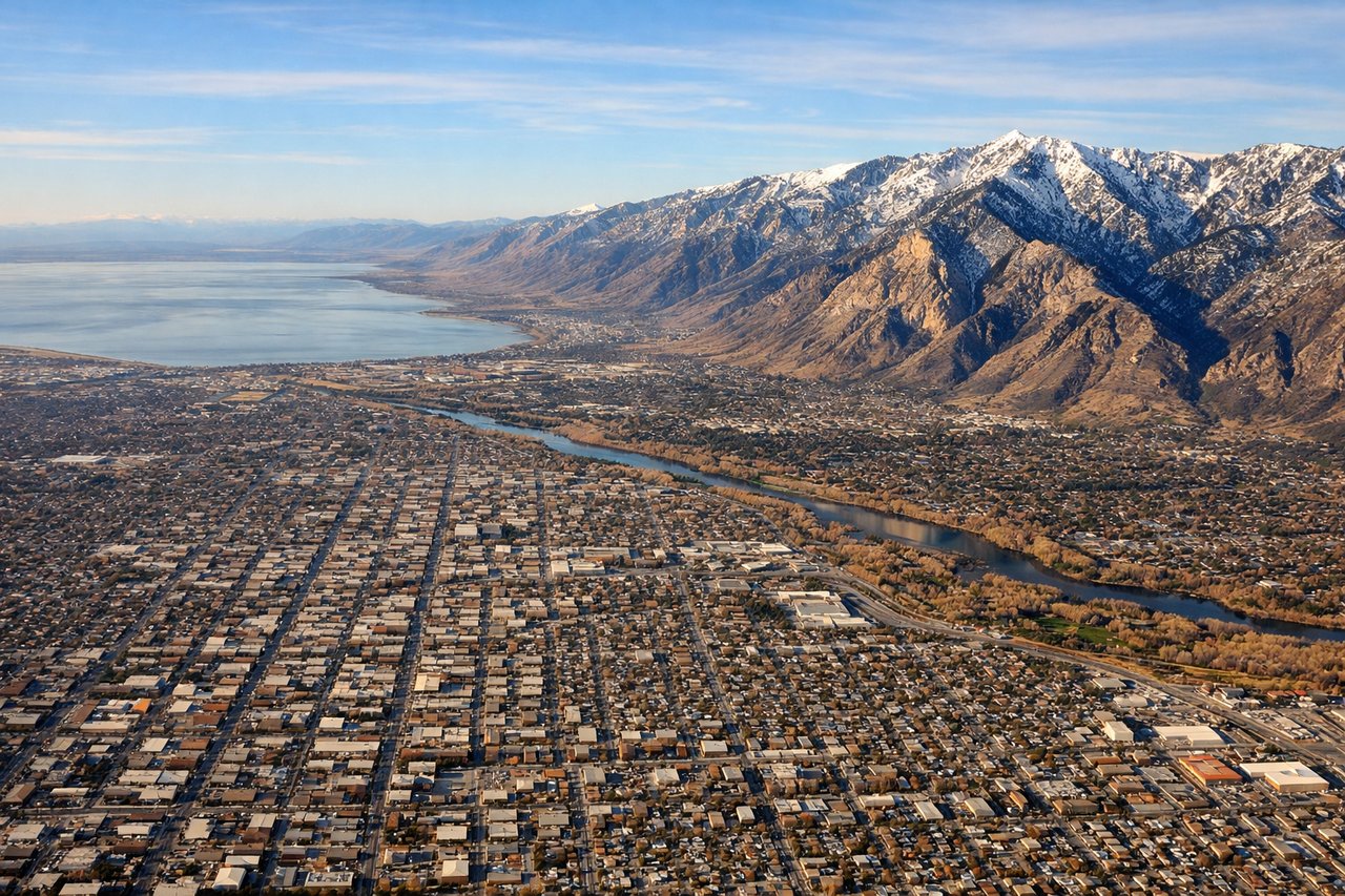
Landing at SLC
LEFTLeft-side seats provide excellent views of the Wasatch Range, the Great Salt Lake, and the Salt Lake Valley during descent. The mountains dominate the approach from the north, and the lake's distinctive shape becomes visible in the final descent phase.
Landmarks on this routeAll landmarks →
Will your flight be in sunlight?
Pick a date and time in the Sun Map to watch the sun move across your whole flight.
About This Route
Which side of the plane should I sit on flying from Lewiston Nez Perce County Airport (LWS) to Salt Lake City International (SLC)?
Sit on the Left side of the plane for the best views on flights from Lewiston to Salt Lake City. While takeoff offers mountain scenery, the landing approach provides more dramatic and varied visuals: the Wasatch Range is more imposing than the Wallowas, and the Great Salt Lake adds a significant water feature not present on departure. The left side captures the most visually distinctive portion of the flight.
What can I see during takeoff from Lewiston Nez Perce County Airport in Lewiston?
During takeoff from Lewiston Nez Perce County Airport (LWS), sit on the Right side for the best views. Right-side seats offer views of the Wallowa Mountains and Grande Ronde Valley as the aircraft climbs southeast toward Salt Lake City. The left side faces northwest toward lower terrain with fewer distinctive landmarks. Notable sights include: Wallowa Mountains, Grande Ronde Valley, Clearwater River drainage system, Blue Mountains to the south.
What can I see when landing at Salt Lake City International in Salt Lake City?
When landing at Salt Lake City International (SLC), sit on the Left side for the best views. Left-side seats provide excellent views of the Wasatch Range, the Great Salt Lake, and the Salt Lake Valley during descent. The mountains dominate the approach from the north, and the lake's distinctive shape becomes visible in the final descent phase. Notable sights include: Wasatch Range, Great Salt Lake, Salt Lake Valley, Antelope Island.
How long is the flight from Lewiston to Salt Lake City?
The flight from Lewiston Nez Perce County Airport (LWS) to Salt Lake City International (SLC) takes about 1 hour 15 minutes. The shortest flight path between them is 461 miles (741 km); winds and air traffic control usually add a few percent.
What does the Lewiston to Salt Lake City flight path pass over?
The flight path crosses the Blue Mountains, then transitions into the high desert plateau of eastern Utah. Notable features include the Burnt River drainage, the Powder River Basin terrain, and the transition from forested mountains to sagebrush-covered high desert. The Raft River Mountains and Grouse Creek Mountains may be visible to the south depending on exact routing. As the aircraft approaches Salt Lake City from the north, the Bear River and its valley become visible before the final descent into the Wasatch Range.