Right side scores higher (3.5 vs 2.5) due to superior scenic variety across the full flight. Takeoff offers coastal Chennai harbor views over the Bay of Bengal. Cruise crosses the Arabian Sea and Indian Ocean with occasional shipping lanes visible. Arrival delivers the dramatic San Gabriel Mountains, Los Angeles basin urban density, and coastal approach—a striking contrast to the ocean-dominated left side. Left side is ocean-heavy for 14+ hours with minimal landmark variety.
Flown MAA to LAX? Did we get it right?
Flight Path
Madras to Los Angeles is 8,972 miles (14,438 km), a flight of about 14 hours 30 minutes.
Arabian Sea and Indian Ocean crossing (open water, occasional shipping traffic and weather systems visible); Oman and Arabian Peninsula coastline visible on southern route variants; Red Sea approaches on some routing; Suez Canal region if routed north; Mediterranean crossing on northern variants; North African coast (Morocco/Western Sahara) on southern routing; Atlantic crossing toward North America; Caribbean islands or Gulf of Mexico depending on final approach routing to LAX; Sierra Nevada mountains and Mojave Desert visible during final descent into Southern California
Great circle distance and headings ›Phase by phase
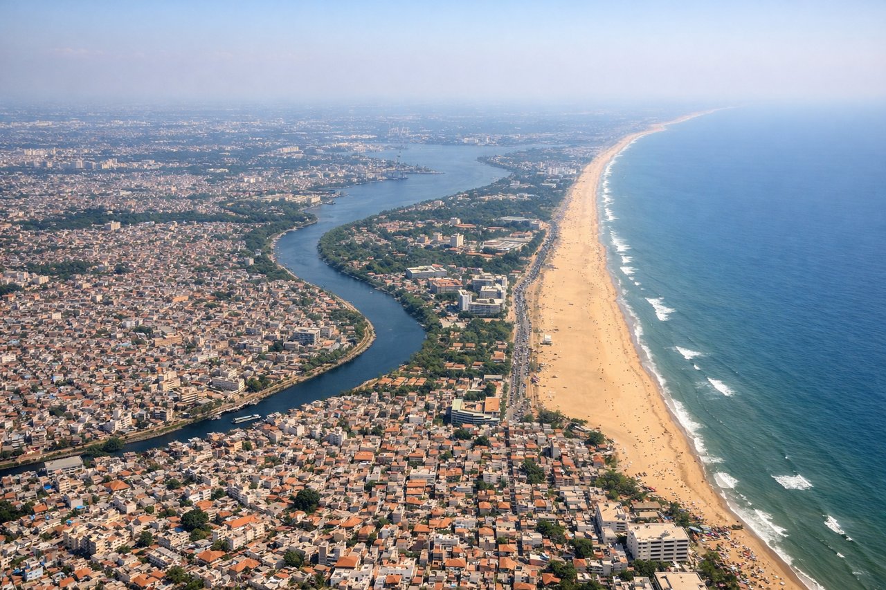
Takeoff from MAA
RIGHTRight side captures Chennai's coastal departure over the Bay of Bengal, with the city's harbor and shoreline visible during initial climb. Left side faces inland toward flat Tamil Nadu plains with minimal visual interest.
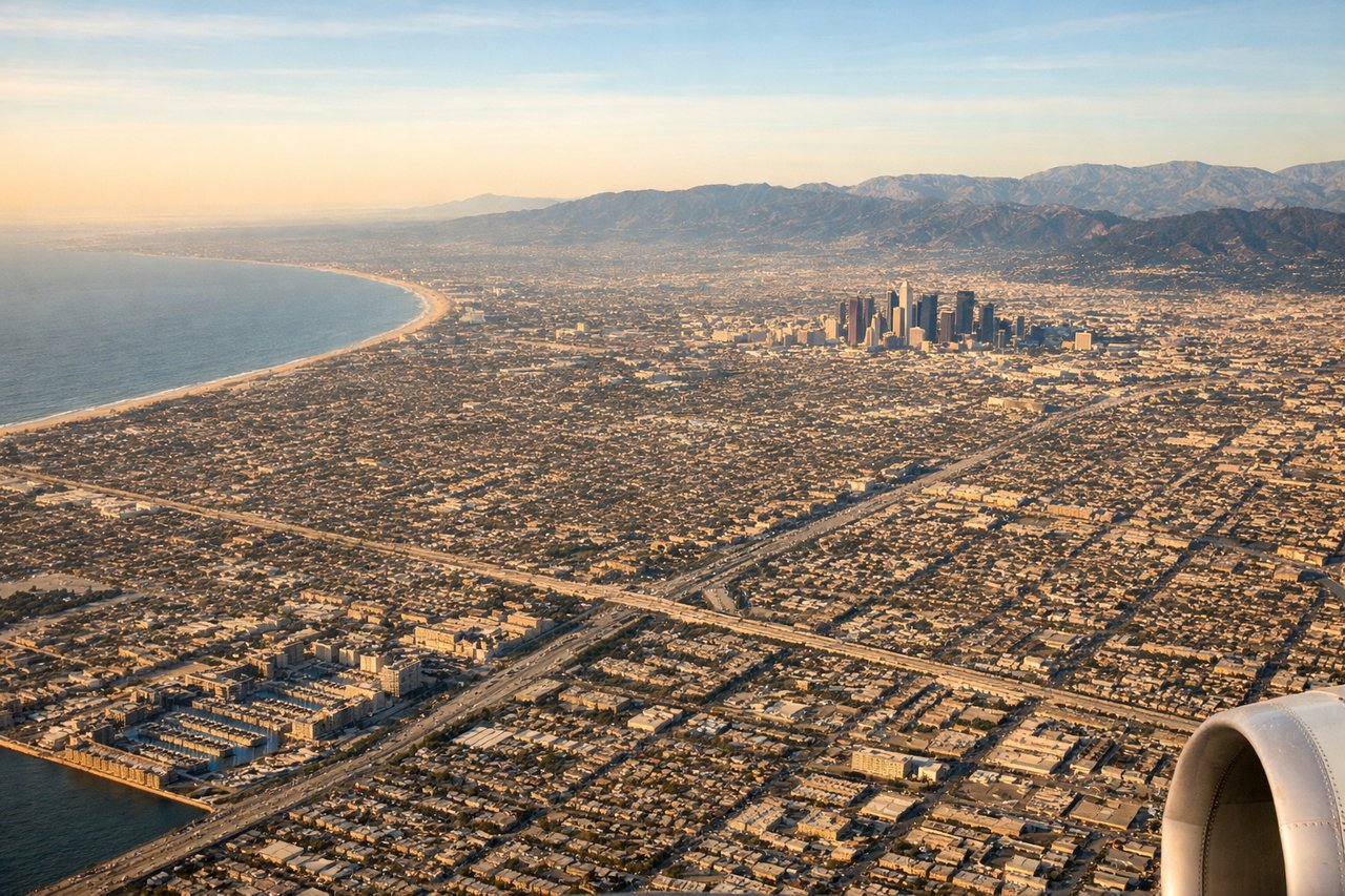
Landing at LAX
RIGHTRight side offers the dramatic Los Angeles basin approach with the San Gabriel Mountains, urban sprawl, and coastal features. During typical west-flow arrivals on 24R/25L, right-side passengers see the mountains, downtown LA, and the approach over populated areas. Left side faces the Pacific Ocean for most of the descent.
Will your flight be in sunlight?
Pick a date and time in the Sun Map to watch the sun move across your whole flight.
About This Route
Which side of the plane should I sit on flying from Chennai International (MAA) to Los Angeles International (LAX)?
Sit on the Right side of the plane for the best views on flights from Madras to Los Angeles. Right side scores higher (3.5 vs 2.5) due to superior scenic variety across the full flight. Takeoff offers coastal Chennai harbor views over the Bay of Bengal. Cruise crosses the Arabian Sea and Indian Ocean with occasional shipping lanes visible. Arrival delivers the dramatic San Gabriel Mountains, Los Angeles basin urban density, and coastal approach—a striking contrast to the ocean-dominated left side. Left side is ocean-heavy for 14+ hours with minimal landmark variety.
What can I see during takeoff from Chennai International in Madras?
During takeoff from Chennai International (MAA), sit on the Right side for the best views. Right side captures Chennai's coastal departure over the Bay of Bengal, with the city's harbor and shoreline visible during initial climb. Left side faces inland toward flat Tamil Nadu plains with minimal visual interest. Notable sights include: Chennai harbor and port facilities, Bay of Bengal coastline, Pulicat Lake to the north.
What can I see when landing at Los Angeles International in Los Angeles?
When landing at Los Angeles International (LAX), sit on the Right side for the best views. Right side offers the dramatic Los Angeles basin approach with the San Gabriel Mountains, urban sprawl, and coastal features. During typical west-flow arrivals on 24R/25L, right-side passengers see the mountains, downtown LA, and the approach over populated areas. Left side faces the Pacific Ocean for most of the descent. Notable sights include: San Gabriel Mountains, Los Angeles downtown skyline, Long Beach harbor, Santa Monica Bay coastline.
How long is the flight from Madras to Los Angeles?
The flight from Chennai International (MAA) to Los Angeles International (LAX) takes about 14 hours 30 minutes. The shortest flight path between them is 8,972 miles (14,438 km); winds and air traffic control usually add a few percent.
What does the Madras to Los Angeles flight path pass over?
Arabian Sea and Indian Ocean crossing (open water, occasional shipping traffic and weather systems visible); Oman and Arabian Peninsula coastline visible on southern route variants; Red Sea approaches on some routing; Suez Canal region if routed north; Mediterranean crossing on northern variants; North African coast (Morocco/Western Sahara) on southern routing; Atlantic crossing toward North America; Caribbean islands or Gulf of Mexico depending on final approach routing to LAX; Sierra Nevada mountains and Mojave Desert visible during final descent into Southern California