While Madrid's departure offers modest mountain views, Guangzhou's arrival over the Pearl River Delta—one of the world's most densely developed and visually complex urban-industrial landscapes—provides significantly more visual interest and landmark density. The delta's intricate waterway system, high-rise clusters, and estuary geography create a more compelling full-flight experience despite the long ocean crossing in between.
Flown MAD to CAN? Did we get it right?
Flight Path
Madrid to Guangzhou is 6,447 miles (10,375 km), a flight of about 11 hours 15 minutes.
The cruise phase crosses the Eurasian landmass from west to east: the Alps and Mediterranean coast (southern France/Italy), the Balkans and Black Sea region, the Caucasus Mountains, the Caspian Sea, the Central Asian steppes and deserts (Kazakhstan, Uzbekistan), the Tian Shan and Pamir mountain ranges, the Taklamakan Desert, the Tibetan Plateau's eastern edge, and finally the Chinese lowlands approaching the Pearl River Delta. The route typically follows a great-circle path at 35,000–43,000 feet, offering views of major mountain ranges and the transition from European to Asian geography, though much of the central Asian segment crosses sparsely populated terrain with limited landmark density.
Great circle distance and headings ›


Phase by phase
Takeoff from MAD
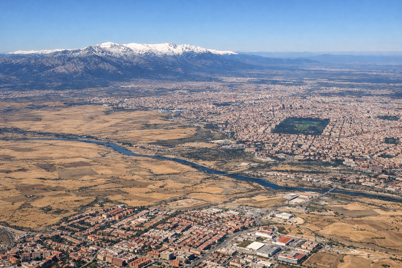
LEFTMadrid's north configuration (predominant) routes departures southwestward over the Tagus River valley and toward the Sierra de Guadarrama foothills. Left-side passengers see the river system and distant mountain ridges during climb-out. Right side faces the flat Meseta plateau with minimal relief.
Landing at CAN
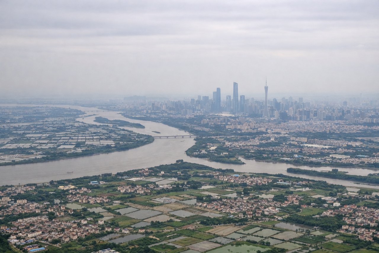
RIGHTGuangzhou's typical summer/monsoon operations use southerly runway approaches (20/19/21), routing arrivals from the north over the Pearl River Delta. Right-side passengers see the densely developed delta landscape, the Guangzhou skyline, and the Pearl River estuary with its islands and waterways. Left side faces the open South China Sea with minimal visual interest.
Will your flight be in sunlight?
Pick a date and time in the Sun Map to watch the sun move across your whole flight.
About This Route
Which side of the plane should I sit on flying from Barajas (MAD) to Guangzhou Baiyun International Airport (CAN)?
Sit on the Right side of the plane for the best views on flights from Madrid to Guangzhou. While Madrid's departure offers modest mountain views, Guangzhou's arrival over the Pearl River Delta—one of the world's most densely developed and visually complex urban-industrial landscapes—provides significantly more visual interest and landmark density. The delta's intricate waterway system, high-rise clusters, and estuary geography create a more compelling full-flight experience despite the long ocean crossing in between.
What can I see during takeoff from Barajas in Madrid?
During takeoff from Barajas (MAD), sit on the Left side for the best views. Madrid's north configuration (predominant) routes departures southwestward over the Tagus River valley and toward the Sierra de Guadarrama foothills. Left-side passengers see the river system and distant mountain ridges during climb-out. Right side faces the flat Meseta plateau with minimal relief. Notable sights include: Tagus River valley, Sierra de Guadarrama (distant), Madrid urban sprawl, Alcalá de Henares to the northeast.
What can I see when landing at Guangzhou Baiyun International Airport in Guangzhou?
When landing at Guangzhou Baiyun International Airport (CAN), sit on the Right side for the best views. Guangzhou's typical summer/monsoon operations use southerly runway approaches (20/19/21), routing arrivals from the north over the Pearl River Delta. Right-side passengers see the densely developed delta landscape, the Guangzhou skyline, and the Pearl River estuary with its islands and waterways. Left side faces the open South China Sea with minimal visual interest. Notable sights include: Pearl River Delta urban sprawl, Guangzhou skyline and Huangpu River, Lantau Island (Hong Kong) to the south, Pearl River estuary islands.
How long is the flight from Madrid to Guangzhou?
The flight from Barajas (MAD) to Guangzhou Baiyun International Airport (CAN) takes about 11 hours 15 minutes. The shortest flight path between them is 6,447 miles (10,375 km); winds and air traffic control usually add a few percent.
What does the Madrid to Guangzhou flight path pass over?
The cruise phase crosses the Eurasian landmass from west to east: the Alps and Mediterranean coast (southern France/Italy), the Balkans and Black Sea region, the Caucasus Mountains, the Caspian Sea, the Central Asian steppes and deserts (Kazakhstan, Uzbekistan), the Tian Shan and Pamir mountain ranges, the Taklamakan Desert, the Tibetan Plateau's eastern edge, and finally the Chinese lowlands approaching the Pearl River Delta. The route typically follows a great-circle path at 35,000–43,000 feet, offering views of major mountain ranges and the transition from European to Asian geography, though much of the central Asian segment crosses sparsely populated terrain with limited landmark density.