The left side wins overall because the Madrid departure offers a genuinely dramatic view of the city and the Sierra de Guadarrama that the right-side Charlotte arrival cannot fully match. Over the Atlantic the difference is minimal, but the departure experience on the left is the highlight of this route.
Flown MAD to CLT? Did we get it right?
Flight Path
Madrid to Charlotte is 4,098 miles (6,596 km), a flight of about 9 hours 15 minutes.
The flight tracks northwest from Madrid, crossing the Cantabrian coast near Galicia or northern Portugal, then over the open North Atlantic at cruise altitude. The route typically passes south of Iceland and Greenland, crossing the Canadian Maritime provinces — Nova Scotia and possibly the Bay of Fundy — before entering the US over New England or the mid-Atlantic states and descending toward the Carolinas. The Appalachian ridgelines may be faintly visible on descent from either side.
Great circle distance and headings ›Phase by phase
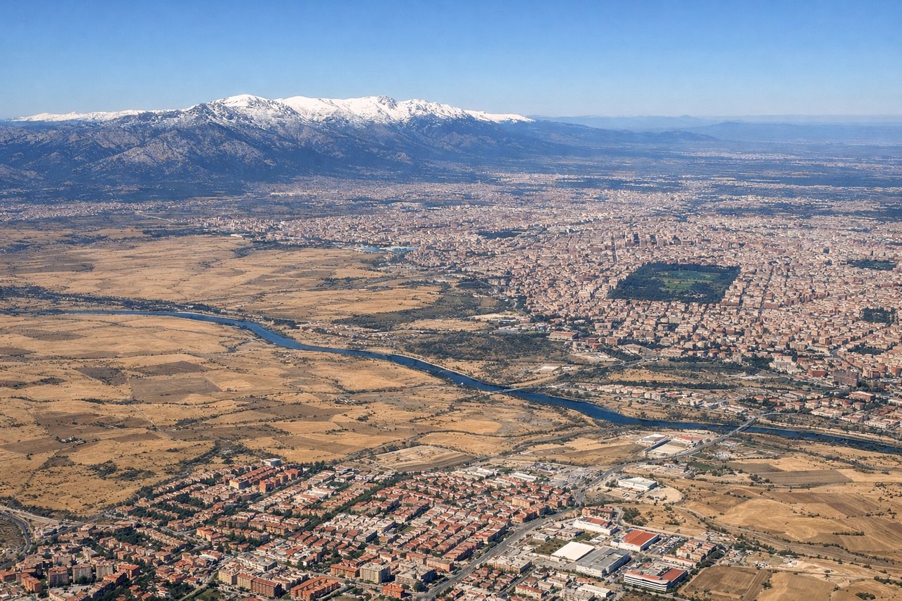
Takeoff from MAD
LEFTBarajas typically departs westbound on runways 32L/32R, meaning a left-side seat gives you a clear view south over Madrid city center as you climb out. You'll see the urban grid of the city, the Manzanares River corridor, and the Sierra de Guadarrama rising to the northwest.

Landing at CLT
RIGHTCharlotte Douglas primarily uses runways 18C/18L for southbound arrivals, meaning the aircraft approaches from the north. A right-side seat gives views east over the Charlotte skyline and the Piedmont landscape on final approach. The compact downtown cluster of towers is clearly visible to the right as you descend.
Will your flight be in sunlight?
Pick a date and time in the Sun Map to watch the sun move across your whole flight.
About This Route
Which side of the plane should I sit on flying from Barajas (MAD) to Charlotte Douglas International (CLT)?
Sit on the Left side of the plane for the best views on flights from Madrid to Charlotte. The left side wins overall because the Madrid departure offers a genuinely dramatic view of the city and the Sierra de Guadarrama that the right-side Charlotte arrival cannot fully match. Over the Atlantic the difference is minimal, but the departure experience on the left is the highlight of this route.
What can I see during takeoff from Barajas in Madrid?
During takeoff from Barajas (MAD), sit on the Left side for the best views. Barajas typically departs westbound on runways 32L/32R, meaning a left-side seat gives you a clear view south over Madrid city center as you climb out. You'll see the urban grid of the city, the Manzanares River corridor, and the Sierra de Guadarrama rising to the northwest. Notable sights include: Madrid city center grid, Manzanares River valley, Sierra de Guadarrama range, Casa de Campo park (large forested area southwest of center).
What can I see when landing at Charlotte Douglas International in Charlotte?
When landing at Charlotte Douglas International (CLT), sit on the Right side for the best views. Charlotte Douglas primarily uses runways 18C/18L for southbound arrivals, meaning the aircraft approaches from the north. A right-side seat gives views east over the Charlotte skyline and the Piedmont landscape on final approach. The compact downtown cluster of towers is clearly visible to the right as you descend. Notable sights include: Charlotte downtown skyline, Lake Norman (large reservoir to the north), Catawba River corridor, Piedmont rolling terrain.
How long is the flight from Madrid to Charlotte?
The flight from Barajas (MAD) to Charlotte Douglas International (CLT) takes about 9 hours 15 minutes. The shortest flight path between them is 4,098 miles (6,596 km); winds and air traffic control usually add a few percent.
What does the Madrid to Charlotte flight path pass over?
The flight tracks northwest from Madrid, crossing the Cantabrian coast near Galicia or northern Portugal, then over the open North Atlantic at cruise altitude. The route typically passes south of Iceland and Greenland, crossing the Canadian Maritime provinces — Nova Scotia and possibly the Bay of Fundy — before entering the US over New England or the mid-Atlantic states and descending toward the Carolinas. The Appalachian ridgelines may be faintly visible on descent from either side.