The right side benefits from the Sierra de Guadarrama at departure and later glimpses of high Andean ridgelines (toward the Cordillera Blanca) during the descent into Peru, giving it more terrain drama than the left side's flatter takeoff and its ocean-facing view for most of the long Atlantic crossing.
Flown MAD to LIM? Did we get it right?
Flight Path
Madrid to Lima is 5,919 miles (9,526 km), a flight of about 12 hours 35 minutes.
The geometric midpoint of the route lies over the open Atlantic well north of the equator, so the crossing itself is largely featureless water for several hours. The more notable scenery comes later, where the flight path crosses the Amazon rainforest near the Brazil-Peru border before climbing over the Andes on the descent into Lima.
Great circle distance and headings ›


Phase by phase

Takeoff from MAD
RIGHTIn Barajas' predominant north configuration, departures climb out heading southeast before turning right onto the westbound track to South America. That turn swings Madrid's northern districts and the Sierra de Guadarrama into view on the right, while the left side only shows the flatter Meseta plains toward Toledo.
Landing at LIM
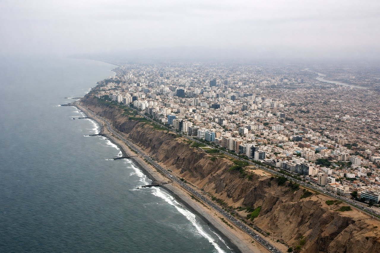
LEFTRunway 16 arrivals into Lima turn onto a south-southeast final approach, which puts the sprawling city and the dry Andean foothills on the left side, while the right side only faces open Pacific water. The urban grid and mountain backdrop make the left side more visually interesting for this final stretch.
Will your flight be in sunlight?
Pick a date and time in the Sun Map to watch the sun move across your whole flight.
About This Route
Which side of the plane should I sit on flying from Barajas (MAD) to Jorge Chávez International Airport (LIM)?
Sit on the Right side of the plane for the best views on flights from Madrid to Lima. The right side benefits from the Sierra de Guadarrama at departure and later glimpses of high Andean ridgelines (toward the Cordillera Blanca) during the descent into Peru, giving it more terrain drama than the left side's flatter takeoff and its ocean-facing view for most of the long Atlantic crossing.
What can I see during takeoff from Barajas in Madrid?
During takeoff from Barajas (MAD), sit on the Right side for the best views. In Barajas' predominant north configuration, departures climb out heading southeast before turning right onto the westbound track to South America. That turn swings Madrid's northern districts and the Sierra de Guadarrama into view on the right, while the left side only shows the flatter Meseta plains toward Toledo. Notable sights include: Sierra de Guadarrama, Madrid's northern suburbs, Jarama river valley.
What can I see when landing at Jorge Chávez International Airport in Lima?
When landing at Jorge Chávez International Airport (LIM), sit on the Left side for the best views. Runway 16 arrivals into Lima turn onto a south-southeast final approach, which puts the sprawling city and the dry Andean foothills on the left side, while the right side only faces open Pacific water. The urban grid and mountain backdrop make the left side more visually interesting for this final stretch. Notable sights include: Rímac River valley, eastern Lima districts, dry Andean foothills.
How long is the flight from Madrid to Lima?
The flight from Barajas (MAD) to Jorge Chávez International Airport (LIM) takes about 12 hours 35 minutes. The shortest flight path between them is 5,919 miles (9,526 km); winds and air traffic control usually add a few percent.
What does the Madrid to Lima flight path pass over?
The geometric midpoint of the route lies over the open Atlantic well north of the equator, so the crossing itself is largely featureless water for several hours. The more notable scenery comes later, where the flight path crosses the Amazon rainforest near the Brazil-Peru border before climbing over the Andes on the descent into Lima.