While takeoff offers the Guadarrama Mountains on the right, the landing approach provides superior scenery with Mount Hood, the Cascade Range, and the Willamette Valley—more dramatic and visually rewarding for a transatlantic flight.
Flown MAD to PDX? Did we get it right?
Flight Path
Madrid to Portland is 5,398 miles (8,688 km), a flight of about 10 hours 15 minutes.
Transatlantic crossing over the North Atlantic with no visible landmarks for approximately 6-7 hours. Notable waypoints include: Greenland's ice sheet (far north, not directly on route), Iceland (north of typical routing), and the Canadian Maritime provinces. Over North America: the Canadian Rockies (Alberta/British Columbia border) appear as a dramatic north-south ridge roughly 2-3 hours before Portland. The Rocky Mountains' western slopes transition into the Columbia Plateau's high desert terrain. The Cascade Range becomes prominent 30-45 minutes before landing, with Mount Hood and Mount Jefferson visible as snow-capped peaks.
Great circle distance and headings ›


Phase by phase

Takeoff from MAD
RIGHTRight side captures the Guadarrama Mountains immediately northwest of Madrid, a dramatic granite range that rises sharply from the plateau. The Sierra de Guadarrama is the most visually distinctive feature during the initial climb-out and remains visible for 10-15 minutes.
Landing at PDX
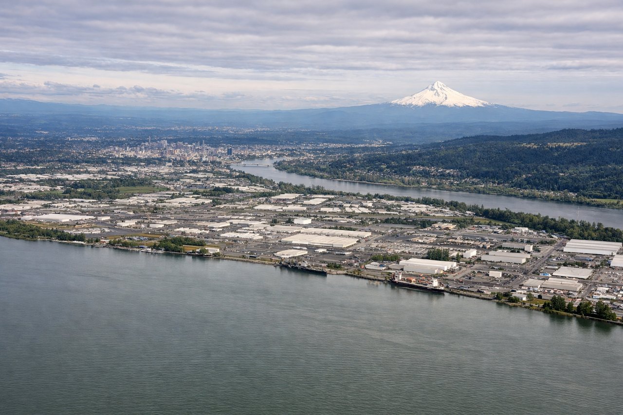
LEFTLeft side offers the best views during approach to Portland. You'll see the Cascade Range—particularly Mount Hood—rising dramatically to the east, and the Willamette Valley's agricultural patchwork spreading below. The Columbia River Gorge is also visible on approach from the east.
Will your flight be in sunlight?
Pick a date and time in the Sun Map to watch the sun move across your whole flight.
About This Route
Which side of the plane should I sit on flying from Barajas (MAD) to Portland International (PDX)?
Sit on the Left side of the plane for the best views on flights from Madrid to Portland. While takeoff offers the Guadarrama Mountains on the right, the landing approach provides superior scenery with Mount Hood, the Cascade Range, and the Willamette Valley—more dramatic and visually rewarding for a transatlantic flight.
What can I see during takeoff from Barajas in Madrid?
During takeoff from Barajas (MAD), sit on the Right side for the best views. Right side captures the Guadarrama Mountains immediately northwest of Madrid, a dramatic granite range that rises sharply from the plateau. The Sierra de Guadarrama is the most visually distinctive feature during the initial climb-out and remains visible for 10-15 minutes. Notable sights include: Guadarrama Mountains (northwest), Madrid city sprawl (directly below/behind), Tagus River valley (south), Central Spanish Meseta plateau (expanding eastward).
What can I see when landing at Portland International in Portland?
When landing at Portland International (PDX), sit on the Left side for the best views. Left side offers the best views during approach to Portland. You'll see the Cascade Range—particularly Mount Hood—rising dramatically to the east, and the Willamette Valley's agricultural patchwork spreading below. The Columbia River Gorge is also visible on approach from the east. Notable sights include: Mount Hood (Cascade Range, southeast), Willamette Valley agricultural fields (south and southwest), Columbia River (north), Portland metro area (west/southwest).
How long is the flight from Madrid to Portland?
The flight from Barajas (MAD) to Portland International (PDX) takes about 10 hours 15 minutes. The shortest flight path between them is 5,398 miles (8,688 km); winds and air traffic control usually add a few percent.
What does the Madrid to Portland flight path pass over?
Transatlantic crossing over the North Atlantic with no visible landmarks for approximately 6-7 hours. Notable waypoints include: Greenland's ice sheet (far north, not directly on route), Iceland (north of typical routing), and the Canadian Maritime provinces. Over North America: the Canadian Rockies (Alberta/British Columbia border) appear as a dramatic north-south ridge roughly 2-3 hours before Portland. The Rocky Mountains' western slopes transition into the Columbia Plateau's high desert terrain. The Cascade Range becomes prominent 30-45 minutes before landing, with Mount Hood and Mount Jefferson visible as snow-capped peaks.