The right side scores higher (3.5 vs 2.5) due to superior landing scenery. While Madrid's takeoff is comparable, the approach to Santiago offers genuine dramatic features: the Ría de Arousa estuary, Atlantic coastline, and Galicia's distinctive green, forested terrain provide far more visual interest and variety than the flat Meseta Central visible on the left during cruise. The flight path crosses from Spain's central plateau to its Atlantic coast, and the right side captures this transition most effectively.
Flown MAD to SCQ? Did we get it right?
Flight Path
Madrid to Santiago is 300 miles (483 km), a flight of about 1 hour 15 minutes.
The flight crosses the Meseta Central plateau (flat, open terrain with sparse vegetation), then transitions into the Sistema Central mountain foothills. As the aircraft approaches Galicia, the landscape becomes progressively greener and more forested. The Duero River valley may be visible in the central portion of the route. The final approach crosses the Galician coast with its characteristic rias (coastal inlets) and Atlantic headlands.
Great circle distance and headings ›Phase by phase
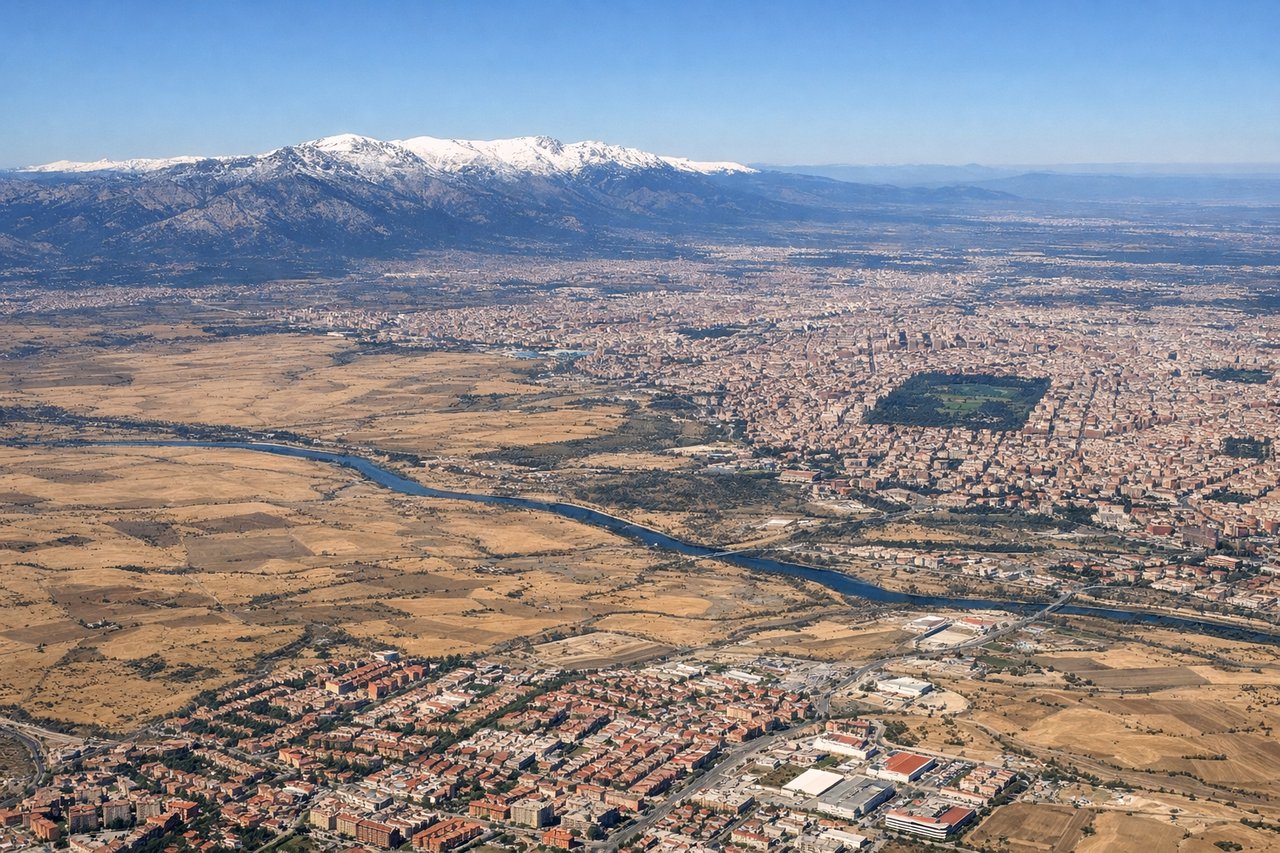
Takeoff from MAD
LEFTMadrid's urban sprawl and surrounding plateau terrain are visible during climb-out. The left side captures the city's northern districts and the transition to the Meseta Central's open plains.
Landing at SCQ
RIGHTThe right side offers superior scenery during approach to Santiago. Galicia's Atlantic coastline, the Ría de Arousa estuary, and the green, forested terrain of northwestern Spain provide dramatic visual variety. The approach path crosses over coastal inlets and agricultural valleys before landing.
Will your flight be in sunlight?
Pick a date and time in the Sun Map to watch the sun move across your whole flight.
About This Route
Which side of the plane should I sit on flying from Barajas (MAD) to Santiago (SCQ)?
Sit on the Right side of the plane for the best views on flights from Madrid to Santiago. The right side scores higher (3.5 vs 2.5) due to superior landing scenery. While Madrid's takeoff is comparable, the approach to Santiago offers genuine dramatic features: the Ría de Arousa estuary, Atlantic coastline, and Galicia's distinctive green, forested terrain provide far more visual interest and variety than the flat Meseta Central visible on the left during cruise. The flight path crosses from Spain's central plateau to its Atlantic coast, and the right side captures this transition most effectively.
What can I see during takeoff from Barajas in Madrid?
During takeoff from Barajas (MAD), sit on the Left side for the best views. Madrid's urban sprawl and surrounding plateau terrain are visible during climb-out. The left side captures the city's northern districts and the transition to the Meseta Central's open plains. Notable sights include: Madrid city center and northern suburbs, Sierra de Guadarrama foothills (distant, northeast), Meseta Central plateau extending westward.
What can I see when landing at Santiago in Santiago?
When landing at Santiago (SCQ), sit on the Right side for the best views. The right side offers superior scenery during approach to Santiago. Galicia's Atlantic coastline, the Ría de Arousa estuary, and the green, forested terrain of northwestern Spain provide dramatic visual variety. The approach path crosses over coastal inlets and agricultural valleys before landing. Notable sights include: Ría de Arousa (large coastal estuary with islands), Atlantic coastline with rocky headlands, Galician green hills and forests, Santiago de Compostela city and surrounding valleys.
How long is the flight from Madrid to Santiago?
The flight from Barajas (MAD) to Santiago (SCQ) takes about 1 hour 15 minutes. The shortest flight path between them is 300 miles (483 km); winds and air traffic control usually add a few percent.
What does the Madrid to Santiago flight path pass over?
The flight crosses the Meseta Central plateau (flat, open terrain with sparse vegetation), then transitions into the Sistema Central mountain foothills. As the aircraft approaches Galicia, the landscape becomes progressively greener and more forested. The Duero River valley may be visible in the central portion of the route. The final approach crosses the Galician coast with its characteristic rias (coastal inlets) and Atlantic headlands.