While takeoff offers river views on the right, the landing approach on the left provides more dramatic and sustained scenery—the Appalachian foothills and the Schuylkill River valley are visually distinctive and occupy a larger portion of the descent. Left seats win for the overall flight experience.
Flown MCI to PHL? Did we get it right?
Flight Path
Kansas City to Philadelphia is 1,036 miles (1,667 km), a flight of about 3 hours 15 minutes.
The flight path crosses the Ohio River valley (visible around the 1.5-hour mark near Cincinnati/northern Kentucky), then transitions into the ridge-and-valley topography of the Appalachian system. The Allegheny Mountains form a series of parallel ridges running northeast-southwest across Pennsylvania and West Virginia, creating distinctive linear terrain features visible from altitude. The Shenandoah Valley in Virginia and the Blue Ridge Mountains may be visible on clear days during the southern portion of the route, depending on exact flight path. As you approach Philadelphia, the terrain flattens into the Piedmont and Coastal Plain provinces.
Great circle distance and headings ›Phase by phase
Takeoff from MCI
RIGHTRight-side seats offer views of the Missouri River as it winds through Kansas City during climb-out, plus the urban sprawl of the metro area spreading eastward. The river's distinctive meanders are clearly visible from 5,000-10,000 feet.
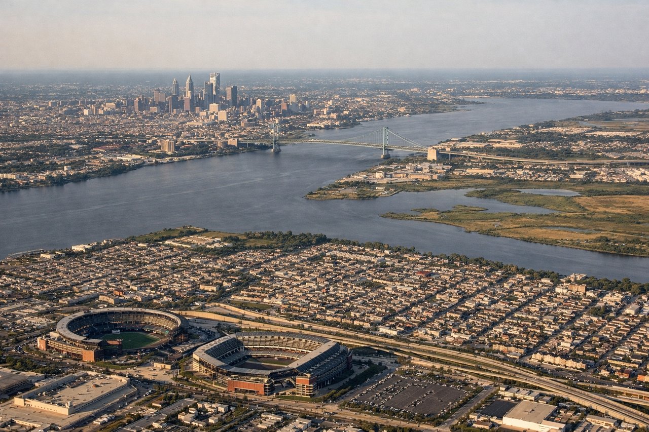
Landing at PHL
LEFTLeft-side seats provide excellent views of the Appalachian foothills and the Schuylkill River valley as you descend into Philadelphia. The river's course through the city and the ridge-and-valley topography become increasingly distinct in the final approach.
Will your flight be in sunlight?
Pick a date and time in the Sun Map to watch the sun move across your whole flight.
About This Route
Which side of the plane should I sit on flying from Kansas City International (MCI) to Philadelphia International (PHL)?
Sit on the Left side of the plane for the best views on flights from Kansas City to Philadelphia. While takeoff offers river views on the right, the landing approach on the left provides more dramatic and sustained scenery—the Appalachian foothills and the Schuylkill River valley are visually distinctive and occupy a larger portion of the descent. Left seats win for the overall flight experience.
What can I see during takeoff from Kansas City International in Kansas City?
During takeoff from Kansas City International (MCI), sit on the Right side for the best views. Right-side seats offer views of the Missouri River as it winds through Kansas City during climb-out, plus the urban sprawl of the metro area spreading eastward. The river's distinctive meanders are clearly visible from 5,000-10,000 feet. Notable sights include: Missouri River, Kansas City metropolitan area, Northland suburban grid, Blue River confluence.
What can I see when landing at Philadelphia International in Philadelphia?
When landing at Philadelphia International (PHL), sit on the Left side for the best views. Left-side seats provide excellent views of the Appalachian foothills and the Schuylkill River valley as you descend into Philadelphia. The river's course through the city and the ridge-and-valley topography become increasingly distinct in the final approach. Notable sights include: Schuylkill River, Philadelphia downtown skyline, Appalachian ridges, Delaware River.
How long is the flight from Kansas City to Philadelphia?
The flight from Kansas City International (MCI) to Philadelphia International (PHL) takes about 3 hours 15 minutes. The shortest flight path between them is 1,036 miles (1,667 km); winds and air traffic control usually add a few percent.
What does the Kansas City to Philadelphia flight path pass over?
The flight path crosses the Ohio River valley (visible around the 1.5-hour mark near Cincinnati/northern Kentucky), then transitions into the ridge-and-valley topography of the Appalachian system. The Allegheny Mountains form a series of parallel ridges running northeast-southwest across Pennsylvania and West Virginia, creating distinctive linear terrain features visible from altitude. The Shenandoah Valley in Virginia and the Blue Ridge Mountains may be visible on clear days during the southern portion of the route, depending on exact flight path. As you approach Philadelphia, the terrain flattens into the Piedmont and Coastal Plain provinces.