Muscat to Istanbul is 2,095 miles (3,372 km), a flight of about 4 hours 50 minutes.
The right side wins on both ends of the flight: dramatic mountain and coastal scenery leaving Muscat, and a rare, genuinely scenic Bosphorus/Istanbul skyline view on the approach into IST, while the left side offers mostly flat desert and countryside throughout.
Flight Path
Vast sand and gravel deserts of the Arabian Peninsula (An Nafud region), the Euphrates River valley near the Iraq-Syria border, and the rising foothills of the Taurus Mountains as the route enters southeastern Turkey.
Great circle distance and headings ›
.jpg?width=600)
_in_Istanbul.jpg?width=600)
Phase by phase
Takeoff from MCT
RIGHTDeparting Muscat, the right (north) side shows the jagged Al Hajar Mountains rising right behind the coastal plain, along with glimpses of the turquoise Gulf of Oman coastline as the aircraft climbs out. The left side only shows flat desert interior with little relief.
Landing at IST
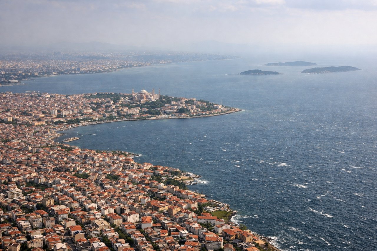
RIGHTOn approach to Istanbul Airport from the south, the northbound landing pattern puts the historic city center, Bosphorus Strait, and Golden Horn on the right side of the aircraft as it descends over the Sea of Marmara. The left side mostly shows the flatter, less distinctive Thracian countryside west of the city.
Landmarks on this routeAll landmarks →
Will your flight be in sunlight?
Pick a date and time in the Sun Map to watch the sun move across your whole flight.
About This Route
Which side of the plane should I sit on flying from Seeb International (MCT) to İstanbul Airport (IST)?
Sit on the Right side of the plane for the best views on flights from Muscat to Istanbul. The right side wins on both ends of the flight: dramatic mountain and coastal scenery leaving Muscat, and a rare, genuinely scenic Bosphorus/Istanbul skyline view on the approach into IST, while the left side offers mostly flat desert and countryside throughout.
What can I see during takeoff from Seeb International in Muscat?
During takeoff from Seeb International (MCT), sit on the Right side for the best views. Departing Muscat, the right (north) side shows the jagged Al Hajar Mountains rising right behind the coastal plain, along with glimpses of the turquoise Gulf of Oman coastline as the aircraft climbs out. The left side only shows flat desert interior with little relief. Notable sights include: Al Hajar Mountains, Gulf of Oman coastline, Muscat's rocky headlands, Qurm nature reserve area.
What can I see when landing at İstanbul Airport in Istanbul?
When landing at İstanbul Airport (IST), sit on the Right side for the best views. On approach to Istanbul Airport from the south, the northbound landing pattern puts the historic city center, Bosphorus Strait, and Golden Horn on the right side of the aircraft as it descends over the Sea of Marmara. The left side mostly shows the flatter, less distinctive Thracian countryside west of the city. Notable sights include: Bosphorus Strait, Golden Horn, historic Istanbul peninsula (Hagia Sophia/Topkapi area), Sea of Marmara coastline.
How long is the flight from Muscat to Istanbul?
The flight from Seeb International (MCT) to İstanbul Airport (IST) takes about 4 hours 50 minutes. The shortest flight path between them is 2,095 miles (3,372 km); winds and air traffic control usually add a few percent.
What does the Muscat to Istanbul flight path pass over?
Vast sand and gravel deserts of the Arabian Peninsula (An Nafud region), the Euphrates River valley near the Iraq-Syria border, and the rising foothills of the Taurus Mountains as the route enters southeastern Turkey.