Right-side seats offer superior views for both segments: the dramatic Andean terrain during departure from Medellín and the canal approach during descent into Panama. The takeoff view is particularly compelling with the valley-and-ridge topography.
Flown MDE to PTY? Did we get it right?
Flight Path
Rio Negro to Panama City is 337 miles (543 km), a flight of about 1 hour 15 minutes.
The flight path crosses the Caribbean coastal plains of Colombia and Panama. Notable features include the Serranía del Darién (low mountain range, 1,000-1,500m) visible to the left (north) around 30 minutes into flight, the Atrato River delta and swamplands in the left-front quadrant, and the transition from Colombian Pacific lowlands to Panamanian rainforest. The Caribbean coast itself remains visible to the north throughout much of the flight. No major cities are directly on the route, but the landscape transitions from Andean valleys to tropical lowlands to dense rainforest.
Great circle distance and headings ›Phase by phase
Takeoff from MDE
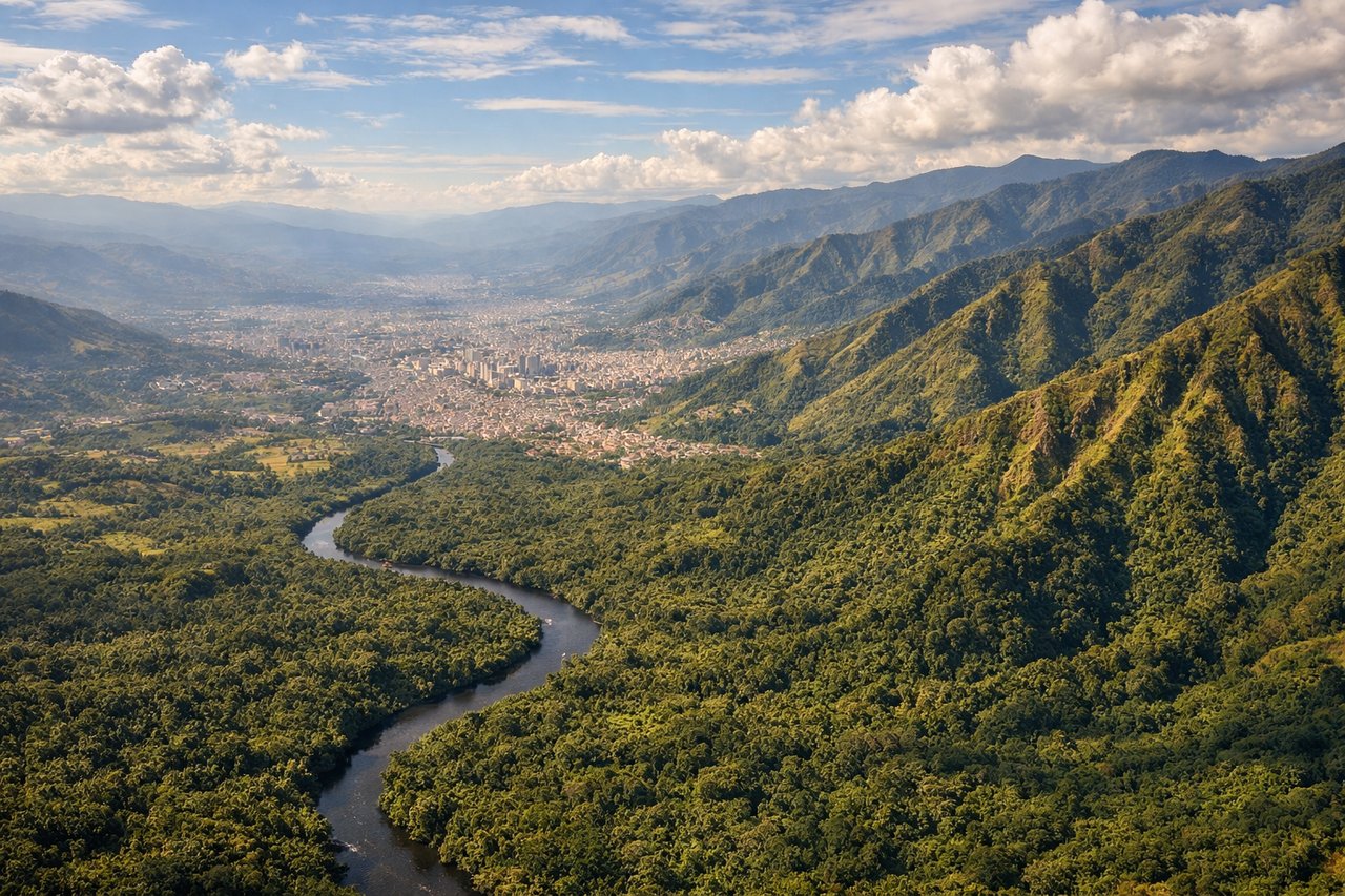
RIGHTMDE typically departs runway 01 (northbound) or 19 (southbound). Right-side seats offer the best view of the Aburrá Valley's urban sprawl and the surrounding Andes ridgelines that define Medellín's geography. The Cauca River valley is also visible to the right during northbound climbs.
Landing at PTY
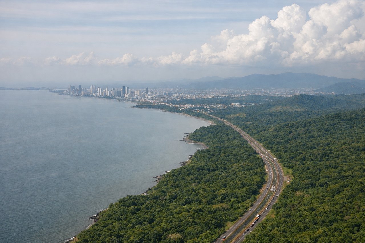
LEFTPTY typically uses runways 03R/03L (eastbound) or 21R/21L (westbound). Left-side seats during approach capture the Panama Canal's Gatun Lake and the surrounding rainforest canopy—the most distinctive geographic feature of the approach corridor. The Chagres River and canal locks are visible on final approach.
Will your flight be in sunlight?
Pick a date and time in the Sun Map to watch the sun move across your whole flight.
About This Route
Which side of the plane should I sit on flying from Jose Maria Cordova (MDE) to Tocumen International (PTY)?
Sit on the Right side of the plane for the best views on flights from Rio Negro to Panama City. Right-side seats offer superior views for both segments: the dramatic Andean terrain during departure from Medellín and the canal approach during descent into Panama. The takeoff view is particularly compelling with the valley-and-ridge topography.
What can I see during takeoff from Jose Maria Cordova in Rio Negro?
During takeoff from Jose Maria Cordova (MDE), sit on the Right side for the best views. MDE typically departs runway 01 (northbound) or 19 (southbound). Right-side seats offer the best view of the Aburrá Valley's urban sprawl and the surrounding Andes ridgelines that define Medellín's geography. The Cauca River valley is also visible to the right during northbound climbs. Notable sights include: Aburrá Valley urban grid, Western Cordillera peaks (3,000-4,000m ridgelines), Cauca River valley to the north, Medellín city districts spreading across the valley floor.
What can I see when landing at Tocumen International in Panama City?
When landing at Tocumen International (PTY), sit on the Left side for the best views. PTY typically uses runways 03R/03L (eastbound) or 21R/21L (westbound). Left-side seats during approach capture the Panama Canal's Gatun Lake and the surrounding rainforest canopy—the most distinctive geographic feature of the approach corridor. The Chagres River and canal locks are visible on final approach. Notable sights include: Gatun Lake (massive artificial reservoir with island-dotted surface), Panama Canal corridor and locks, Chagres River, dense rainforest canopy (green expanse with river meanders visible).
How long is the flight from Rio Negro to Panama City?
The flight from Jose Maria Cordova (MDE) to Tocumen International (PTY) takes about 1 hour 15 minutes. The shortest flight path between them is 337 miles (543 km); winds and air traffic control usually add a few percent.
What does the Rio Negro to Panama City flight path pass over?
The flight path crosses the Caribbean coastal plains of Colombia and Panama. Notable features include the Serranía del Darién (low mountain range, 1,000-1,500m) visible to the left (north) around 30 minutes into flight, the Atrato River delta and swamplands in the left-front quadrant, and the transition from Colombian Pacific lowlands to Panamanian rainforest. The Caribbean coast itself remains visible to the north throughout much of the flight. No major cities are directly on the route, but the landscape transitions from Andean valleys to tropical lowlands to dense rainforest.