While Chicago's takeoff offers urban drama, the landing approach into Santa Barbara provides superior scenic value with the dramatic Santa Ynez Mountains, Pacific coastline, and Channel Islands creating a more visually distinctive and varied experience. The mountain-to-ocean transition on approach outweighs the urban skyline advantage at departure.
Flown MDW to SBA? Did we get it right?
Flight Path
Chicago to Santa Barbara is 1,805 miles (2,905 km), a flight of about 4 hours 15 minutes.
Colorado River valley near the Arizona-California border, Lake Havasu, Mojave Desert with Joshua Tree National Park area, San Bernardino Mountains, San Gabriel Mountains, and the transition from high desert to coastal ranges as the flight approaches Southern California
Great circle distance and headings ›


Phase by phase
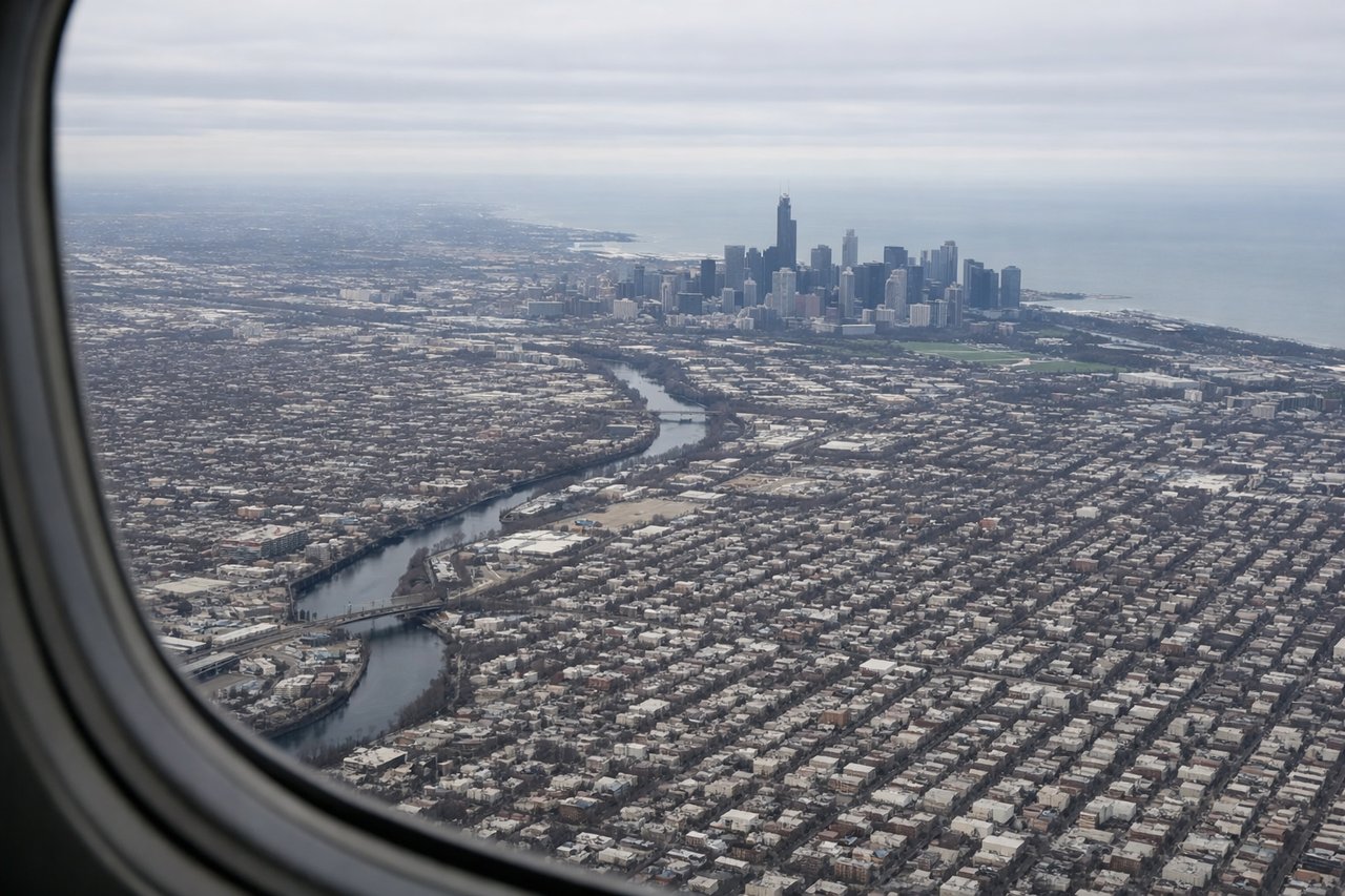
Takeoff from MDW
LEFTLeft side captures Chicago's urban skyline and Lake Michigan waterfront during climb-out, with the downtown core and harbor clearly visible. Right side shows inland suburbs and flat terrain with minimal visual interest.
Landing at SBA
RIGHTRight side offers the dramatic Santa Ynez Mountains rising directly behind Santa Barbara and the Pacific coastline with the Channel Islands visible offshore. Left side shows only inland valleys and foothills with less visual drama during approach.
Will your flight be in sunlight?
Pick a date and time in the Sun Map to watch the sun move across your whole flight.
About This Route
Which side of the plane should I sit on flying from Chicago Midway International (MDW) to Santa Barbara Municipal Airport (SBA)?
Sit on the Right side of the plane for the best views on flights from Chicago to Santa Barbara. While Chicago's takeoff offers urban drama, the landing approach into Santa Barbara provides superior scenic value with the dramatic Santa Ynez Mountains, Pacific coastline, and Channel Islands creating a more visually distinctive and varied experience. The mountain-to-ocean transition on approach outweighs the urban skyline advantage at departure.
What can I see during takeoff from Chicago Midway International in Chicago?
During takeoff from Chicago Midway International (MDW), sit on the Left side for the best views. Left side captures Chicago's urban skyline and Lake Michigan waterfront during climb-out, with the downtown core and harbor clearly visible. Right side shows inland suburbs and flat terrain with minimal visual interest. Notable sights include: Chicago downtown skyline and Willis Tower, Lake Michigan shoreline, Grant Park and Museum Campus, Chicago Harbor.
What can I see when landing at Santa Barbara Municipal Airport in Santa Barbara?
When landing at Santa Barbara Municipal Airport (SBA), sit on the Right side for the best views. Right side offers the dramatic Santa Ynez Mountains rising directly behind Santa Barbara and the Pacific coastline with the Channel Islands visible offshore. Left side shows only inland valleys and foothills with less visual drama during approach. Notable sights include: Santa Ynez Mountains, Santa Barbara coastline and harbor, Channel Islands (Anacapa and Santa Cruz visible), Pacific Ocean.
How long is the flight from Chicago to Santa Barbara?
The flight from Chicago Midway International (MDW) to Santa Barbara Municipal Airport (SBA) takes about 4 hours 15 minutes. The shortest flight path between them is 1,805 miles (2,905 km); winds and air traffic control usually add a few percent.
What does the Chicago to Santa Barbara flight path pass over?
Colorado River valley near the Arizona-California border, Lake Havasu, Mojave Desert with Joshua Tree National Park area, San Bernardino Mountains, San Gabriel Mountains, and the transition from high desert to coastal ranges as the flight approaches Southern California