Left side scores marginally higher due to the more distinctive departure scenery from Madinah, including the iconic mosque complex and the dramatic transition from urban center to open desert plateau. While Kuwait's coastal landing is visually interesting, the overall flight path over relatively flat, featureless desert terrain limits scenic variety. Left side captures more geographic character during the critical takeoff phase.
Flight Path
The flight path crosses the Arabian Desert plateau between Madinah and Kuwait, passing over flat to gently rolling terrain with sparse vegetation. Notable features include the transition from Madinah's volcanic plateau (Harrat Rahat region) into the open Nefud Desert, and the gradual descent toward the Persian Gulf coastal plain as the aircraft approaches Kuwait. No major mountain ranges, significant water bodies, or urban centers are visible along the cruise segment. The terrain remains predominantly tan desert with minimal relief throughout the 1h 25m flight.
Great circle distance and headings ›Phase by phase
Takeoff from MED
LEFTLeft side captures Madinah's urban sprawl and the transition from the city into the Arabian Desert plateau. The departure corridor typically heads northeast, offering views of the city's distinctive layout and surrounding arid terrain.
Landing at KWI
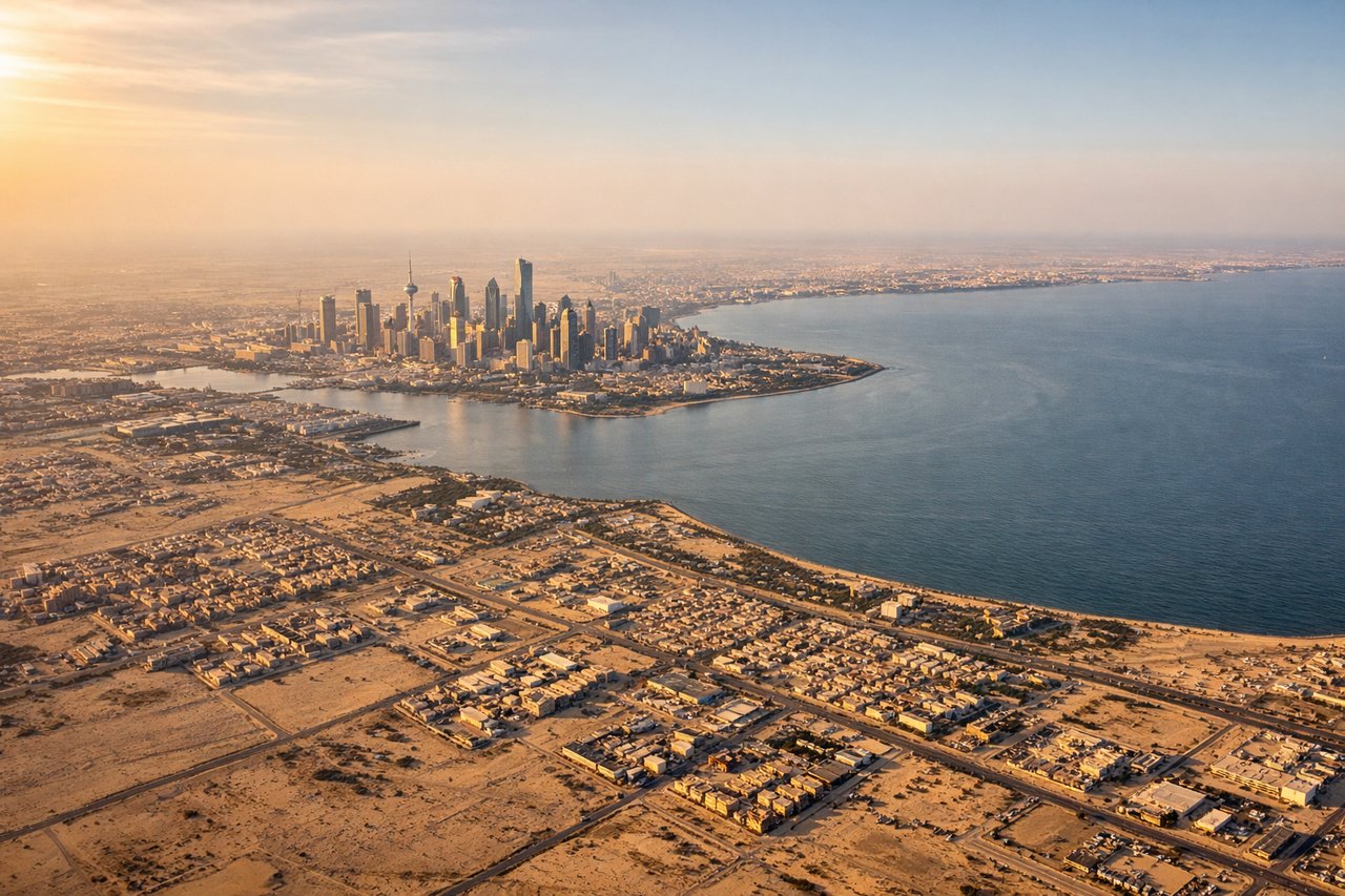
RIGHTRight side offers views of Kuwait's coastal approach, including the Persian Gulf shoreline, Kuwait Bay, and the city's waterfront development. The descent into Kuwait International provides clear sightlines of the bay's distinctive geography and urban density along the coast.
Will your flight be in sunlight?
See exactly which side of the plane gets sun and shade at your departure time.
About This Route
Which side of the plane should I sit on flying from Prince Mohammad Bin Abdulaziz (MED) to Kuwait International Airport (KWI)?
Sit on the Left side of the plane for the best views on flights from Madinah to Kuwait. Left side scores marginally higher due to the more distinctive departure scenery from Madinah, including the iconic mosque complex and the dramatic transition from urban center to open desert plateau. While Kuwait's coastal landing is visually interesting, the overall flight path over relatively flat, featureless desert terrain limits scenic variety. Left side captures more geographic character during the critical takeoff phase.
What can I see during takeoff from Prince Mohammad Bin Abdulaziz in Madinah?
During takeoff from Prince Mohammad Bin Abdulaziz (MED), sit on the Left side for the best views. Left side captures Madinah's urban sprawl and the transition from the city into the Arabian Desert plateau. The departure corridor typically heads northeast, offering views of the city's distinctive layout and surrounding arid terrain. Notable sights include: Madinah city center and Al-Masjid an-Nabawi complex, surrounding date palm plantations, transition zone to Nefud Desert plateau.
What can I see when landing at Kuwait International Airport in Kuwait?
When landing at Kuwait International Airport (KWI), sit on the Right side for the best views. Right side offers views of Kuwait's coastal approach, including the Persian Gulf shoreline, Kuwait Bay, and the city's waterfront development. The descent into Kuwait International provides clear sightlines of the bay's distinctive geography and urban density along the coast. Notable sights include: Kuwait Bay and Persian Gulf coastline, Kuwait City's waterfront and harbor district, Subiya area and northern coastal developments.
How long is the flight from Madinah to Kuwait?
The flight from Prince Mohammad Bin Abdulaziz (MED) to Kuwait International Airport (KWI) takes 1h 25m.
What does the Madinah to Kuwait flight path pass over?
The flight path crosses the Arabian Desert plateau between Madinah and Kuwait, passing over flat to gently rolling terrain with sparse vegetation. Notable features include the transition from Madinah's volcanic plateau (Harrat Rahat region) into the open Nefud Desert, and the gradual descent toward the Persian Gulf coastal plain as the aircraft approaches Kuwait. No major mountain ranges, significant water bodies, or urban centers are visible along the cruise segment. The terrain remains predominantly tan desert with minimal relief throughout the 1h 25m flight.