The right side has the better takeoff, with Melbourne's skyline, Port Phillip Bay and the Dandenongs. It also has the better descent, with Moreton Bay's islands, the Gold Coast and the Scenic Rim peaks. The left side has mostly inland farmland and the Brisbane city angle on approach.
Flown MEL to BNE? Did we get it right?
Flight Path
Melbourne to Brisbane is 858 miles (1,381 km), a flight of about 2 hours 15 minutes.
Murray River near the Victoria-NSW border, the NSW Central West farmland around Parkes and Dubbo, the Great Dividing Range and Liverpool Plains near Tamworth, the New England Tablelands, then the Main Range and Scenic Rim peaks (Mount Barney, Lamington Plateau) before Brisbane. The Warrumbungles may be visible on the left, depending on routing.
Great circle distance and headings ›Phase by phase
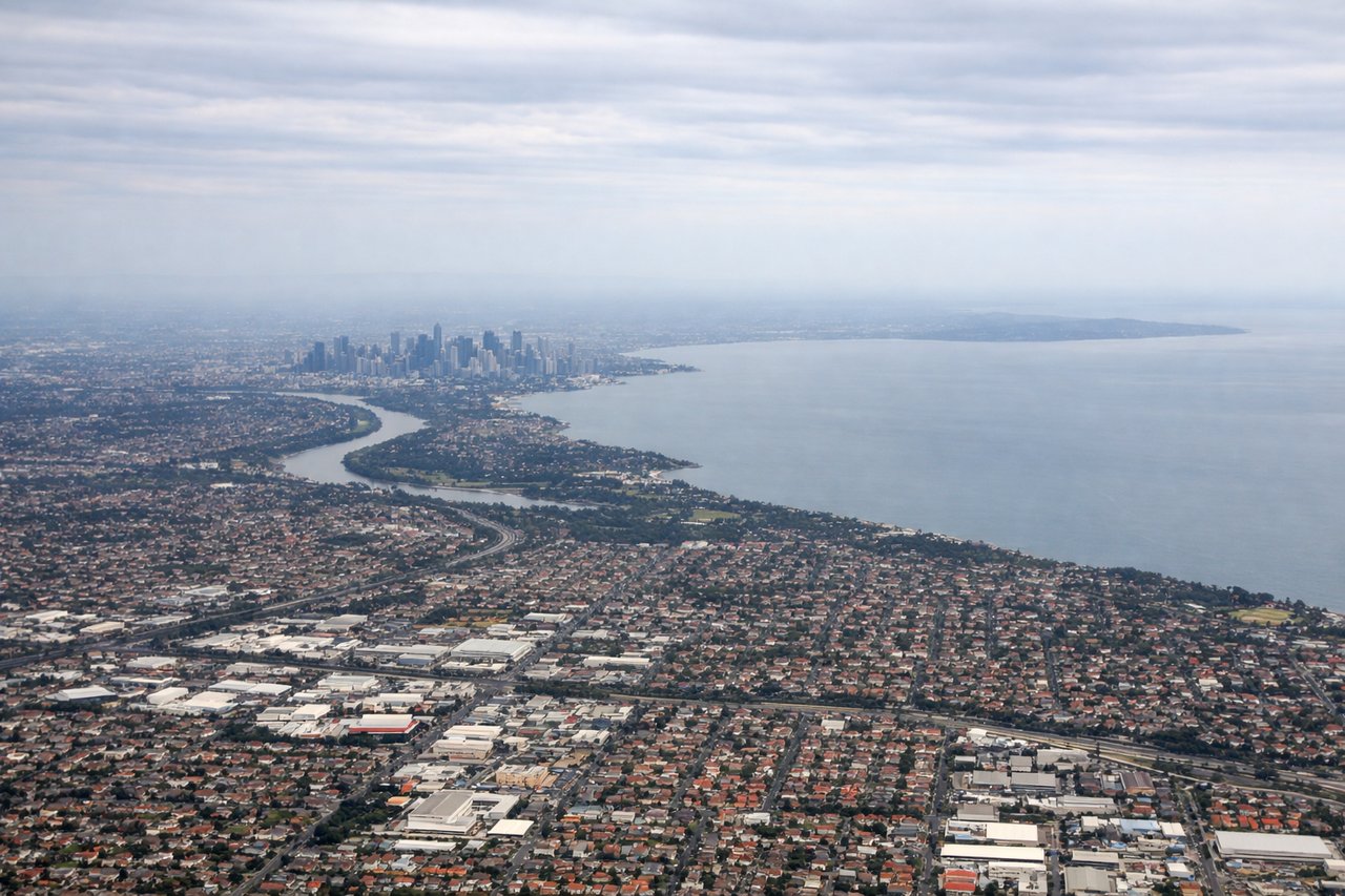
Takeoff from MEL
RIGHTAssuming a runway 34 departure and a right turn toward the northeast, the right side looks back toward Melbourne's CBD with Port Phillip Bay behind it. The forested Dandenong Ranges rise on the eastern horizon. The left side mostly sees flat western basalt plains and farmland.
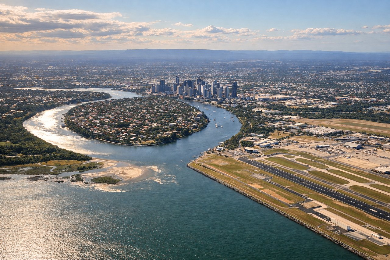
Landing at BNE
RIGHTAssuming an approach from the southwest to runway 01, the right side faces southern Moreton Bay and its islands, with North Stradbroke Island and the distant Gold Coast skyline along the coast. The left side gets suburbs and the Brisbane CBD at an angle, but the bay view is more varied.
Will your flight be in sunlight?
Pick a date and time in the Sun Map to watch the sun move across your whole flight.
About This Route
Which side of the plane should I sit on flying from Melbourne International (MEL) to Brisbane International (BNE)?
Sit on the Right side of the plane for the best views on flights from Melbourne to Brisbane. The right side has the better takeoff, with Melbourne's skyline, Port Phillip Bay and the Dandenongs. It also has the better descent, with Moreton Bay's islands, the Gold Coast and the Scenic Rim peaks. The left side has mostly inland farmland and the Brisbane city angle on approach.
What can I see during takeoff from Melbourne International in Melbourne?
During takeoff from Melbourne International (MEL), sit on the Right side for the best views. Assuming a runway 34 departure and a right turn toward the northeast, the right side looks back toward Melbourne's CBD with Port Phillip Bay behind it. The forested Dandenong Ranges rise on the eastern horizon. The left side mostly sees flat western basalt plains and farmland. Notable sights include: Melbourne CBD skyline, Port Phillip Bay, Dandenong Ranges, Kinglake and Yarra Ranges foothills.
What can I see when landing at Brisbane International in Brisbane?
When landing at Brisbane International (BNE), sit on the Right side for the best views. Assuming an approach from the southwest to runway 01, the right side faces southern Moreton Bay and its islands, with North Stradbroke Island and the distant Gold Coast skyline along the coast. The left side gets suburbs and the Brisbane CBD at an angle, but the bay view is more varied. Notable sights include: Moreton Bay and its islands, North Stradbroke Island, Gold Coast skyline, Mount Tamborine.
How long is the flight from Melbourne to Brisbane?
The flight from Melbourne International (MEL) to Brisbane International (BNE) takes about 2 hours 15 minutes. The shortest flight path between them is 858 miles (1,381 km); winds and air traffic control usually add a few percent.
What does the Melbourne to Brisbane flight path pass over?
Murray River near the Victoria-NSW border, the NSW Central West farmland around Parkes and Dubbo, the Great Dividing Range and Liverpool Plains near Tamworth, the New England Tablelands, then the Main Range and Scenic Rim peaks (Mount Barney, Lamington Plateau) before Brisbane. The Warrumbungles may be visible on the left, depending on routing.