Right side scores higher due to the dramatic Andean descent and approach to Bogotá, which provides significant terrain variety and visual interest during the critical landing phase. While Melbourne's departure offers some urban and water scenery, the Andes approach is substantially more visually compelling and geographically distinctive. The right side captures two major scenic moments (Port Phillip Bay departure and Andean arrival), whereas the left side remains relatively flat and featureless throughout most of the flight.
Flown MEL to BOG? Did we get it right?
Flight Path
Melbourne to Bogota is 9,089 miles (14,628 km), a flight of about 14 hours 20 minutes.
Southern Indian Ocean (featureless open water for approximately 8 hours), Kerguelen Islands region (rarely visible, typically south of standard routing), Madagascar's eastern coast (possible southern routing), Mozambique Channel, East African highlands (Kenya/Tanzania region on some routing variations), Congo Basin rainforest, Atlantic crossing toward South America, Brazilian Amazon basin, and approach to Colombian Andes
Great circle distance and headings ›Phase by phase
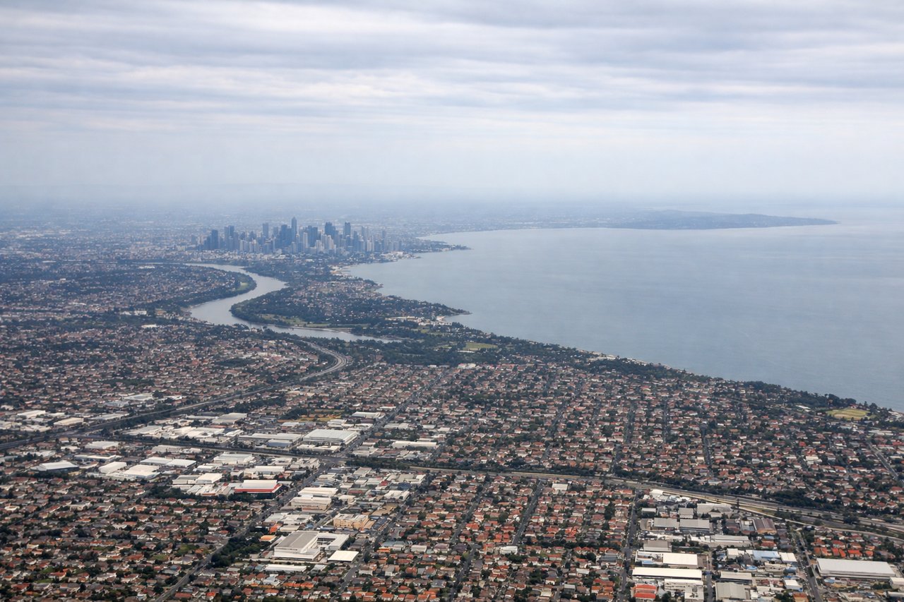
Takeoff from MEL
RIGHTRight side captures Melbourne's urban sprawl and Port Phillip Bay during initial climb. Left side faces inland toward flat plains with minimal visual interest during departure.
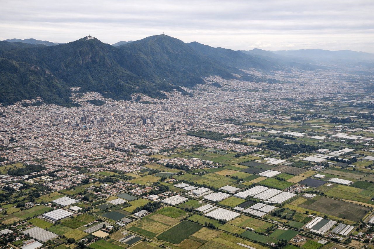
Landing at BOG
RIGHTRight side offers the dramatic Andean approach to Bogotá. The Eastern Cordillera dominates the descent and final approach, with the high-altitude plateau visible before landing. Left side shows only flat savanna and agricultural plains with minimal terrain variation.
Will your flight be in sunlight?
Pick a date and time in the Sun Map to watch the sun move across your whole flight.
About This Route
Which side of the plane should I sit on flying from Melbourne International (MEL) to Eldorado International (BOG)?
Sit on the Right side of the plane for the best views on flights from Melbourne to Bogota. Right side scores higher due to the dramatic Andean descent and approach to Bogotá, which provides significant terrain variety and visual interest during the critical landing phase. While Melbourne's departure offers some urban and water scenery, the Andes approach is substantially more visually compelling and geographically distinctive. The right side captures two major scenic moments (Port Phillip Bay departure and Andean arrival), whereas the left side remains relatively flat and featureless throughout most of the flight.
What can I see during takeoff from Melbourne International in Melbourne?
During takeoff from Melbourne International (MEL), sit on the Right side for the best views. Right side captures Melbourne's urban sprawl and Port Phillip Bay during initial climb. Left side faces inland toward flat plains with minimal visual interest during departure. Notable sights include: Port Phillip Bay, Melbourne CBD skyline, Dandenong Ranges to the east.
What can I see when landing at Eldorado International in Bogota?
When landing at Eldorado International (BOG), sit on the Right side for the best views. Right side offers the dramatic Andean approach to Bogotá. The Eastern Cordillera dominates the descent and final approach, with the high-altitude plateau visible before landing. Left side shows only flat savanna and agricultural plains with minimal terrain variation. Notable sights include: Eastern Cordillera (Andes), Bogotá high-altitude plateau, Monserrate peak, surrounding agricultural valleys.
How long is the flight from Melbourne to Bogota?
The flight from Melbourne International (MEL) to Eldorado International (BOG) takes about 14 hours 20 minutes. The shortest flight path between them is 9,089 miles (14,628 km); winds and air traffic control usually add a few percent.
What does the Melbourne to Bogota flight path pass over?
Southern Indian Ocean (featureless open water for approximately 8 hours), Kerguelen Islands region (rarely visible, typically south of standard routing), Madagascar's eastern coast (possible southern routing), Mozambique Channel, East African highlands (Kenya/Tanzania region on some routing variations), Congo Basin rainforest, Atlantic crossing toward South America, Brazilian Amazon basin, and approach to Colombian Andes