While left offers good takeoff views, right side dominates the landing approach with the dramatic Mahakam delta and Balikpapan Bay—the most visually distinctive features of the entire flight. The delta's complex geography is genuinely striking from altitude.
Flown MEL to BPN? Did we get it right?
Flight Path
Melbourne to Balikpapan is 3,078 miles (4,954 km), a flight of about 5 hours 15 minutes.
The flight path crosses the Tasman Sea initially, then passes over the Australian continent's interior (sparse visibility), before crossing the Coral Sea and approaching the Indonesian archipelago. Notable midpoint geography includes the Great Dividing Range (visible during early climb), the Coral Sea's open waters, and the transition into Borneo's coastal zones with visible river systems and rainforest canopy as the aircraft descends into Balikpapan.
Great circle distance and headings ›Phase by phase
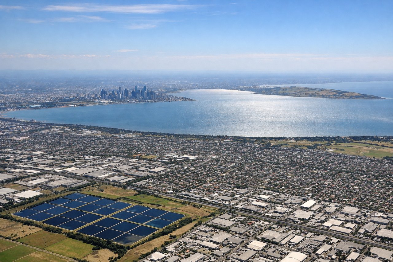
Takeoff from MEL
LEFTLeft side offers views of Port Phillip Bay and the Dandenong Ranges as the aircraft climbs northwestward out of Melbourne. The bay's distinctive shape and the forested ridgeline provide strong visual landmarks during the initial climb.
Landing at BPN
RIGHTRight side provides views of the Mahakam River delta and Balikpapan Bay during descent. The river's distinctive branching channels and the coastal geography are prominent on approach to Sepinggan Airport, which sits on the peninsula east of the bay.
Will your flight be in sunlight?
Pick a date and time in the Sun Map to watch the sun move across your whole flight.
About This Route
Which side of the plane should I sit on flying from Melbourne International (MEL) to Sultan Aji Muhammad Sulaiman Sepinggan International Airport (BPN)?
Sit on the Right side of the plane for the best views on flights from Melbourne to Balikpapan. While left offers good takeoff views, right side dominates the landing approach with the dramatic Mahakam delta and Balikpapan Bay—the most visually distinctive features of the entire flight. The delta's complex geography is genuinely striking from altitude.
What can I see during takeoff from Melbourne International in Melbourne?
During takeoff from Melbourne International (MEL), sit on the Left side for the best views. Left side offers views of Port Phillip Bay and the Dandenong Ranges as the aircraft climbs northwestward out of Melbourne. The bay's distinctive shape and the forested ridgeline provide strong visual landmarks during the initial climb. Notable sights include: Port Phillip Bay, Dandenong Ranges, Yarra River estuary, Melbourne CBD skyline.
What can I see when landing at Sultan Aji Muhammad Sulaiman Sepinggan International Airport in Balikpapan?
When landing at Sultan Aji Muhammad Sulaiman Sepinggan International Airport (BPN), sit on the Right side for the best views. Right side provides views of the Mahakam River delta and Balikpapan Bay during descent. The river's distinctive branching channels and the coastal geography are prominent on approach to Sepinggan Airport, which sits on the peninsula east of the bay. Notable sights include: Mahakam River delta, Balikpapan Bay, Borneo rainforest interior, coastal mangrove zones.
How long is the flight from Melbourne to Balikpapan?
The flight from Melbourne International (MEL) to Sultan Aji Muhammad Sulaiman Sepinggan International Airport (BPN) takes about 5 hours 15 minutes. The shortest flight path between them is 3,078 miles (4,954 km); winds and air traffic control usually add a few percent.
What does the Melbourne to Balikpapan flight path pass over?
The flight path crosses the Tasman Sea initially, then passes over the Australian continent's interior (sparse visibility), before crossing the Coral Sea and approaching the Indonesian archipelago. Notable midpoint geography includes the Great Dividing Range (visible during early climb), the Coral Sea's open waters, and the transition into Borneo's coastal zones with visible river systems and rainforest canopy as the aircraft descends into Balikpapan.