While takeoff offers good views of Melbourne's geography, the landing approach into Cairo provides more dramatic and distinctive visual features—the Nile Delta's agricultural geometry and the stark desert-to-city transition are more visually compelling than suburban Melbourne.
Flight Path
The flight path crosses the Indian Ocean for approximately 7 hours with no visible landmarks, then enters Asian airspace over the Arabian Sea. Notable features along the routing include the Red Sea's narrow waters (visible during descent into Cairo), the Suez Canal approach corridor, and the transition from the Sinai Peninsula's desert terrain to the Nile Delta's green agricultural zone.
Great circle distance and headings ›_8.JPG?width=600)

.JPG?width=600)
.jpg?width=600)


Phase by phase
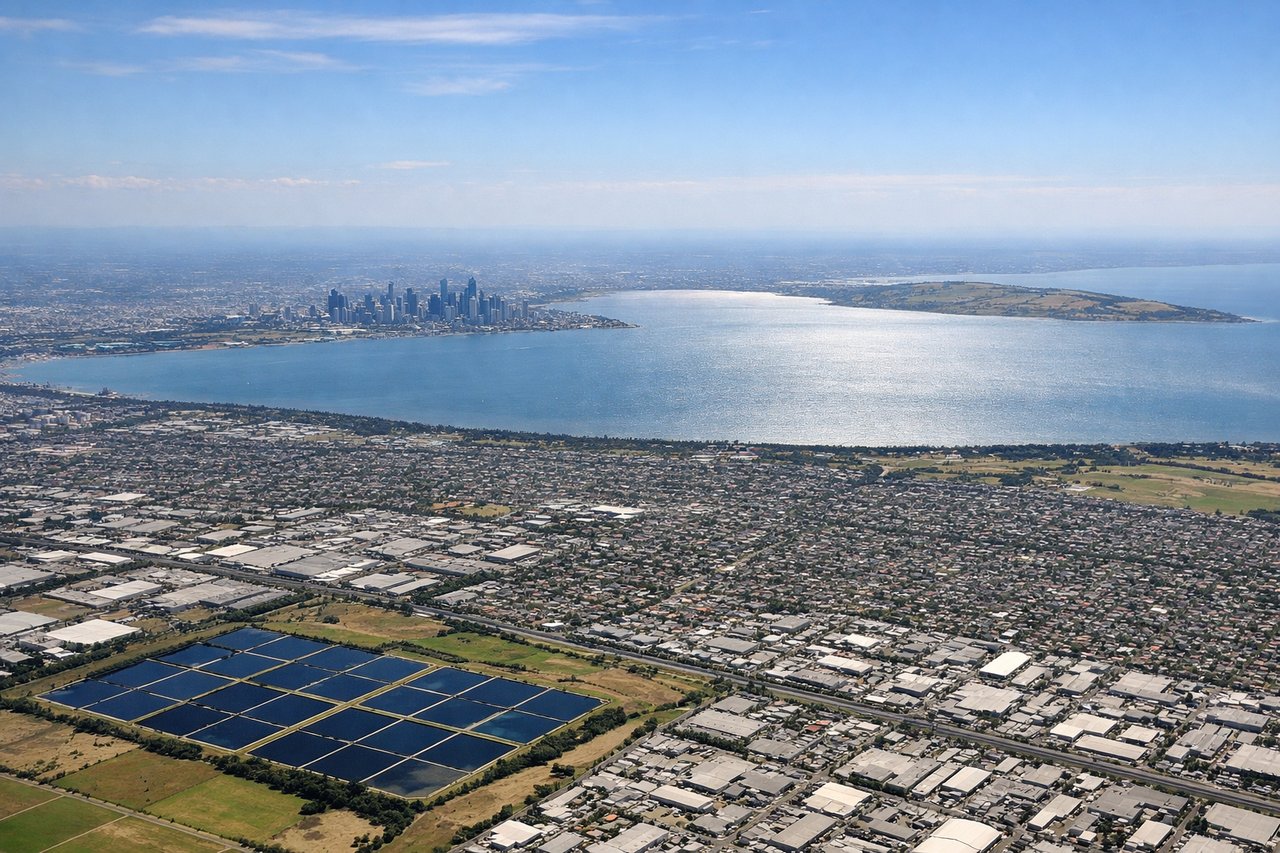
Takeoff from MEL
LEFTLeft seats offer views of Port Phillip Bay and the Dandenong Ranges as the aircraft climbs northwest from Melbourne. The bay's distinctive shape and the forested ridgelines provide clear visual reference during the initial climb.
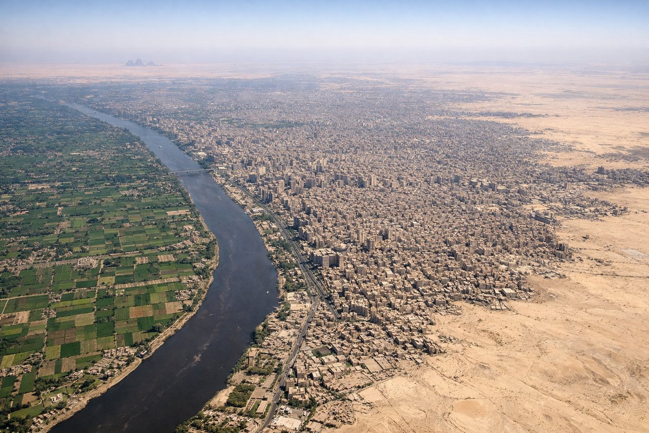
Landing at CAI
RIGHTRight seats provide views of the Nile Delta's distinctive fan shape and Cairo's urban sprawl as the aircraft descends from the northeast. The delta's agricultural patchwork and the Nile's main channel are striking visual features during final approach.
Landmarks on this routeAll landmarks →
Will your flight be in sunlight?
See exactly which side of the plane gets sun and shade at your departure time.
About This Route
Which side of the plane should I sit on flying from Melbourne International (MEL) to Cairo International (CAI)?
Sit on the Right side of the plane for the best views on flights from Melbourne to Cairo. While takeoff offers good views of Melbourne's geography, the landing approach into Cairo provides more dramatic and distinctive visual features—the Nile Delta's agricultural geometry and the stark desert-to-city transition are more visually compelling than suburban Melbourne.
What can I see during takeoff from Melbourne International in Melbourne?
During takeoff from Melbourne International (MEL), sit on the Left side for the best views. Left seats offer views of Port Phillip Bay and the Dandenong Ranges as the aircraft climbs northwest from Melbourne. The bay's distinctive shape and the forested ridgelines provide clear visual reference during the initial climb. Notable sights include: Port Phillip Bay, Dandenong Ranges, Yarra River estuary, Western suburbs sprawl.
What can I see when landing at Cairo International in Cairo?
When landing at Cairo International (CAI), sit on the Right side for the best views. Right seats provide views of the Nile Delta's distinctive fan shape and Cairo's urban sprawl as the aircraft descends from the northeast. The delta's agricultural patchwork and the Nile's main channel are striking visual features during final approach. Notable sights include: Nile Delta, Nile River main channel, Cairo metropolitan area, Eastern Desert plateau edge.
How long is the flight from Melbourne to Cairo?
The flight from Melbourne International (MEL) to Cairo International (CAI) takes 14h 20m.
What does the Melbourne to Cairo flight path pass over?
The flight path crosses the Indian Ocean for approximately 7 hours with no visible landmarks, then enters Asian airspace over the Arabian Sea. Notable features along the routing include the Red Sea's narrow waters (visible during descent into Cairo), the Suez Canal approach corridor, and the transition from the Sinai Peninsula's desert terrain to the Nile Delta's green agricultural zone.