While Melbourne's departure offers modest bay and mountain views, Toronto's arrival over Lake Ontario and the dramatic waterfront approach with the CN Tower and downtown skyline provides significantly more visual interest and landmark density. The cruise phase over the Pacific and North America is ocean-dominated on both sides, but the landing sequence tips the balance decisively to the right.
Flown MEL to YYZ? Did we get it right?
Flight Path
Melbourne to Toronto is 10,099 miles (16,252 km), a flight of about 17 hours 20 minutes.
Pacific Ocean (12+ hours of open water crossing), Aleutian Islands region (distant, rarely visible), North American west coast approaching British Columbia, Rocky Mountains (visible during descent into North America), Great Lakes region (Lake Superior, Lake Michigan visible during approach to Toronto)
Great circle distance and headings ›Phase by phase
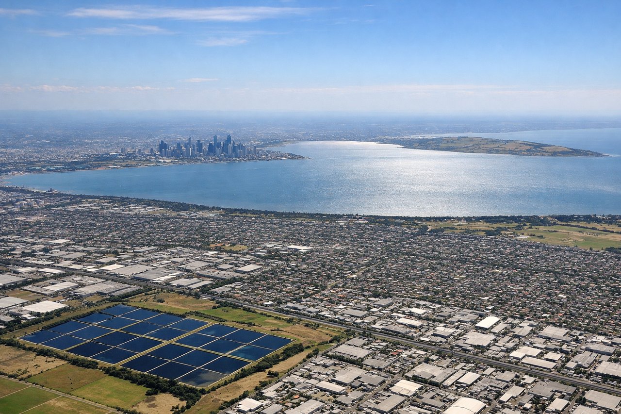
Takeoff from MEL
LEFTMelbourne's departure typically heads north or northeast over Port Phillip Bay and the Dandenong Ranges. Left-side passengers see the bay's water and suburban sprawl immediately after takeoff, with the Dandenongs rising to the northeast. Right side faces inland plains with minimal visual interest during climb-out.
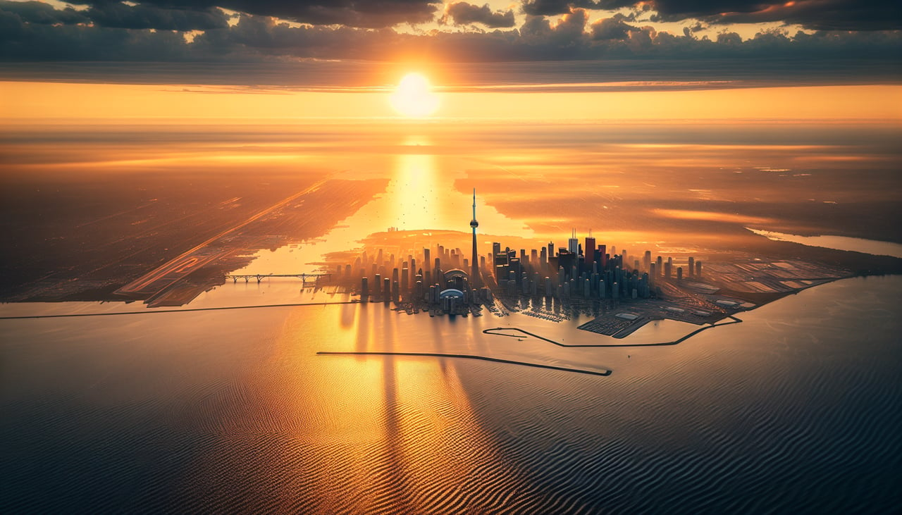
Landing at YYZ
RIGHTApproach to Toronto typically descends over Lake Ontario from the southwest or south. Right-side passengers see the vast expanse of Lake Ontario, the Toronto waterfront with the CN Tower and harbor, and the city skyline during final approach. Left side faces inland Ontario farmland and suburbs with less dramatic visual interest.
Will your flight be in sunlight?
Pick a date and time in the Sun Map to watch the sun move across your whole flight.
About This Route
Which side of the plane should I sit on flying from Melbourne International (MEL) to Lester B Pearson International (YYZ)?
Sit on the Right side of the plane for the best views on flights from Melbourne to Toronto. While Melbourne's departure offers modest bay and mountain views, Toronto's arrival over Lake Ontario and the dramatic waterfront approach with the CN Tower and downtown skyline provides significantly more visual interest and landmark density. The cruise phase over the Pacific and North America is ocean-dominated on both sides, but the landing sequence tips the balance decisively to the right.
What can I see during takeoff from Melbourne International in Melbourne?
During takeoff from Melbourne International (MEL), sit on the Left side for the best views. Melbourne's departure typically heads north or northeast over Port Phillip Bay and the Dandenong Ranges. Left-side passengers see the bay's water and suburban sprawl immediately after takeoff, with the Dandenongs rising to the northeast. Right side faces inland plains with minimal visual interest during climb-out. Notable sights include: Port Phillip Bay, Dandenong Ranges foothills, Melbourne CBD skyline (receding), suburban sprawl of outer Melbourne.
What can I see when landing at Lester B Pearson International in Toronto?
When landing at Lester B Pearson International (YYZ), sit on the Right side for the best views. Approach to Toronto typically descends over Lake Ontario from the southwest or south. Right-side passengers see the vast expanse of Lake Ontario, the Toronto waterfront with the CN Tower and harbor, and the city skyline during final approach. Left side faces inland Ontario farmland and suburbs with less dramatic visual interest. Notable sights include: Lake Ontario (dominant), Toronto waterfront and harbor, CN Tower and downtown Toronto skyline, Scarborough Bluffs (eastern shoreline).
How long is the flight from Melbourne to Toronto?
The flight from Melbourne International (MEL) to Lester B Pearson International (YYZ) takes about 17 hours 20 minutes. The shortest flight path between them is 10,099 miles (16,252 km); winds and air traffic control usually add a few percent.
What does the Melbourne to Toronto flight path pass over?
Pacific Ocean (12+ hours of open water crossing), Aleutian Islands region (distant, rarely visible), North American west coast approaching British Columbia, Rocky Mountains (visible during descent into North America), Great Lakes region (Lake Superior, Lake Michigan visible during approach to Toronto)