The left side wins overall because the Boston Harbor and skyline arrival is one of the most iconic urban approaches in the US, and the left side also captures the Gulf Coast and Atlantic seaboard during cruise. The right side's volcanic views at departure are spectacular but brief, while the left side delivers sustained interest across the Gulf of Mexico and the Eastern Seaboard.
Flown MEX to BOS? Did we get it right?
Flight Path
Mexico City to Boston is 2,277 miles (3,665 km), a flight of about 5 hours 30 minutes.
The route tracks northeast over the Gulf of Mexico, crossing the Yucatan Peninsula or the Gulf itself depending on routing, then over the Gulf Coast near Louisiana or Mississippi, up through the Appalachian Mountains of Tennessee, Virginia, and the mid-Atlantic states, before descending over New England. The Appalachian ridgelines are visible as parallel corrugated terrain from altitude, and on clear days the Chesapeake Bay and Delaware Bay are recognizable coastal inlets on the left side during descent.
Great circle distance and headings ›


Phase by phase
Takeoff from MEX
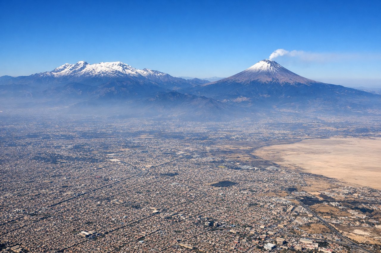
RIGHTMexico City's main departure runway 05R sends the aircraft northeast, putting the right side facing northwest toward the Sierra Nevada volcanic chain. Popocatépetl and Iztaccíhuatl are clearly visible as snow-capped peaks rising above the Valley of Mexico, and the dense urban sprawl of CDMX fills the foreground before giving way to the basin rim.
Landing at BOS
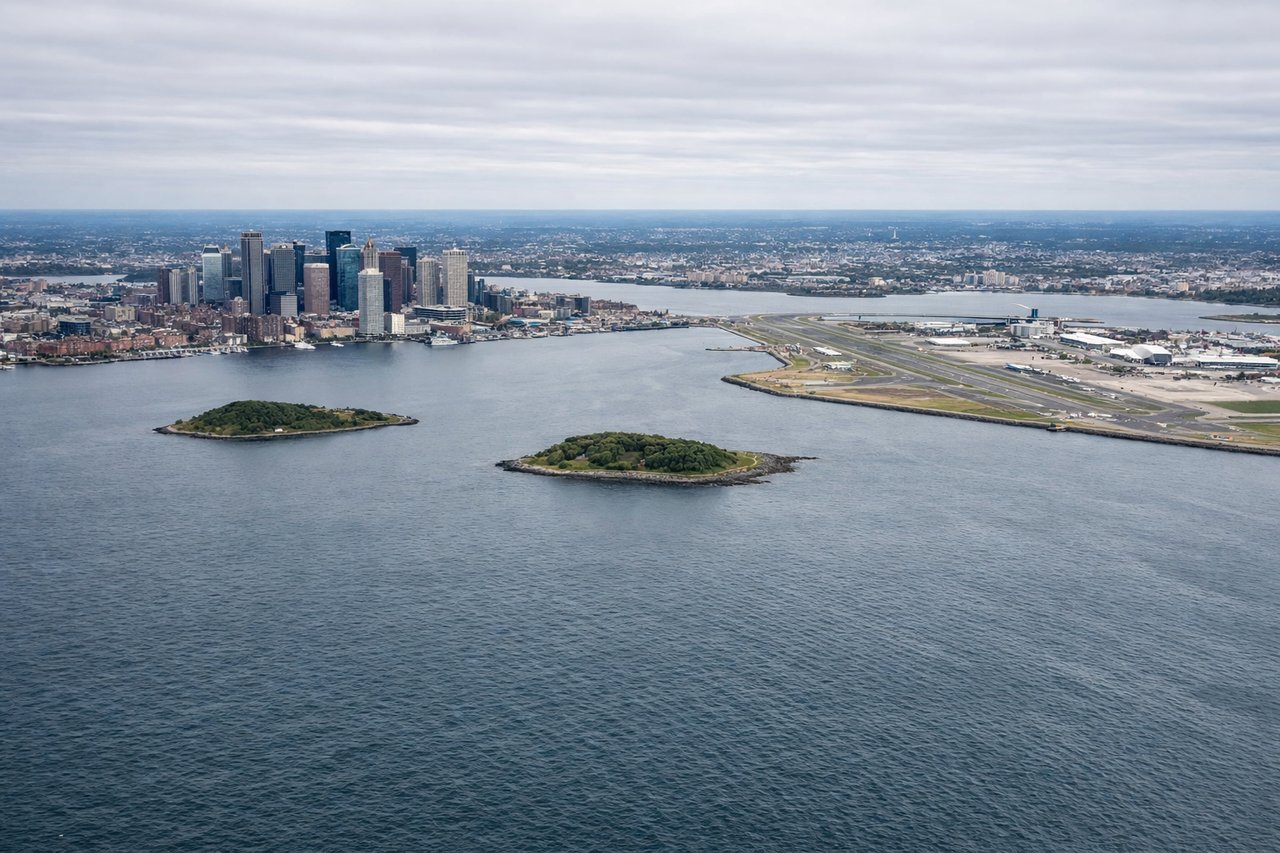
LEFTLogan Airport's primary northeast arrival (runway 33L/22R depending on winds) typically brings aircraft in over Massachusetts Bay from the south or southeast. The left side gets a direct view of Boston Harbor, the downtown skyline, and Cape Cod Bay in the distance. The right side faces inland toward suburban sprawl with far less visual interest.
Will your flight be in sunlight?
Pick a date and time in the Sun Map to watch the sun move across your whole flight.
About This Route
Which side of the plane should I sit on flying from Licenciado Benito Juarez International (MEX) to General Edward Lawrence Logan International (BOS)?
Sit on the Left side of the plane for the best views on flights from Mexico City to Boston. The left side wins overall because the Boston Harbor and skyline arrival is one of the most iconic urban approaches in the US, and the left side also captures the Gulf Coast and Atlantic seaboard during cruise. The right side's volcanic views at departure are spectacular but brief, while the left side delivers sustained interest across the Gulf of Mexico and the Eastern Seaboard.
What can I see during takeoff from Licenciado Benito Juarez International in Mexico City?
During takeoff from Licenciado Benito Juarez International (MEX), sit on the Right side for the best views. Mexico City's main departure runway 05R sends the aircraft northeast, putting the right side facing northwest toward the Sierra Nevada volcanic chain. Popocatépetl and Iztaccíhuatl are clearly visible as snow-capped peaks rising above the Valley of Mexico, and the dense urban sprawl of CDMX fills the foreground before giving way to the basin rim. Notable sights include: Popocatépetl (active volcano, 17,802 ft), Iztaccíhuatl (dormant volcano, 17,159 ft), the urban grid of Mexico City spreading across the basin, Texcoco lakebed remnants to the northeast.
What can I see when landing at General Edward Lawrence Logan International in Boston?
When landing at General Edward Lawrence Logan International (BOS), sit on the Left side for the best views. Logan Airport's primary northeast arrival (runway 33L/22R depending on winds) typically brings aircraft in over Massachusetts Bay from the south or southeast. The left side gets a direct view of Boston Harbor, the downtown skyline, and Cape Cod Bay in the distance. The right side faces inland toward suburban sprawl with far less visual interest. Notable sights include: Boston Harbor and its islands, downtown Boston skyline (Prudential Tower, Hancock Tower), Cape Cod peninsula visible to the south, the Charles River basin.
How long is the flight from Mexico City to Boston?
The flight from Licenciado Benito Juarez International (MEX) to General Edward Lawrence Logan International (BOS) takes about 5 hours 30 minutes. The shortest flight path between them is 2,277 miles (3,665 km); winds and air traffic control usually add a few percent.
What does the Mexico City to Boston flight path pass over?
The route tracks northeast over the Gulf of Mexico, crossing the Yucatan Peninsula or the Gulf itself depending on routing, then over the Gulf Coast near Louisiana or Mississippi, up through the Appalachian Mountains of Tennessee, Virginia, and the mid-Atlantic states, before descending over New England. The Appalachian ridgelines are visible as parallel corrugated terrain from altitude, and on clear days the Chesapeake Bay and Delaware Bay are recognizable coastal inlets on the left side during descent.