Right side scores higher (3.5 vs 2.5) due to superior scenery on both legs. Takeoff offers Mexico City's urban drama and volcanic peaks; landing provides Cartagena's distinctive colonial architecture, turquoise Caribbean waters, and the scenic Rosario Islands. Left side faces westward over mountains and then open Caribbean with less distinctive features.
Flown MEX to CTG? Did we get it right?
Flight Path
Mexico City to Cartagena is 1,688 miles (2,717 km), a flight of about 3 hours 15 minutes.
Sierra Madre Occidental mountain range (southern edge), Yucatan Peninsula lowlands, Gulf of Mexico coastal regions, transition from Mexican highlands to Central American tropical terrain, Caribbean coastal plains of Guatemala and Honduras, approach to Colombian Caribbean coast
Great circle distance and headings ›Phase by phase
Takeoff from MEX
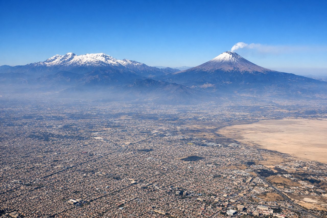
RIGHTRight side captures Mexico City's urban sprawl and the surrounding Valley of Mexico basin during climb-out. Departures typically use runway 05L (heading ENE), banking right over the city's eastern districts, offering views of the metropolitan area, nearby lakes (Lake Texcoco remnants), and the Sierra Nevada foothills rising to the east.
Landing at CTG
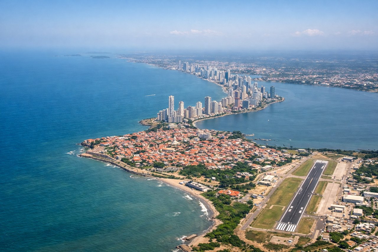
RIGHTRight side provides superior approach scenery into Cartagena. The aircraft descends over the Caribbean Sea and approaches from the north or northeast, offering views of Cartagena's colonial walled city, the harbor, nearby islands (Rosario Islands), and the Caribbean coastline. The coastal approach is visually distinctive with turquoise waters and the city's distinctive urban pattern.
Will your flight be in sunlight?
Pick a date and time in the Sun Map to watch the sun move across your whole flight.
About This Route
Which side of the plane should I sit on flying from Licenciado Benito Juarez International (MEX) to Rafael Nunez (CTG)?
Sit on the Right side of the plane for the best views on flights from Mexico City to Cartagena. Right side scores higher (3.5 vs 2.5) due to superior scenery on both legs. Takeoff offers Mexico City's urban drama and volcanic peaks; landing provides Cartagena's distinctive colonial architecture, turquoise Caribbean waters, and the scenic Rosario Islands. Left side faces westward over mountains and then open Caribbean with less distinctive features.
What can I see during takeoff from Licenciado Benito Juarez International in Mexico City?
During takeoff from Licenciado Benito Juarez International (MEX), sit on the Right side for the best views. Right side captures Mexico City's urban sprawl and the surrounding Valley of Mexico basin during climb-out. Departures typically use runway 05L (heading ENE), banking right over the city's eastern districts, offering views of the metropolitan area, nearby lakes (Lake Texcoco remnants), and the Sierra Nevada foothills rising to the east. Notable sights include: Mexico City urban grid and Paseo de la Reforma corridor, Lake Texcoco basin, Sierra Nevada peaks (Popocatépetl and Iztaccíhuatl visible on clear days to the southeast), Chapultepec Park and surrounding neighborhoods.
What can I see when landing at Rafael Nunez in Cartagena?
When landing at Rafael Nunez (CTG), sit on the Right side for the best views. Right side provides superior approach scenery into Cartagena. The aircraft descends over the Caribbean Sea and approaches from the north or northeast, offering views of Cartagena's colonial walled city, the harbor, nearby islands (Rosario Islands), and the Caribbean coastline. The coastal approach is visually distinctive with turquoise waters and the city's distinctive urban pattern. Notable sights include: Cartagena's walled old city and harbor, Rosario Islands (Islas del Rosario) archipelago with turquoise waters, Caribbean coastline and beaches, Boca Grande channel entrance.
How long is the flight from Mexico City to Cartagena?
The flight from Licenciado Benito Juarez International (MEX) to Rafael Nunez (CTG) takes about 3 hours 15 minutes. The shortest flight path between them is 1,688 miles (2,717 km); winds and air traffic control usually add a few percent.
What does the Mexico City to Cartagena flight path pass over?
Sierra Madre Occidental mountain range (southern edge), Yucatan Peninsula lowlands, Gulf of Mexico coastal regions, transition from Mexican highlands to Central American tropical terrain, Caribbean coastal plains of Guatemala and Honduras, approach to Colombian Caribbean coast