Mexico City to Culiacan is 652 miles (1,049 km), a flight of about 2 hours.
While Mexico City's volcanic peaks provide dramatic takeoff scenery, the right side captures more varied terrain across the full flight: the Sierra Madre Occidental foothills, river valleys, and agricultural landscape during cruise and descent. The landing approach into Culiacán offers more sustained visual interest than the takeoff advantage, and the overall route diversity favors the right side.
Flight Path
Durango state highlands and Sierra Madre Occidental foothills dominate the cruise segment. The flight passes over the transition zone between the Mexican Plateau and the western Sierra ranges, with scattered peaks and valleys visible below. The terrain gradually descends northwestward toward the Sinaloa coastal plain.
Great circle distance and headings ›Phase by phase
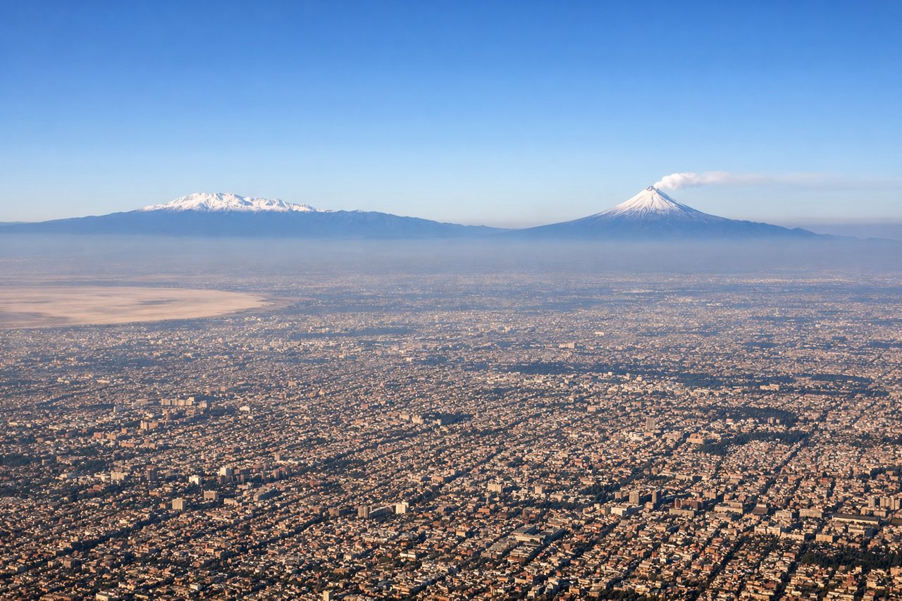
Takeoff from MEX
LEFTMexico City's urban sprawl and surrounding volcanic peaks (Popocatépetl and Iztaccíhuatl) dominate the left side during departure. The city's dense development and the Sierra Madre Oriental foothills provide immediate visual interest that the right side cannot match.
Landing at CUL
RIGHTThe approach to Culiacán from the south reveals the Sinaloa coastal plain and the Sierra Madre Occidental foothills to the east. The right side captures the transition from agricultural valleys to the city's approach, with more varied terrain than the left side's open Pacific approaches.
Landmarks on this routeAll landmarks →
Will your flight be in sunlight?
Pick a date and time in the Sun Map to watch the sun move across your whole flight.
About This Route
Which side of the plane should I sit on flying from Licenciado Benito Juarez International (MEX) to Culiacan International (CUL)?
Sit on the Right side of the plane for the best views on flights from Mexico City to Culiacan. While Mexico City's volcanic peaks provide dramatic takeoff scenery, the right side captures more varied terrain across the full flight: the Sierra Madre Occidental foothills, river valleys, and agricultural landscape during cruise and descent. The landing approach into Culiacán offers more sustained visual interest than the takeoff advantage, and the overall route diversity favors the right side.
What can I see during takeoff from Licenciado Benito Juarez International in Mexico City?
During takeoff from Licenciado Benito Juarez International (MEX), sit on the Left side for the best views. Mexico City's urban sprawl and surrounding volcanic peaks (Popocatépetl and Iztaccíhuatl) dominate the left side during departure. The city's dense development and the Sierra Madre Oriental foothills provide immediate visual interest that the right side cannot match. Notable sights include: Mexico City metropolitan area, Popocatépetl volcano (5,426 m, often snow-capped), Iztaccíhuatl volcano, Sierra Madre Oriental ridgeline.
What can I see when landing at Culiacan International in Culiacan?
When landing at Culiacan International (CUL), sit on the Right side for the best views. The approach to Culiacán from the south reveals the Sinaloa coastal plain and the Sierra Madre Occidental foothills to the east. The right side captures the transition from agricultural valleys to the city's approach, with more varied terrain than the left side's open Pacific approaches. Notable sights include: Sierra Madre Occidental eastern slopes, Culiacán River valley, agricultural fields of central Sinaloa, Culiacán city grid.
How long is the flight from Mexico City to Culiacan?
The flight from Licenciado Benito Juarez International (MEX) to Culiacan International (CUL) takes about 2 hours. The shortest flight path between them is 652 miles (1,049 km); winds and air traffic control usually add a few percent.
What does the Mexico City to Culiacan flight path pass over?
Durango state highlands and Sierra Madre Occidental foothills dominate the cruise segment. The flight passes over the transition zone between the Mexican Plateau and the western Sierra ranges, with scattered peaks and valleys visible below. The terrain gradually descends northwestward toward the Sinaloa coastal plain.