Mexico City to Chihuahua is 774 miles (1,245 km), a flight of about 1 hour 55 minutes.
Right-side seats capture the most dramatic scenery: the Sierra Madre Oriental during takeoff provides an impressive visual anchor, and throughout the flight northward, right-side passengers see the western slopes of the Sierra Madre Occidental as the aircraft approaches Chihuahua. The right side offers more consistent mountain views across the journey.
Flight Path
The flight path crosses the high plateau of central Mexico, passing east of the Sierra Madre Occidental. Notable features include the transition from the Valley of Mexico's agricultural lands to the arid high desert plateau around 1,000-1,500 meters elevation, scattered mining towns and agricultural areas in Guanajuato and Zacatecas states, and the gradual appearance of the Sierra Madre Occidental's western escarpment as the aircraft approaches Chihuahua airspace. The terrain becomes progressively drier and more sparsely vegetated northward.
Great circle distance and headings ›Phase by phase
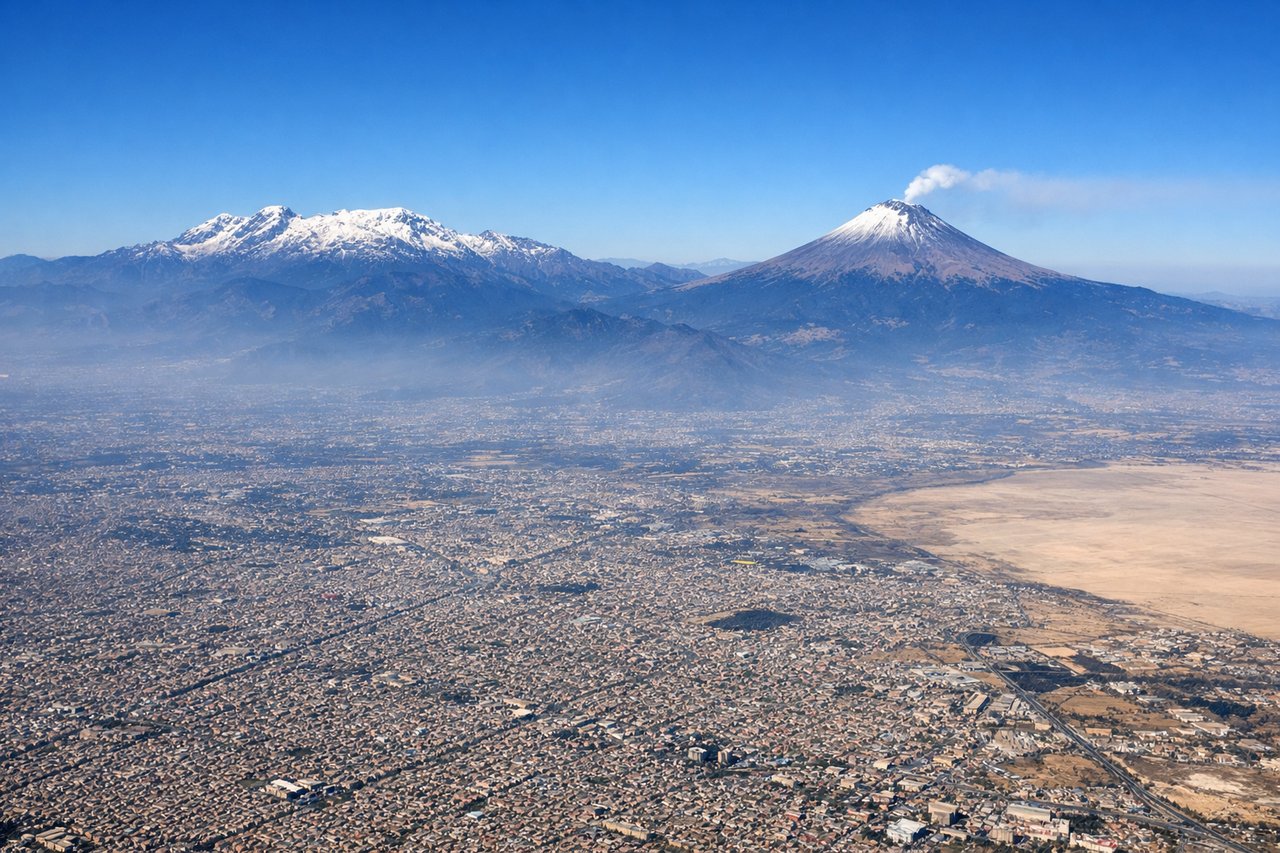
Takeoff from MEX
RIGHTRight-side seats offer views of the Sierra Madre Oriental as the aircraft climbs northwestward from Mexico City. The mountain range rises dramatically to the east and northeast of the airport, creating a striking backdrop during the initial climb phase.
Landing at CUU
LEFTLeft-side seats provide views of the Sierra Madre Occidental and the high desert plateau as the aircraft descends toward Chihuahua. The terrain transitions from lower elevations to the distinctive arid landscape surrounding the airport, with visible mountain ridges and desert vegetation patterns.
Landmarks on this routeAll landmarks →
Will your flight be in sunlight?
Pick a date and time in the Sun Map to watch the sun move across your whole flight.
About This Route
Which side of the plane should I sit on flying from Licenciado Benito Juarez International (MEX) to General R Fierro Villalobos International (CUU)?
Sit on the Right side of the plane for the best views on flights from Mexico City to Chihuahua. Right-side seats capture the most dramatic scenery: the Sierra Madre Oriental during takeoff provides an impressive visual anchor, and throughout the flight northward, right-side passengers see the western slopes of the Sierra Madre Occidental as the aircraft approaches Chihuahua. The right side offers more consistent mountain views across the journey.
What can I see during takeoff from Licenciado Benito Juarez International in Mexico City?
During takeoff from Licenciado Benito Juarez International (MEX), sit on the Right side for the best views. Right-side seats offer views of the Sierra Madre Oriental as the aircraft climbs northwestward from Mexico City. The mountain range rises dramatically to the east and northeast of the airport, creating a striking backdrop during the initial climb phase. Notable sights include: Sierra Madre Oriental (northeast), Lake Texcoco remnants (south), Mexico City urban sprawl (immediate surroundings), Popocatépetl volcano (southeast, weather permitting).
What can I see when landing at General R Fierro Villalobos International in Chihuahua?
When landing at General R Fierro Villalobos International (CUU), sit on the Left side for the best views. Left-side seats provide views of the Sierra Madre Occidental and the high desert plateau as the aircraft descends toward Chihuahua. The terrain transitions from lower elevations to the distinctive arid landscape surrounding the airport, with visible mountain ridges and desert vegetation patterns. Notable sights include: Sierra Madre Occidental (west and northwest), Chihuahua high desert plateau, Rio Conchos valley (if visible during descent), scattered desert towns and mining areas.
How long is the flight from Mexico City to Chihuahua?
The flight from Licenciado Benito Juarez International (MEX) to General R Fierro Villalobos International (CUU) takes about 1 hour 55 minutes. The shortest flight path between them is 774 miles (1,245 km); winds and air traffic control usually add a few percent.
What does the Mexico City to Chihuahua flight path pass over?
The flight path crosses the high plateau of central Mexico, passing east of the Sierra Madre Occidental. Notable features include the transition from the Valley of Mexico's agricultural lands to the arid high desert plateau around 1,000-1,500 meters elevation, scattered mining towns and agricultural areas in Guanajuato and Zacatecas states, and the gradual appearance of the Sierra Madre Occidental's western escarpment as the aircraft approaches Chihuahua airspace. The terrain becomes progressively drier and more sparsely vegetated northward.