Right side scores marginally higher due to superior takeoff scenery from Mexico City's dramatic urban context and surrounding mountain valleys. While landing views are comparable on both sides, the takeoff experience from MEX—with the city's sprawl and immediate Sierra de Guadalupe and Sierra de las Cruces visibility—provides more visual interest than the approach to DGO's more uniform high-altitude plateau. This is a close call on a short, relatively flat-to-moderate terrain route; neither side is exceptional.
Flown MEX to DGO? Did we get it right?
Flight Path
Mexico City to Durango is 477 miles (768 km), a flight of about 1 hour 15 minutes.
The flight path crosses the high-altitude Mexican plateau (altiplano) at approximately 7,000-8,000 feet elevation. Notable features include the transition from Mexico City's valley (elevation 7,382 ft) northwestward across the Sierra Madre Occidental foothills, passing over semi-arid plateau terrain with sparse vegetation, scattered small towns, and occasional volcanic features. The landscape is predominantly open plateau with low mountain ridges; no major rivers or dramatic canyons are visible from cruise altitude on this route. Durango sits at 6,010 feet elevation in a valley surrounded by the Sierra Madre ranges.
Great circle distance and headings ›Phase by phase
Takeoff from MEX
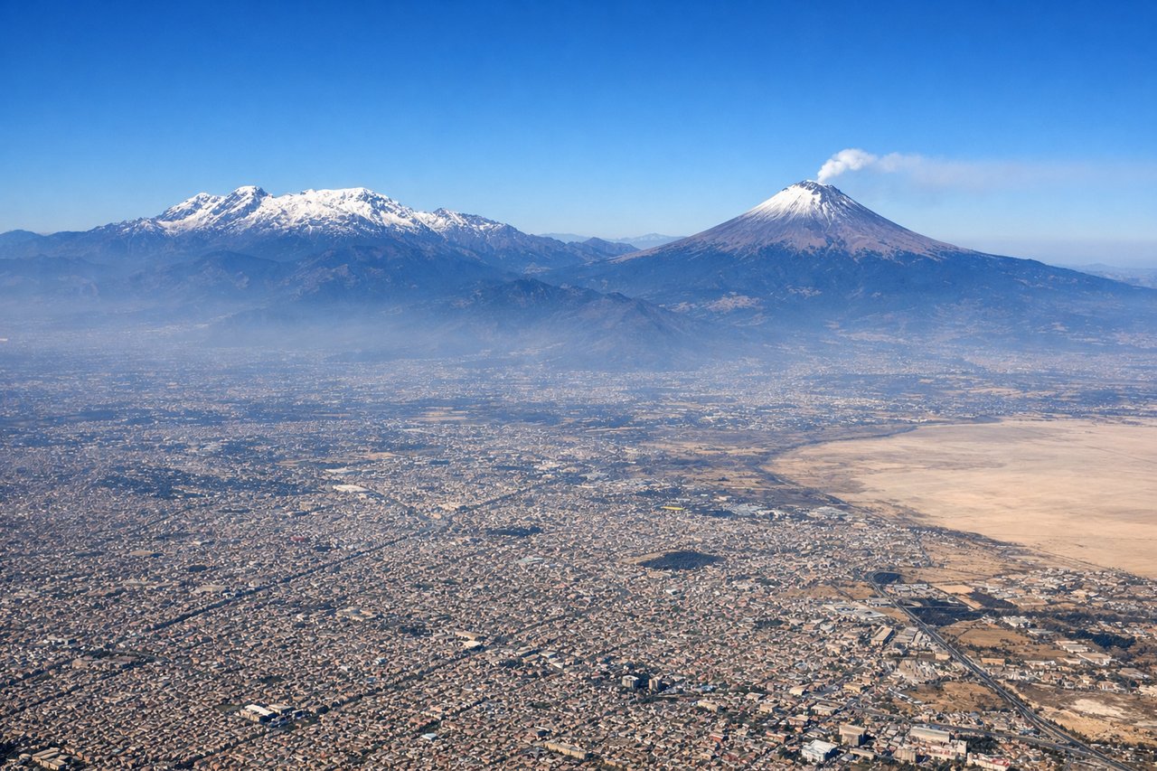
RIGHTRight side captures Mexico City's urban sprawl and the surrounding valley floor during initial climb. The city's grid pattern and surrounding mountains (Sierra de Guadalupe to the north, Sierra de las Cruces to the west) are visible during the northwesterly departure climb, offering more immediate urban context than the left side.
Landing at DGO
LEFTLeft side during approach to DGO offers views of the Sierra Madre Occidental foothills and the Durango valley floor. The descent path typically brings aircraft over the surrounding high-altitude plateau terrain, and the left side captures the approach to the valley with better visibility of the surrounding mountain ridges and the city's position within the landscape.
Will your flight be in sunlight?
Pick a date and time in the Sun Map to watch the sun move across your whole flight.
About This Route
Which side of the plane should I sit on flying from Licenciado Benito Juarez International (MEX) to Durango International (DGO)?
Sit on the Right side of the plane for the best views on flights from Mexico City to Durango. Right side scores marginally higher due to superior takeoff scenery from Mexico City's dramatic urban context and surrounding mountain valleys. While landing views are comparable on both sides, the takeoff experience from MEX—with the city's sprawl and immediate Sierra de Guadalupe and Sierra de las Cruces visibility—provides more visual interest than the approach to DGO's more uniform high-altitude plateau. This is a close call on a short, relatively flat-to-moderate terrain route; neither side is exceptional.
What can I see during takeoff from Licenciado Benito Juarez International in Mexico City?
During takeoff from Licenciado Benito Juarez International (MEX), sit on the Right side for the best views. Right side captures Mexico City's urban sprawl and the surrounding valley floor during initial climb. The city's grid pattern and surrounding mountains (Sierra de Guadalupe to the north, Sierra de las Cruces to the west) are visible during the northwesterly departure climb, offering more immediate urban context than the left side. Notable sights include: Mexico City metropolitan area, Sierra de Guadalupe, Sierra de las Cruces, Lake Texcoco remnants.
What can I see when landing at Durango International in Durango?
When landing at Durango International (DGO), sit on the Left side for the best views. Left side during approach to DGO offers views of the Sierra Madre Occidental foothills and the Durango valley floor. The descent path typically brings aircraft over the surrounding high-altitude plateau terrain, and the left side captures the approach to the valley with better visibility of the surrounding mountain ridges and the city's position within the landscape. Notable sights include: Sierra Madre Occidental foothills, Durango valley floor, high-altitude plateau terrain, approach corridor ridgelines.
How long is the flight from Mexico City to Durango?
The flight from Licenciado Benito Juarez International (MEX) to Durango International (DGO) takes about 1 hour 15 minutes. The shortest flight path between them is 477 miles (768 km); winds and air traffic control usually add a few percent.
What does the Mexico City to Durango flight path pass over?
The flight path crosses the high-altitude Mexican plateau (altiplano) at approximately 7,000-8,000 feet elevation. Notable features include the transition from Mexico City's valley (elevation 7,382 ft) northwestward across the Sierra Madre Occidental foothills, passing over semi-arid plateau terrain with sparse vegetation, scattered small towns, and occasional volcanic features. The landscape is predominantly open plateau with low mountain ridges; no major rivers or dramatic canyons are visible from cruise altitude on this route. Durango sits at 6,010 feet elevation in a valley surrounded by the Sierra Madre ranges.